

Knowledge base › Survey guide
Survey guide
What is an RTK tide, and how is it applied?
An RTK tide is a water level correction worked out from RTK GNSS height instead of a tide gauge. The software takes the antenna height above the ellipsoid, subtracts the antenna height above the water, and applies a good local geoid model (and a chart datum offset if needed), so your soundings come out as elevations on the datum you want. It only works with RTK-quality heights.
<10 cm typical tide correction spec
9 + 11 GGA height fields
2–3 min height averaging for waves
N, K geoid separation, chart datum
“RTK tide” is the hydrographic term for correcting echo sounder data with RTK GNSS heights. It might be a tide correction to chart datum for coastal charting, or have nothing to do with tides at all, such as expressing river bathymetry as bottom elevations on a vertical datum. The terms can be confusing, but the idea is simple.
What heights does a GNSS receiver give?
Any GNSS receiver gives two vertical values: height above the ellipsoid (the WGS 84 reference ellipsoid is the fundamental surface for GPS), and height above mean sea level (MSL).
- The ellipsoid is a mathematical shape that approximates the Earth, so it can be used directly in calculations.
- The geoid follows the Earth’s gravity field, which mostly controls sea level, so geoid height and MSL are effectively the same. Gravity varies irregularly with the thickness and density of the crust, so the geoid isn’t a simple mathematical surface.
- A geoid model is a grid of points with geoid values from gravity measurements, MSL observations and extrapolation. Quality varies: some have values every 10 miles, others are much denser.
Every GNSS receiver has a coarse global geoid model built in (such as EGM96) so it can output an approximate elevation anywhere. That’s not good enough for surveying, so a higher resolution local geoid is always applied instead, in the hydrographic software or GNSS data collector. Without a good geoid model, a river might appear to flow uphill.
On land the receiver’s 3D position barely changes. On a boat tied to a jetty, it rises and falls with the tide, and so does its height above the ellipsoid. Relating that movement to the local vertical datum is the tricky part.
Where are the heights in the GGA message?
The NMEA GGA message (position, satellites, quality and height) carries the height in two fields:
$GPGGA,172814.0,3723.46587704,N,12202.26957864,W,2,6,1.2,18.8,M,-25.6,M,2.0
- Field 9 (18.8 here): orthometric height above the receiver’s own geoid model, its best estimate of MSL.
- Field 11 (−25.6): the separation between ellipsoid and geoid at that position.
Ellipsoid height = Field 9 + Field 11. The ellipsoid height isn’t in the GGA message, but you can work it back from these two. It’s the value you really need, because a better geoid is applied later. Remember the receiver reports the antenna height, so the offset from the antenna to the water must be included.
To use RTK for tides you need two things: the height of the antenna above the water, and the local geoid value.
Why does it have to be RTK?
GNSS without RTK corrections can’t give elevation accurate enough for tide corrections or surveying in general. There’s no point measuring soundings to 1 cm and then applying an elevation that may be 0.5 m out. A tide correction is typically specified to better than 10 cm (4″). So for a fully satellite-derived water level (no tide gauge or manual levels) where the water surface changes during the survey, RTK-quality positioning must be used.
How is it applied?
The receiver’s built-in geoid probably isn’t accurate, and many government authorities publish much better geoid models for their regions. With the antenna height above the waterline measured accurately and RTK giving the antenna height above the ellipsoid, the accuracy of the tide data depends directly on the quality of the geoid model.
Hydrographic software holds the geoid models and datum tools. The surveyor picks the most suitable geoid, and the software uses it in place of the receiver’s own, applied to the ellipsoid height.
| Term | Meaning |
|---|---|
| N | Separation between ellipsoid and geoid. |
| K | Difference between the geoid and the chart datum. |
| LAT | Lowest astronomical tide, the usual datum for hydrographic charts. |
If you need soundings on a different datum from the geoid, you’ll be given the K value and your soundings are “reduced” to that datum. On a lake or river with no reduction to LAT, the RTK tide height is the same as the newly calculated geoid height.
How is this set up in HYPACK®?
HYPACK® gives these geodesy options for RTK tide corrections:
| Area | RTK selection | Enter geoid? | KTD file? | Enter chart datum? |
|---|---|---|---|---|
| US coastal waters | N from geoid, K from VDatum | Yes | No | Chart datum |
| Geoid present, constant separation geoid–chart datum | N from geoid, K from user value | Yes | No | Height of geoid above chart datum |
| Geoid present, changing separation geoid–chart datum | N from geoid, K from KTD | Yes | Yes: geoid above chart datum values | No |
| No geoid, constant separation ellipsoid–chart datum | (K−N) from user value | No | No | Height of ellipsoid above chart datum |
| No geoid, changing separation ellipsoid–chart datum | (K−N) from KTD | No | Yes: ellipsoid above chart datum values | No |
Source: HYPACK® documentation. The chart datum fields are enabled or disabled by the RTK selection. If you use the 2012 geoid you must also use the 2012 VDatum files; otherwise use the previous VDatum with Geoid 2009. With VDatum you must use one of the predefined chart datums: a user-defined chart datum level makes HYPACK® ignore the VDatum database.
- For surveys with no reduction to LAT, the RTK Tide selection with a geoid is commonly used. The HYPACK® geoid replaces the one in the receiver, and the height of the geoid above chart datum is zero.
- An orthometric height correction shifts the geoid heights up or down equally over the whole area, so the result can be tied to a local datum where an offset remains.
- KTD files log K minus N during the survey. This varies across the area, so a KTD file gives a position-dependent correction to chart datum. If you’re surveying on the geoid for RTK tide elevations, you can ignore the VDatum and KTD options.
Worked example
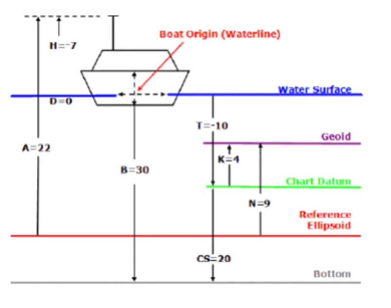
| Value | In this example |
|---|---|
| Antenna height above the waterline | 7 m |
| A: antenna height above the ellipsoid | 22 m |
| Sea level (waterline) above the ellipsoid | 22 − 7 = 15 m |
| N: geoid above the ellipsoid (the ellipsoid is below the geoid) | 9 m |
| K: geoid above chart datum (the chart datum is below the geoid) | 4 m |
| Measured depth (waterline to bottom) | 30 m |
| Tide correction | −10 m (15 − 9 + 4 = 10 m of water above chart datum) |
| Chart sounding | 20 m (30 − 10) |
That’s the same as a conventional tide gauge reading +10 m: subtract 10 m from the 30 m sounding to get a 20 m chart sounding. If the chart datum were MSL (K = 0), the tide reduction would be 6 m.
What can go wrong?
- Geoid model quality limits the result.
- RTK base station corrections must be good quality.
- Waves and swell cause short-term height changes that aren’t tide, so RTK heights are normally averaged over 2–3 minutes (HYPACK® has a tool for this).
Variable draft doesn’t matter for tide data: as the boat sits deeper, the antenna sits lower by the same amount.
Equipment used
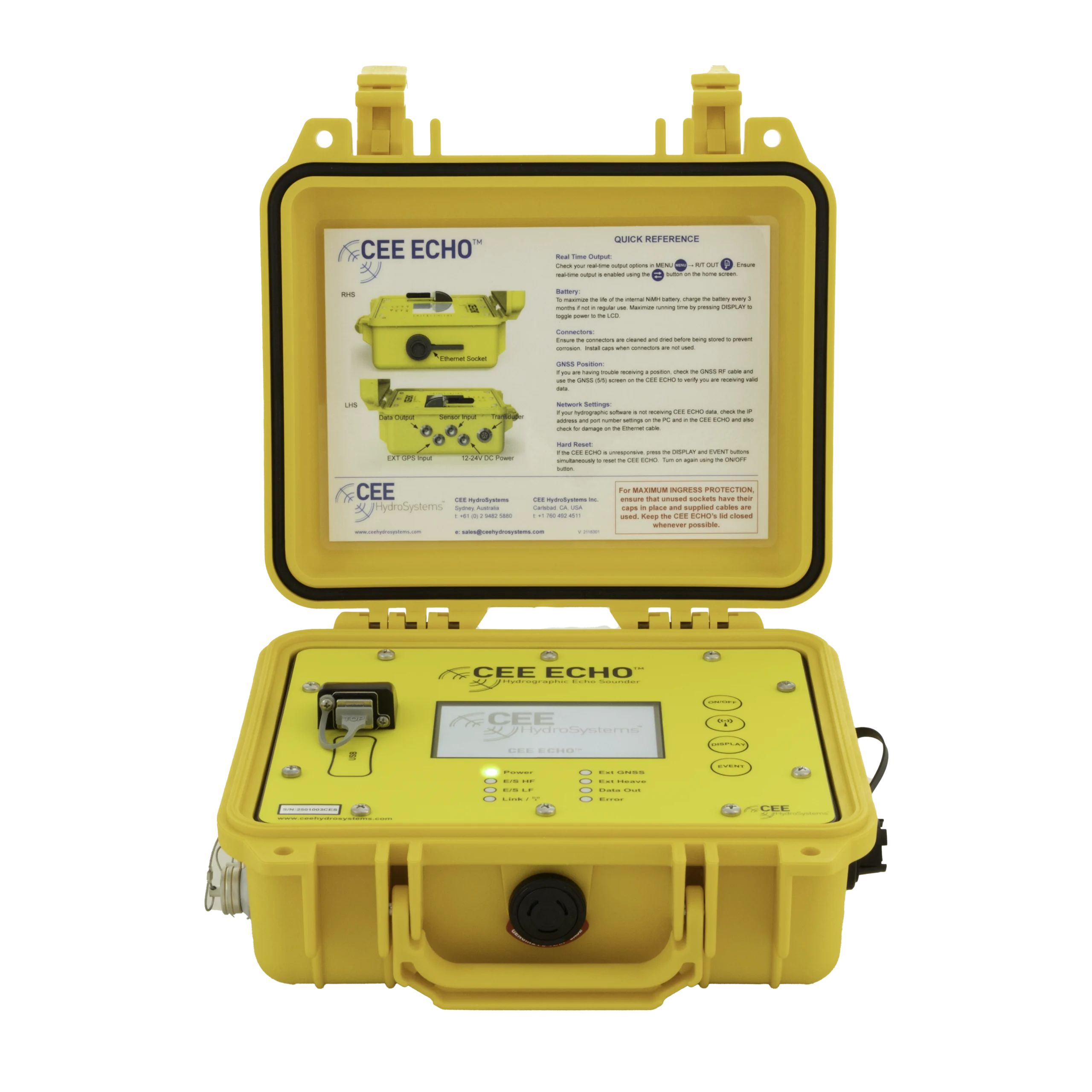

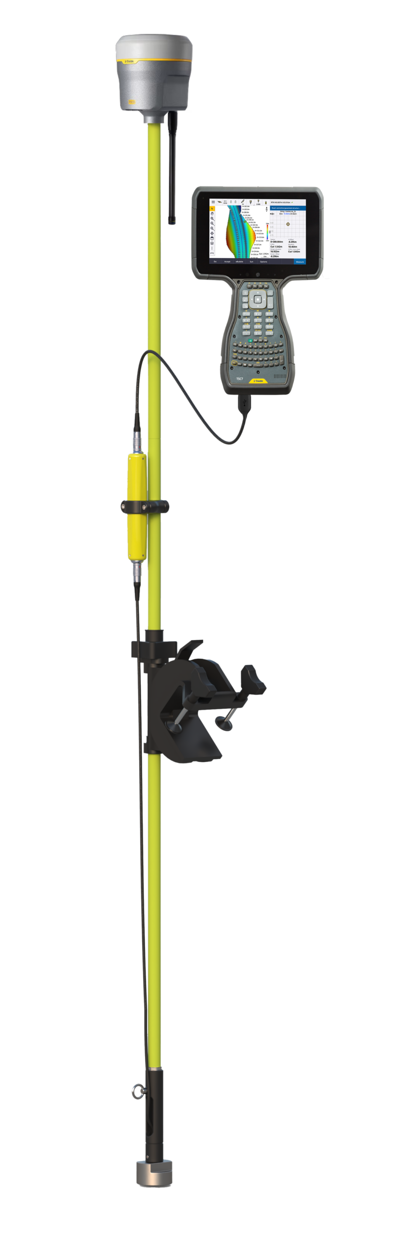
Talk to US
Need a hand with your set-up?
Our engineers answer survey questions every day.