

Case histories › Case history
Case history
Automated fly ash pond surveys with the CEE-USV™ and autopilot
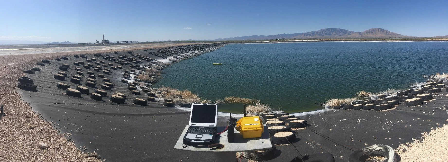
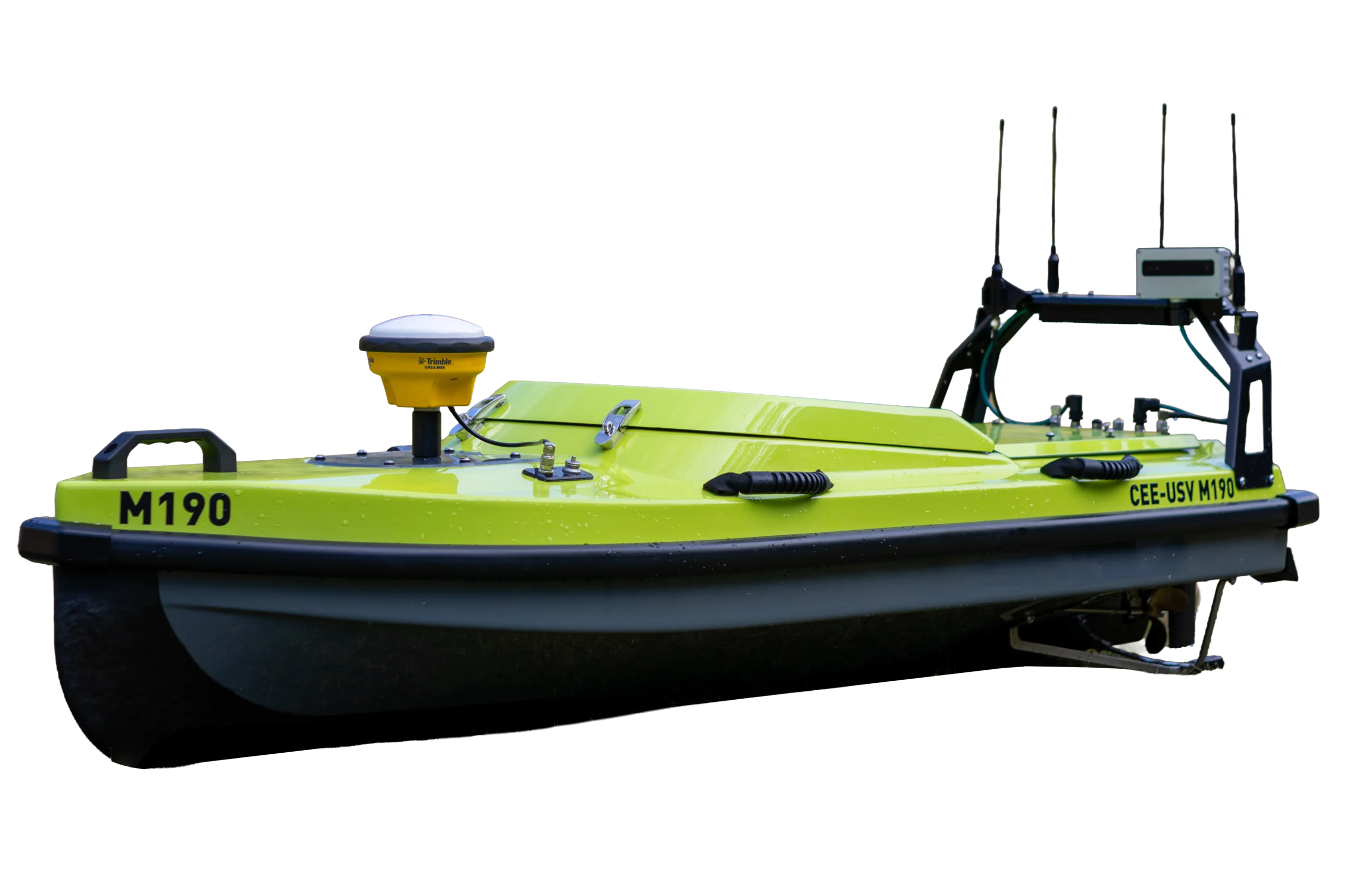
Bowman Consulting used the CEE-USV™ with its autopilot and drone flights to measure water and ash volumes in three Arizona power station fly ash lagoons in a two-day survey. The autopilot ran laser straight lines at 25 ft spacing with cross track errors of just a few inches, and using the USV eliminated on-water safety risks.
At a glance
- Client
- Bowman Consulting (for power generation customers)
- Location
- Arizona, USA
- Application
- Water and ash volume surveys of three power station fly ash lagoons
- Equipment
- CEE-USV™ with integrated autopilot (Dynautics Ltd) and CEESCOPE LITE™ echo sounder; drone
- Software
- Hydromagic
- Survey time
- Two days on site
About the project
To supply a site bathymetric survey of their power generation customers’ fly ash lagoons, US consulting firm Bowman Consulting called in the CEE-USV™ with its fully integrated professional autopilot system (Dynautics Ltd).
Fly ash is a byproduct of combustion in power generation, and consists of fused mineral impurities. It is often held in wet storage lagoons, and these lagoons are surveyed regularly for regulatory compliance among other reasons.
In combination with drone flights to map the ash volume above the water, the CEE-USV™ allowed determination of water and ash volumes in three power station fly ash lagoons in Arizona, USA. For the larger lagoon, the autopilot effected spectacular survey lines and “hands free” surveying. For the smaller lagoons, real time drone video was used to navigate the boat through narrow channels and ensure full coverage in the bathymetric dataset.
The large lagoon: autopilot survey
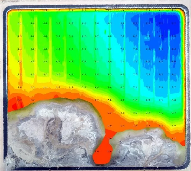
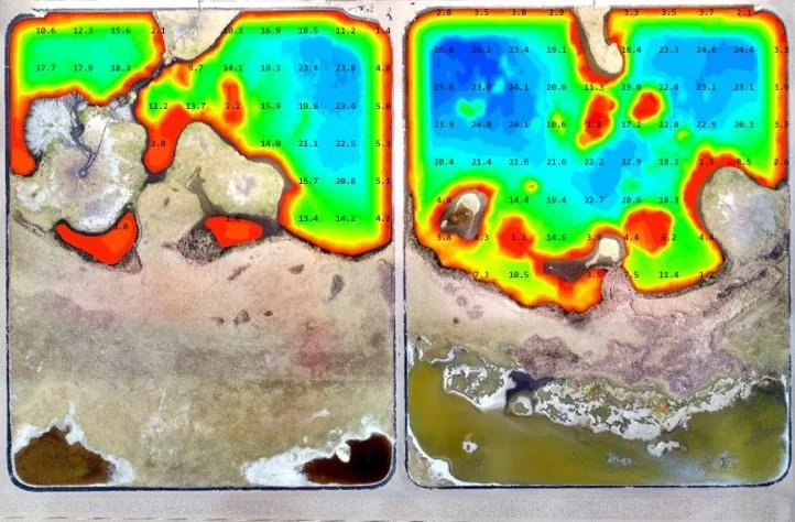
The first lagoon was large with an unobstructed open water area and a single long beach, making it ideal for a robotic autopilot-controlled survey pattern. A 25 ft spaced east-west line plan was set up in the Hydromagic shore PC control and acquisition software, after the survey boundary was accurately established from imported drone orthophotogrammetry images from the previous week’s overflights.

After the USV was launched, the Hydromagic line plan was telemetered to the CEE-USV™ autopilot and the vehicle got down to business. With typical cross track error distances measured in just a few inches, the USV’s remarkable survey line consistency allowed generation of a confidence-inspiring survey product for the site operator.
When closer to the beach, manual control was engaged. The survey was concluded by a perimeter run across the 1 ft contour to mark the edge of the survey, and fill-in back to the robotically-surveyed area.
The smaller ponds: manual survey with drone video
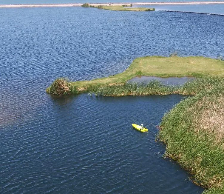
For the two smaller ponds, the situation was quite different. With only a small open water area to survey robotically, most of the survey was conducted with the CEE-USV™ in manual control.
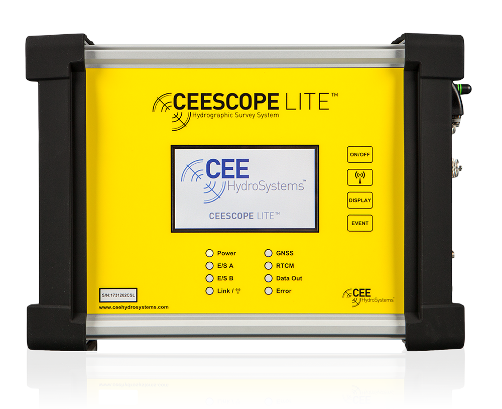
As there were some parts of the lagoon obscured from view by vegetation, a drone was used to supply real time overhead video of the site. The USV operator used the combination of Hydromagic real time depths and GNSS position from the on-board CEESCOPE LITE™ echo sounder with the drone video to maximize the available survey coverage. No USV on-board video can match a drone view!
The results
3fly ash lagoons surveyed in Arizona
25 ftautopilot line spacing in the large lagoon
A few inchestypical cross track error
2 daysexpedient survey
Bowman were able to supply a detailed, accurate and defensible dataset to the site operator, with Hydromagic results seamlessly fitting in with the rest of the survey data.
When on site, safety was the top priority. The use of the USV eliminated on water personnel safety risks as well as providing an expedient two-day survey.
Planning a similar survey?
Tell us about your site and we’ll recommend the right equipment.
Talk to us →
More from the field
6 Jan 2026
Trimble RTX for accurate wastewater sludge comparison surveys with the CEE-USV™
Team Lab monitors sludge in hundreds of wastewater lagoons with the CEE-USV™. Adding a CEESCOPE™ with Trimble CenterPoint® RTX in 2025 gave about 1 in (2.5 cm) vertical accuracy for the lagoon water level on every survey, so repeat surveys compare sludge volumes accurately without anyone going out on the water.
Team Lab monitors sludge in hundreds of wastewater lagoons with the CEE-USV™. Adding a CEESCOPE™ with Trimble CenterPoint® RTX in 2025 gave about 1 in (2.5 cm) vertical accuracy for the lagoon water level on every survey, so repeat surveys compare sludge volumes accurately without anyone going out on the water.
Read case history →
17 Sep 2023
Surveying industrial water with single beam echo sounders and USVs: mine water, frac pits and effluent ponds
How single beam echo sounders and unmanned survey boats are used for industrial water management: reservoir volume, sludge and sediment, and regulatory reporting. Worked examples cover mine tailings storage facilities, frac pits and effluent lagoon dredging.
How single beam echo sounders and unmanned survey boats are used for industrial water management: reservoir volume, sludge and sediment, and regulatory reporting. Worked examples cover mine tailings storage facilities, frac pits and effluent lagoon dredging.
Read case history →
29 Apr 2022
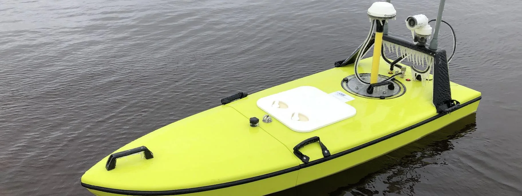
CEE-USV™ surveys a wastewater lagoon in 45 mph winds and sub-zero temperatures
Midwest Planning LLC ran a CEE-USV™ survey of a Minnesota wastewater lagoon in late April, in 45 mph gusts and sub-zero temperatures, with the surveyor operating from a warm truck. Ice on the antennas caused some data drop-outs, but the on-board CEESCOPE LITE™ logged everything, so any gaps could be filled in Hydromagic.
Midwest Planning LLC ran a CEE-USV™ survey of a Minnesota wastewater lagoon in late April, in 45 mph gusts and sub-zero temperatures, with the surveyor operating from a warm truck. Ice on the antennas caused some data drop-outs, but the on-board CEESCOPE LITE™ logged everything, so any gaps could be filled in Hydromagic.
Read case history →