

Knowledge base › Survey guide
Survey guide
How can a dual frequency echo sounder show recent sedimentation?
Run both frequencies at once. The high frequency (200 kHz) reports the top of soft sediment; the low frequency (24 or 33 kHz) often passes through it to a harder layer below. The difference between the two surveys shows where recent sediment has built up and roughly how thick it is. Confirm thickness with probing or cores, and work in about 2 m of water or more.
200 kHz top of sediment
24 / 33 kHz harder layer below
0.6 m shallowest reliable LF
~2 m recommended water depth
All CEE HydroSystems dual frequency units run high and low frequency sonar at the same time: effectively two independent surveys at once. As well as showing sedimentation, this gives a useful cross-check on your soundings.
How does it work?
- High frequency (HF) gives the depth to the first return: sand or rock, but also the top of soft sediment or a vegetation canopy.
- Low frequency (LF) usually gives the same depth on sand and rock, but its longer wavelength can pass through upper layers to a harder, more consolidated surface below.
So you get two depths: the top of the sediment, and the top of the harder layer. That might be a dredged river channel that has refilled, or a concrete pond with sludge build-up.
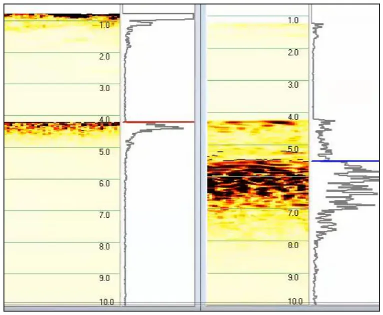
In Figure 1 the sediment surface is visible on the LF echogram, but the strongest return is the black band 1–2 m lower, so the echo sounder picks that sub-bottom layer as its depth. Seeing the echogram in real time and in processing, not just the digital depth, is crucial for interpreting results correctly. Manual mode lets you tune the ping to bring out sub-bottom features.
What does it look like along a line?
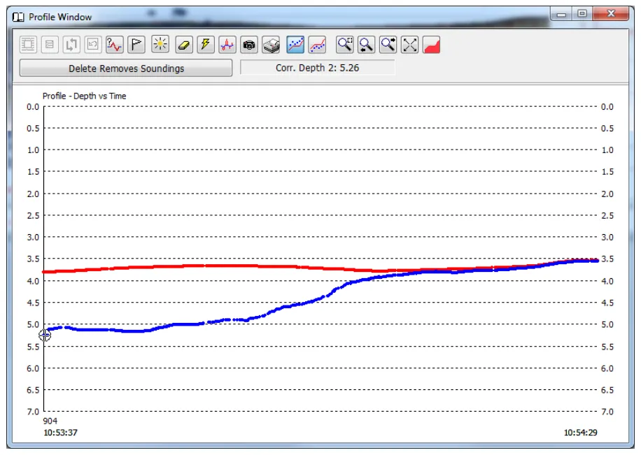
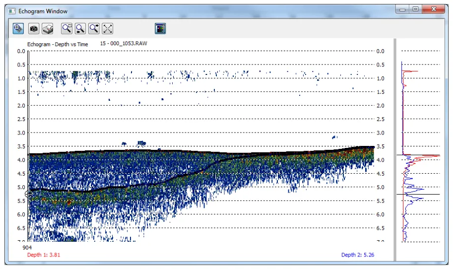
How do I map the sediment?
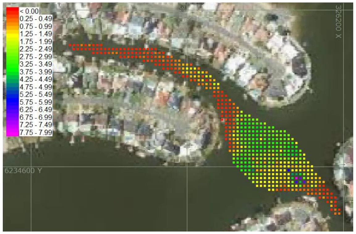
Because the two frequencies make two independent datasets, you can overlay them and compare surface to surface over the whole area. The colour shows the HF–LF depth difference, and therefore the surface sediment thickness.
What are the limits?
Confirm thickness physically. Dual frequency depths indicate where sediment is. For a true thickness, correlate with manual probing or core samples.
- Shallow water: the CEESCOPE™ and CEE ECHO™ HF can read reliably in under 0.2 m (0.65 ft), but the LF uses low power to allow shallow readings and struggles to penetrate sediment there. The shallowest reliable LF depth is 0.6 m (2 ft) below the transducer. Work in around 2 m (6.5 ft) of water to get enough energy into softer material.
- Run lines across the contours. The echo sounder reports the first return within its footprint. Running along contours where depth varies will clip depths from the shallower side of the boat, which may not match the computed position. In a maintained channel with fairly constant depth, running along the contour may be possible; investigate first.
See also what is an echogram, and how does it show the true bottom?
Equipment used
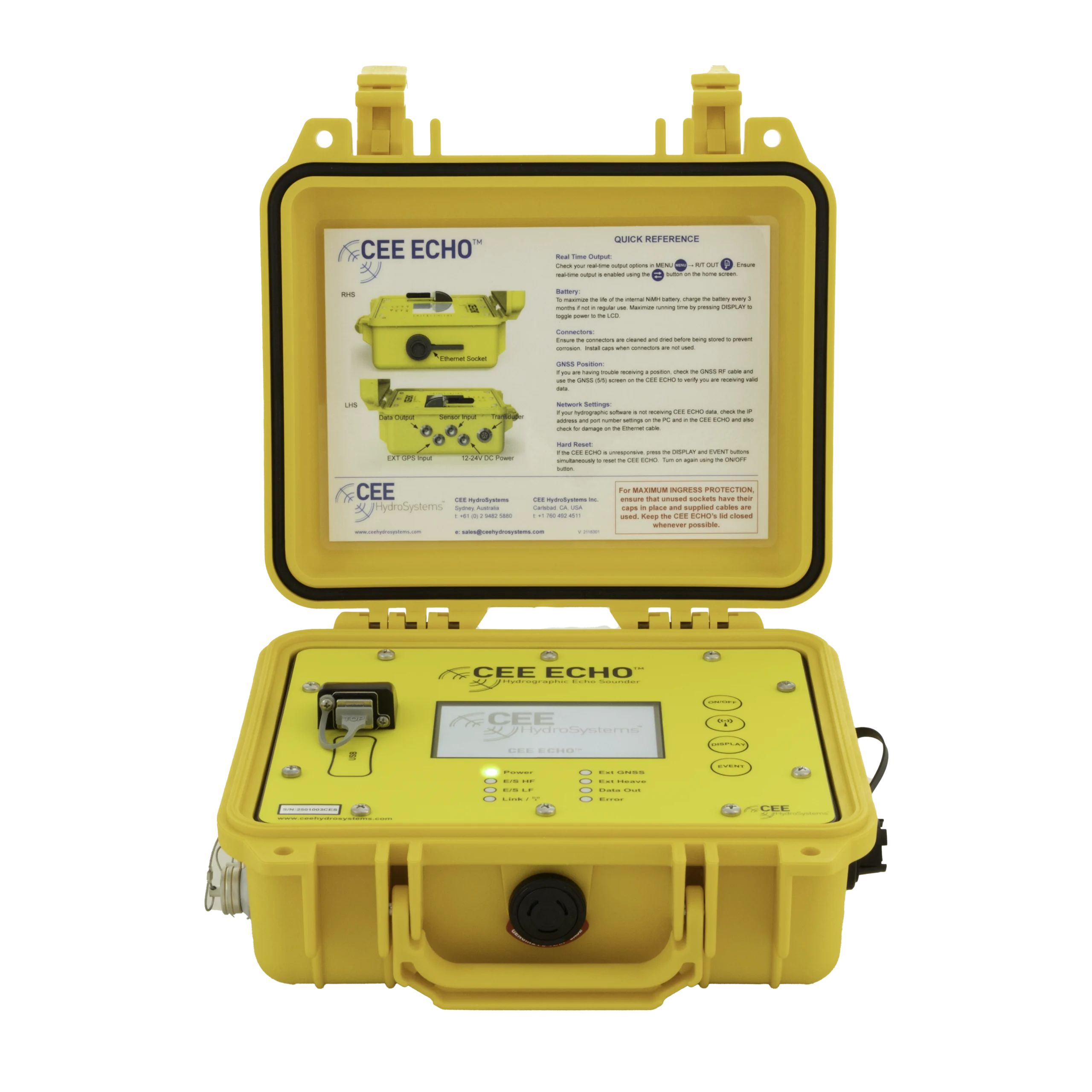
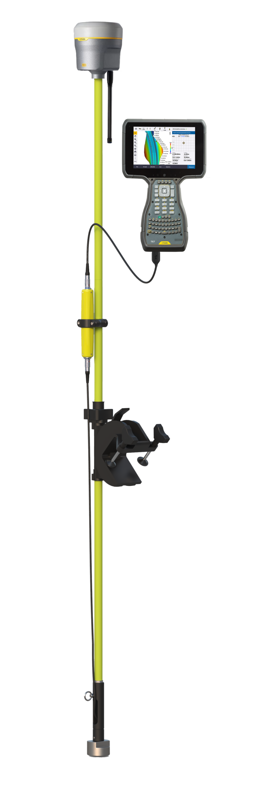

Talk to US
Need a hand with your set-up?
Our engineers answer survey questions every day.