

Knowledge base › Survey guide
Survey guide
Should I use a hydrographic or a land survey setup for bathymetry?
A land survey set-up (an echo sounder such as the CEE-LINE™ plugged into your GNSS data collector) is cheaper and simpler, but gives you no echogram to check the depths, low data density and possible latency errors. A hydrographic set-up (a CEE ECHO™ or CEESCOPE™ with hydrographic software) costs more and needs some training, but gives far better quality control, detail and accuracy.
20 Hz CEE-LINE™ output rate
up to 30 Hz CEE ECHO™ / CEESCOPE™ ping rate
2.5 m possible latency error with a 2 Hz sounder
1–2/s typical data collector position shots
Shallow water bathymetry with single beam echo sounders is usually done with one of two set-ups, which we broadly call land survey and hydrographic survey. Here are the strengths and weaknesses of each.
What is the land survey approach?
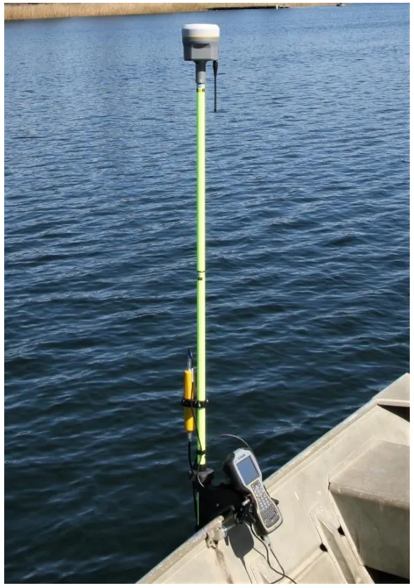
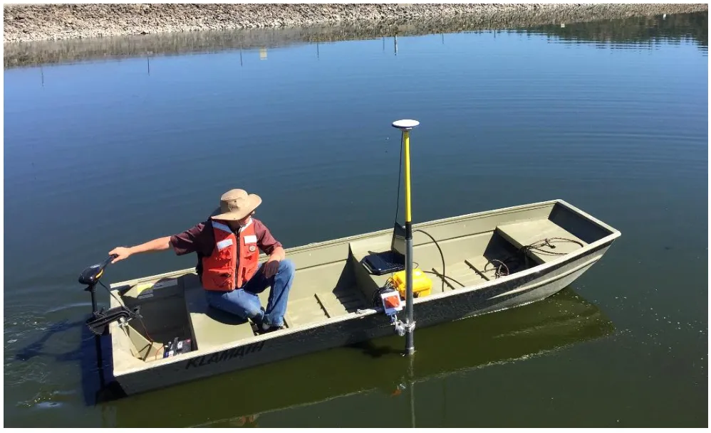
If you already own GNSS equipment, it’s attractive to use it for bathymetry too. Trimble Access, Leica Viva, Carlson SurvCE and Topcon Magnet Field all accept an echo sounder through Bluetooth or a cabled serial connection. Some GNSS software still doesn’t, but most packages in use today do.
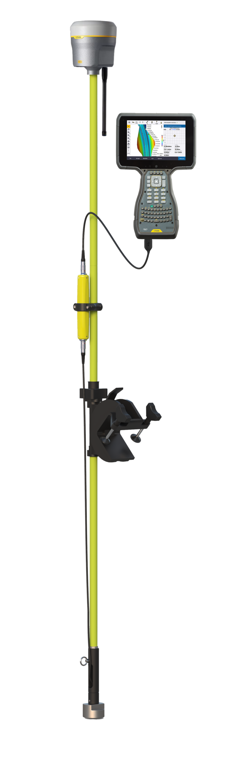
The CEE-LINE™ is built for this. Unlike many competitors it uses a dedicated echo sounder processor and a professional passive transducer, not a “smart” active transducer, so it tracks the bottom well. It shares the same digital-only output as its competitors: the data collector (for example a Trimble TSC5 or Leica CS20) logs the latest depth at each GNSS position shot.
Land survey: pros
- Simplicity. The data collector manages the survey geodesy, so the data matches surrounding land survey data. No new software to learn, and basic echo sounders are simpler. The CEE-LINE™ has no buttons: plug it in and it is pinging.
- Cost. Simpler echo sounders cost less. Be careful: very cheap “smart transducers” are repackaged as survey echo sounders for this market, and they perform poorly, especially in shallow water.
Land survey: cons
- Survey management. The data collector screen is small, there’s no depth profile view, and poor data easily goes unnoticed until editing back in the office. Position shots are infrequent (say 1 or 2 per second), so data density is low and edits leave gaps.
- Quality control. A digital-only depth must be trusted. The only way to build confidence is to cross-check routinely with a pole or lead line.
- Latency. Depth and position aren’t time-stamped together, so the data collector records the last depth received when it takes a position. That’s up to 0.1 s old with the 10 Hz CEE-LINE™, but up to 0.5 s with a 2 Hz sounder, which on a moving boat can mean an error of up to 2.5 m (8 ft). The only fix is to slow down.
What is the hydrographic approach?
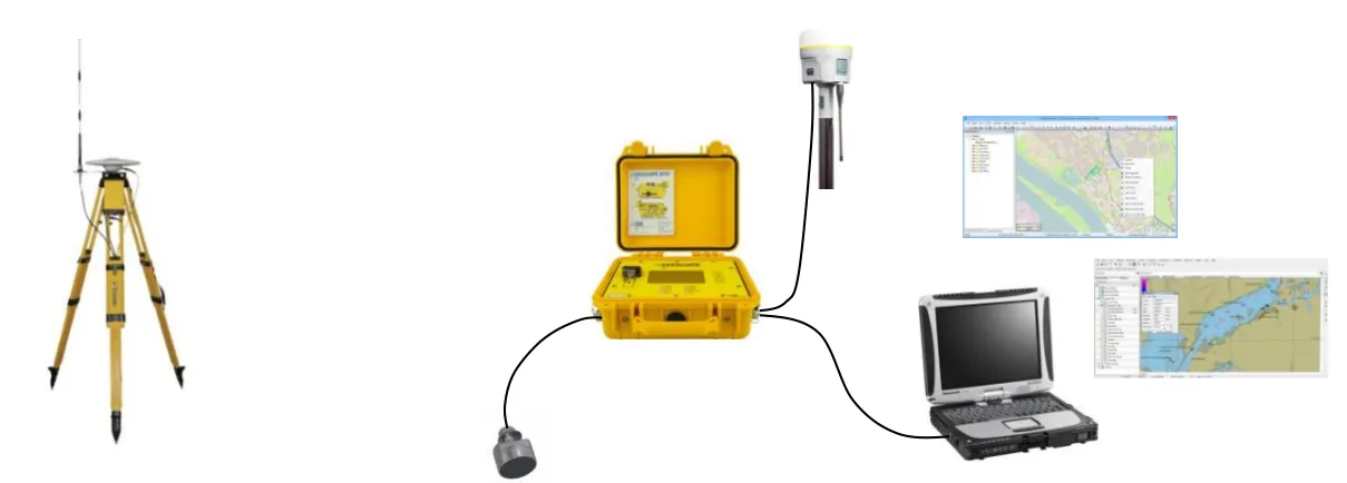
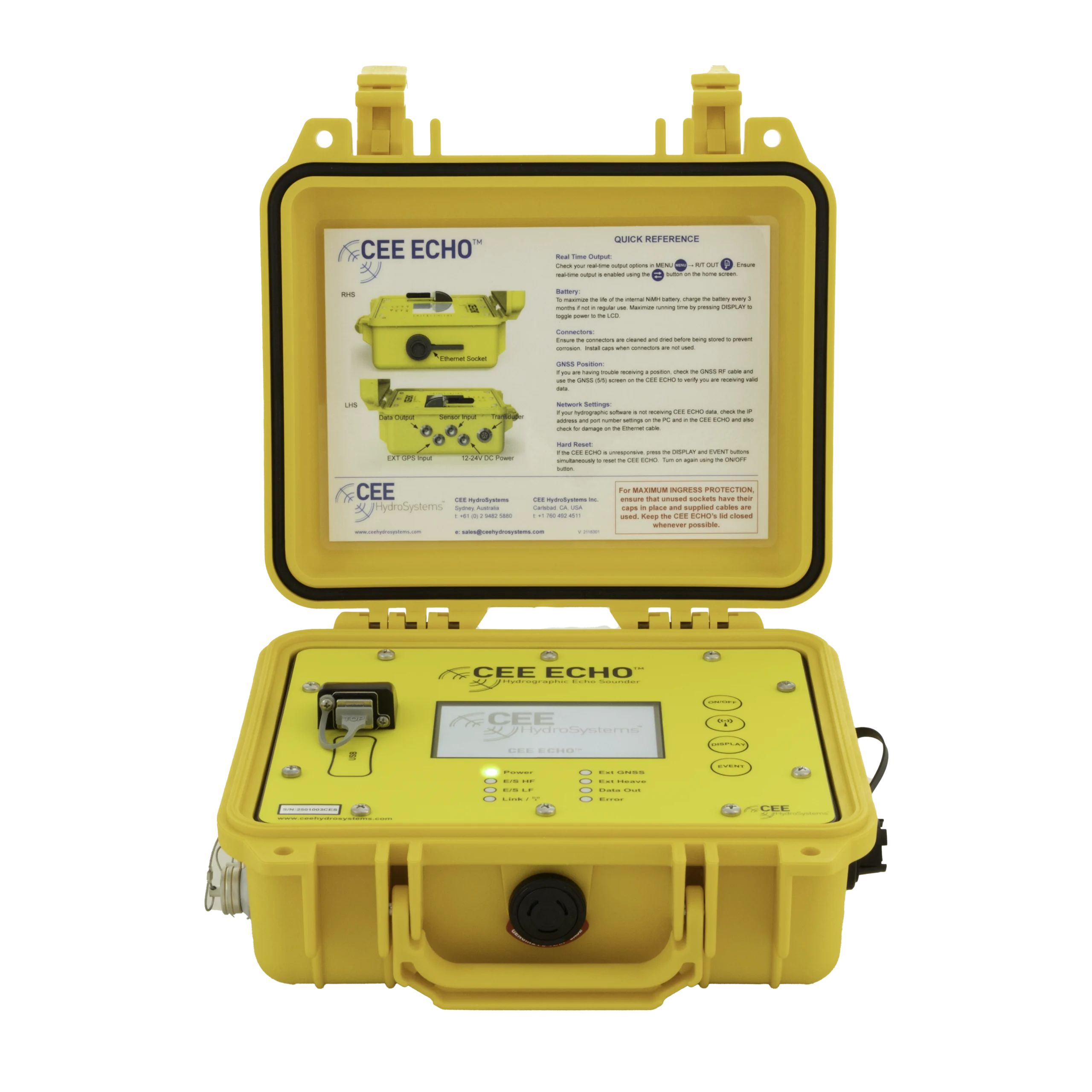
For a more robust, professional result, a GNSS data collector isn’t enough. The key difference is that hydrographic acquisition software such as Hydromagic, HYPACK or QINSy replaces the GNSS software. Visualisation is far better, and these packages unlock the quality control features of echo sounders like the CEE ECHO™ and CEESCOPE™.
- You can still use your existing GNSS receiver: it sends position into the echo sounder, which combines it with depth and sends both to the PC. The data collector is only needed to initialise the receiver, or to supply corrections if it holds the SIM.
- The hydrographic software manages the geodesy, with pre-loaded coordinate systems that match land survey software, local and construction grids, and geoid models for elevation.
- The CEESCOPE™ has fully integrated RTK GNSS, so no third-party GNSS is needed. It connects to a UHF base station through its built-in radio, or uses cell phone / VRS corrections.
- The CEE ECHO™ is echo sounder only and takes NMEA 0183 from your GNSS receiver over Bluetooth or RS-232.
Hydrographic survey: pros
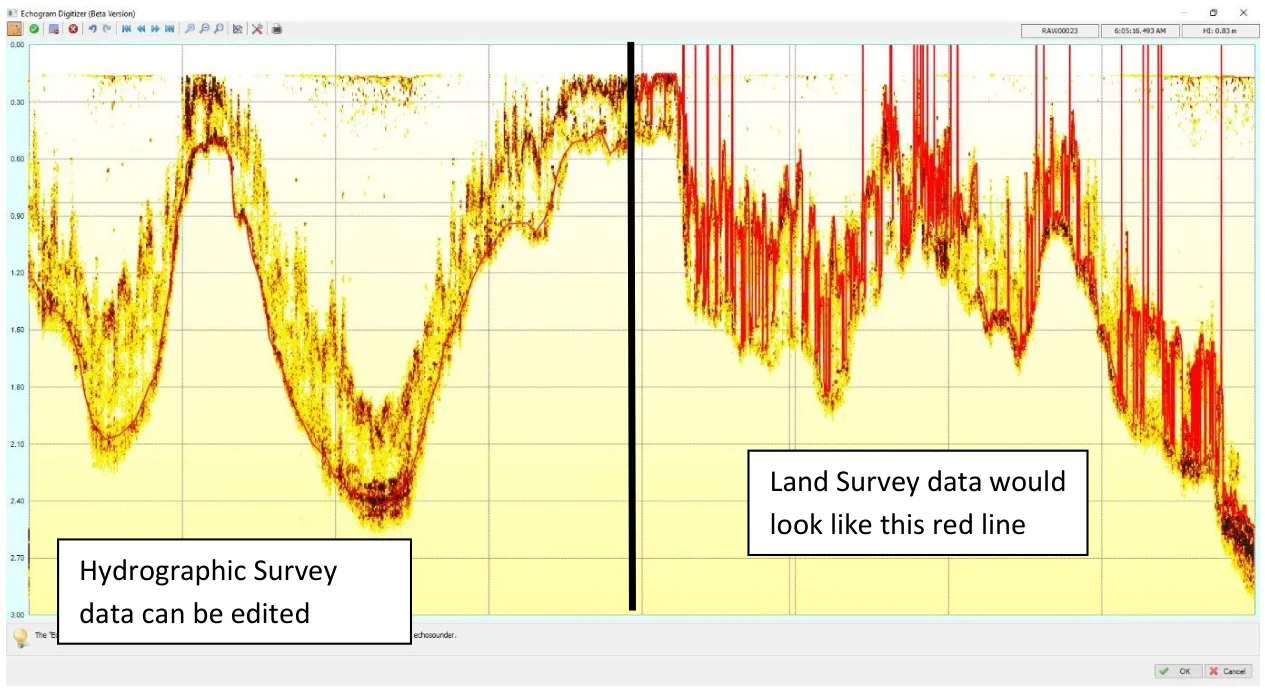
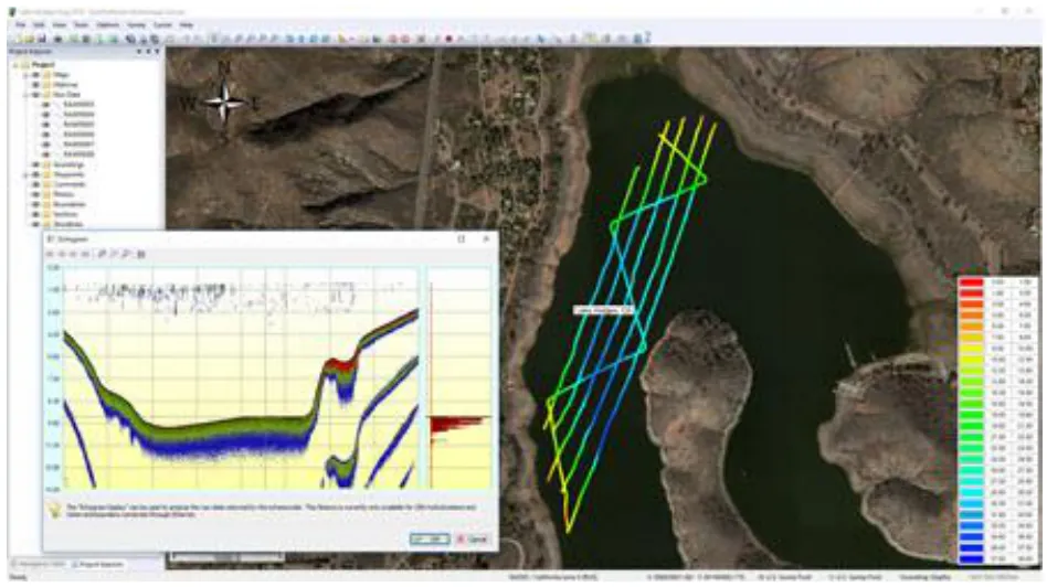
- Quality control. The full water column echogram is displayed and recorded, so you can see what the echo sounder is “seeing” and correct soundings when the digital depth misses the real bottom, for instance in thick vegetation. In Figure 4 the unedited data (right) is what any digital-only land survey set-up would output; the echogram lets you re-digitise to the true bottom (left). The edits are documented for any future client scrutiny.
- Accuracy. The CEE ECHO™ and CEESCOPE™ combine GNSS and depth data with a precise millisecond time stamp, which the software uses to position every sounding exactly. Latency errors are eliminated. They ping at up to 30 Hz, giving much more detail and data that stays dense even after heavy thinning during editing.
- Survey visibility. A live view of the boat with bathymetry in map and profile view makes it much less likely you’ll collect bad data and leave site. Problems can be spotted and fixed on the fly.
- Dual frequency. Using high and low frequency data to understand sedimentation really needs hydrographic software; it’s only possible in a limited way with a land survey set-up.
Hydrographic survey: cons
- Cost. The echo sounders are more capable and cost more, and the software must be bought too. For occasional small jobs it won’t be justified.
- Training. New software needs some training. Options range from practically unusable without training to intuitive and easy. The echo sounders have more features to understand to get the most from them.
Which should I choose?
There is no right or wrong choice. Be aware of the shortcomings of the land survey approach and decide whether your project goals need the bigger investment. The hydrographic approach will always lead to a better survey, but each job decides whether that is warranted. See how a single beam hydrographic survey works for the basics.
Equipment used

Talk to US
Need a hand with your set-up?
Our engineers answer survey questions every day.