

Case histories › Case history
Case history
CEE ECHO™ for very shallow surveys in the San Elijo Lagoon Restoration
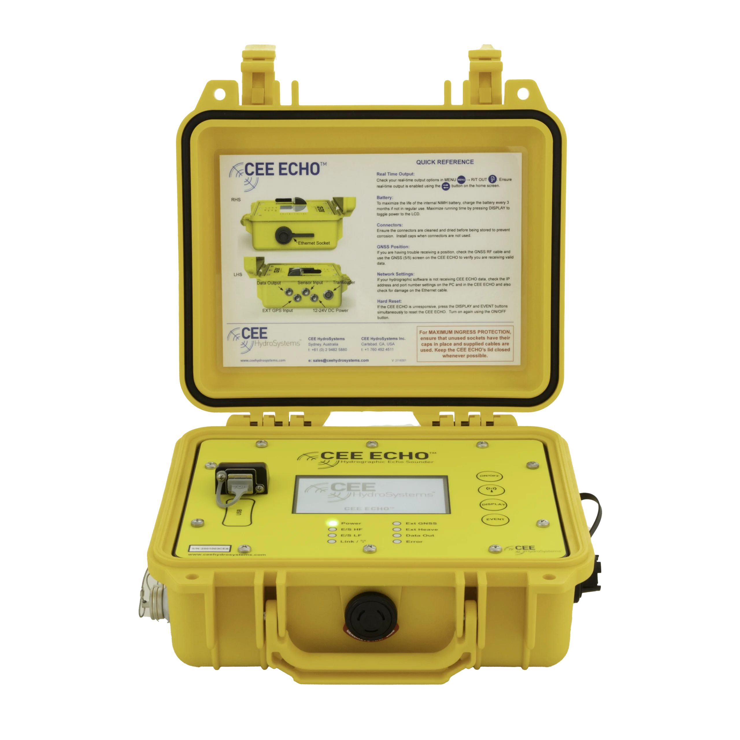
Coastal Frontiers swapped its old echo sounder for a CEE ECHO™ on the San Elijo Lagoon Restoration Project, surveying lagoon depths typically under 4 ft (1.2 m) from a small boat or the CEE-USV™. Auto-gain and sensitivity cut collection and processing time, about 20 lbs of batteries were eliminated, and digital echograms in HYPACK replaced paper charts.
Equipment used
At a glance
- Client
- Coastal Frontiers Corporation
- Location
- San Elijo Lagoon, Cardiff-by-the-Sea, California, USA
- Application
- Very shallow lagoon and channel bathymetry for the San Elijo Lagoon Restoration Project
- Equipment
- CEE ECHO™ on a small manned boat or the CEE-USV™
- GNSS and software
- Hemisphere S320 RTK rover, HYPACK
- Since
- 2017 (Coastal Frontiers on the project)
About the project
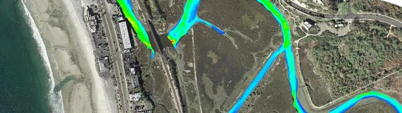
Since 2017, Coastal Frontiers Corporation (Moorpark, CA, USA) has provided lagoon and nearshore data collection services to San Diego’s habitat restoration non-profit Nature Collective and project contractor Moffatt and Nichol, as part of the San Elijo Lagoon Restoration Project (SELRP) in Cardiff-by-the-Sea.
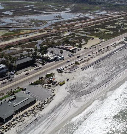
SELRP is one of the most extensive wetland restoration projects in California, and the ecosystem features a number of very shallow channels and lagoons. The lagoon channels and adjacent uplands were dredged and graded to improve tidal flushing and water quality. In addition, 450,000 cubic yards of beach quality sediment was beneficially reused as beach nourishment in Cardiff and Solana Beach.
The challenge
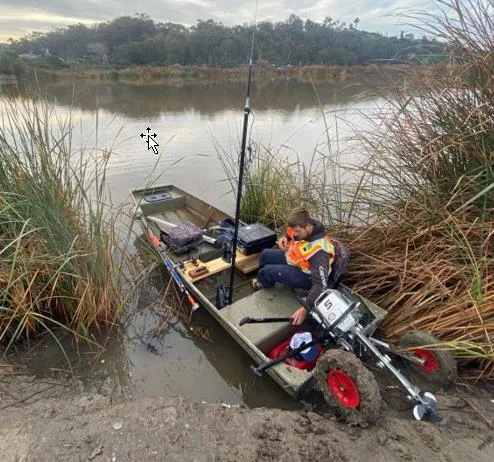
Bathymetry surveys were required to establish the pre and post construction conditions, in addition to progress surveys and ongoing monitoring. Owing to the extremely shallow water, with survey depths typically under 4 ft (1.2 m), echo sounder selection was a critical factor in a successful outcome. The echo sounder had to work when the boat was barely floating above the bottom.
The solution
Coastal Frontiers used the project to replace its previous echo sounder with the CEE ECHO™. Deployed on a small manned boat or the CEE-USV™ in combination with HYPACK software, the CEE ECHO™ received RTK GNSS position data from a Hemisphere S320 rover.
Chris Scott of Coastal Frontiers comments on the new equipment benefits:
“The auto-gain and -sensitivity vastly improved the time required to both collect and process our single-beam data. In addition, the CEE ECHO’s small form-factor allowed us to reduce deck space needed for our gear and eliminate about 20 lbs of batteries required for our old echosounder!”
Chris Scott, Coastal Frontiers
Surveying in active dredging
As specialists in this type of multiple technique nearshore survey project, Coastal Frontiers also monitored the beach nourishment program with UAV flights and bathymetry surveys at depths of 10-60 ft using its CEE ECHO™.
With active dredging and sediment resuspension, survey conditions were tricky at times, and advanced QA/QC supported by the CEE ECHO™ was useful:
“The digital echogram efficiently mapped both the top and bottom of the loosely-consolidated layer. We were die-hard paper chart users, but since using the CEE ECHO™ we would never consider surveying without a digital echogram.”
Coastal Frontiers
The results
450,000 yd³of beach quality sediment reused as beach nourishment
<4 ft (1.2 m)typical survey depths in the lagoon
about 20 lbsof batteries eliminated vs the old echosounder
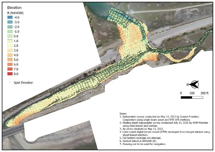
In combination with wading and land survey data, a complete topographic map of the entire lagoon system was generated for the project managers.
Extensive use of digital echograms in HYPACK represented a welcome departure from the “old ways” of the paper chart echo sounder.
Planning a similar survey?
Tell us about your site and we’ll recommend the right equipment.
Talk to us →
More from the field
6 Jan 2026
Dredging contractor brings surveys in-house with the CEE ECHO™ and Hydromagic
ACT Marine, a New England dredging contractor, uses a CEE ECHO™ with Hydromagic for its own QC and pre-final clearance surveys. The system sets up in 20 minutes, its results match the third-party survey, and projects are accepted on the final survey without costly post cleanup.
ACT Marine, a New England dredging contractor, uses a CEE ECHO™ with Hydromagic for its own QC and pre-final clearance surveys. The system sets up in 20 minutes, its results match the third-party survey, and projects are accepted on the final survey without costly post cleanup.
Read case history →
13 Nov 2025
Blue Arc Engineering halves fieldwork on dock permit surveys with the CEE ECHO™ and Hydromagic
Blue Arc Engineering in Fort Myers, Florida swapped manual range pole and GNSS depth surveys for a CEE ECHO™ with Hydromagic and its existing Trimble R780. Fieldwork that would have taken a full day was cut in half, and the bathymetric product followed within days.
Blue Arc Engineering in Fort Myers, Florida swapped manual range pole and GNSS depth surveys for a CEE ECHO™ with Hydromagic and its existing Trimble R780. Fieldwork that would have taken a full day was cut in half, and the bathymetric product followed within days.
Read case history →
10 Dec 2024
AOI Solutions surveys a hurricane-hit construction pond with the CEE ECHO™ and Hydromagic
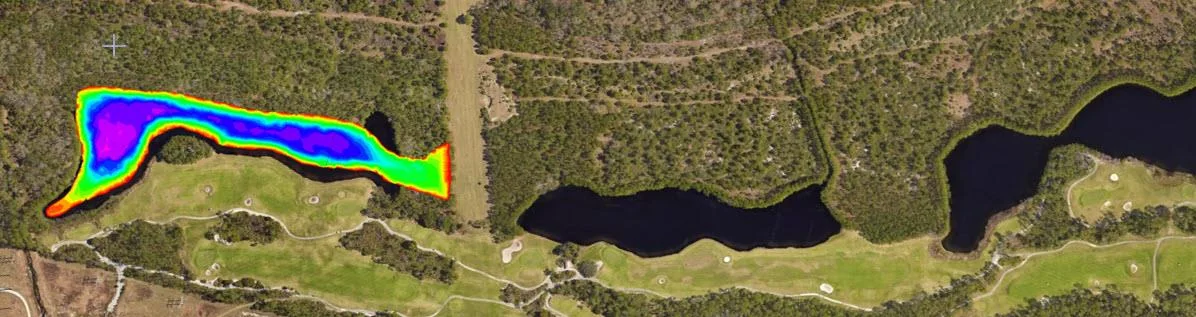
AOI Solutions surveyed a Daytona Beach retention pond, hit by hurricane Helene inflow and active backfilling, in 3 hours with a CEE ECHO™ and Hydromagic. An edited RTK-grade bottom surface reached the client three hours later, and the echograms showed both the sediment level and the original pond bottom.
AOI Solutions surveyed a Daytona Beach retention pond, hit by hurricane Helene inflow and active backfilling, in 3 hours with a CEE ECHO™ and Hydromagic. An edited RTK-grade bottom surface reached the client three hours later, and the echograms showed both the sediment level and the original pond bottom.
Read case history →