

Case histories › Case history
Case history
AOI Solutions surveys a hurricane-hit construction pond with the CEE ECHO™ and Hydromagic
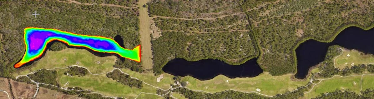
AOI Solutions surveyed a Daytona Beach retention pond, hit by hurricane Helene inflow and active backfilling, in 3 hours with a CEE ECHO™ and Hydromagic. An edited RTK-grade bottom surface reached the client three hours later, and the echograms showed both the sediment level and the original pond bottom.
At a glance
- Client
- Area of Interest (AOI) Solutions, Inc
- Location
- Central Florida, USA (LPGA International golf course, Daytona Beach, FL)
- Application
- Construction site retention pond survey and sediment infill volume
- Equipment
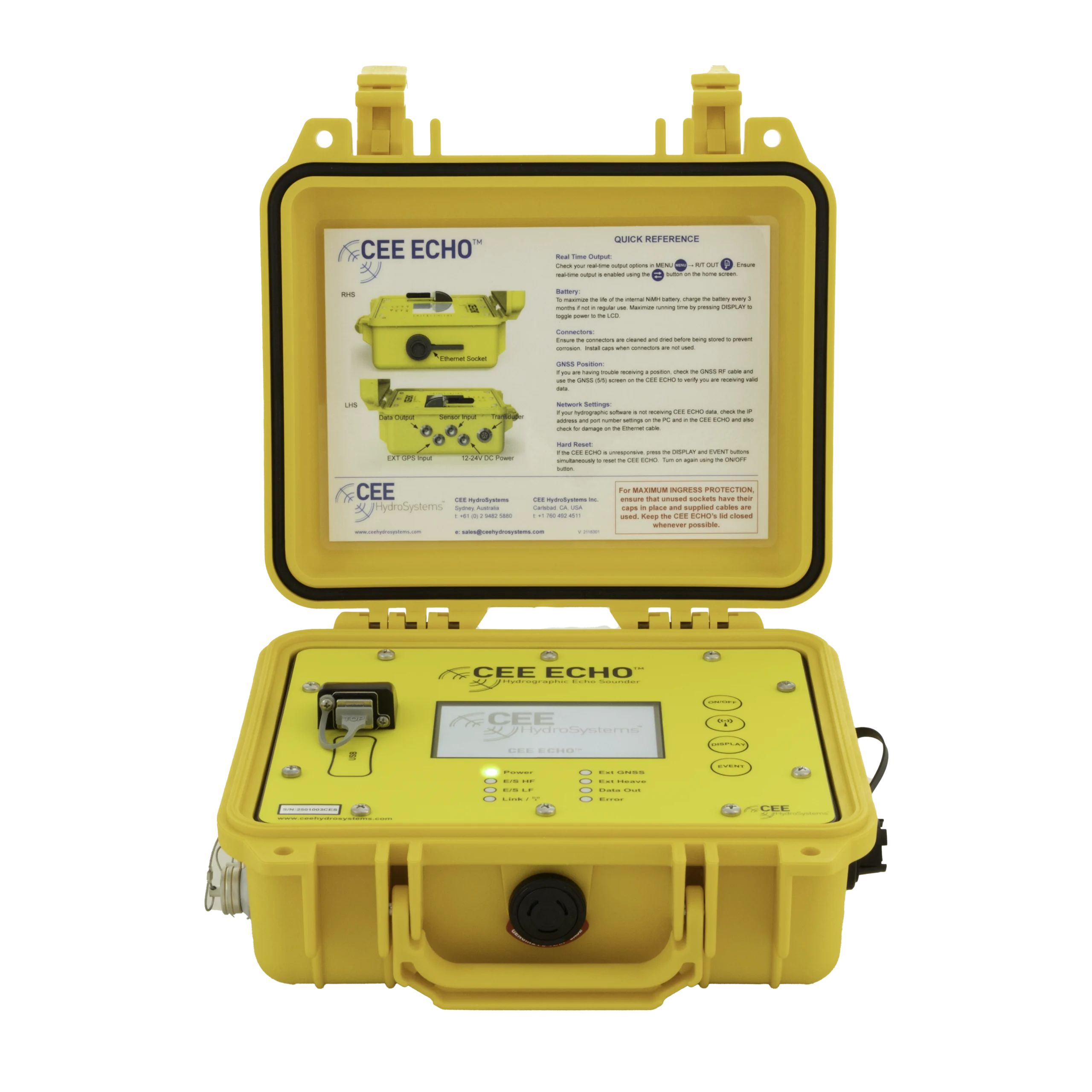
- CEE ECHO™ echo sounder on a 14 ft jon boat
- GNSS and software
- Topcon Hyper VR RTK GNSS receiver, Hydromagic on a rugged PC
- Survey time
- 3 hours, 25 ft line spacing
About AOI Solutions
Central Florida, USA-based land surveyors Area of Interest (AOI) Solutions, Inc contacted CEE while searching for improved equipment for small-scale bathymetry projects.
While land surveyors often opt for basic depth sounders with sometimes challenging output datasets, or laborious but credible manual soundings, AOI instead took advantage of an opportunity to make a real investment for data confidence by upgrading their methods and equipment for key client projects.
The challenge
Having already used basic rented pole mounted Bluetooth sonars, AOI was unhappy with the sometimes unpredictable or inconsistent output, and lack of resilience in more challenging conditions such as high turbidity. Ready to invest in a professional level setup to provide the superior quality data to customers, AOI selected the CEE ECHO™ to be paired with their existing Topcon Hyper VR RTK GNSS receiver.
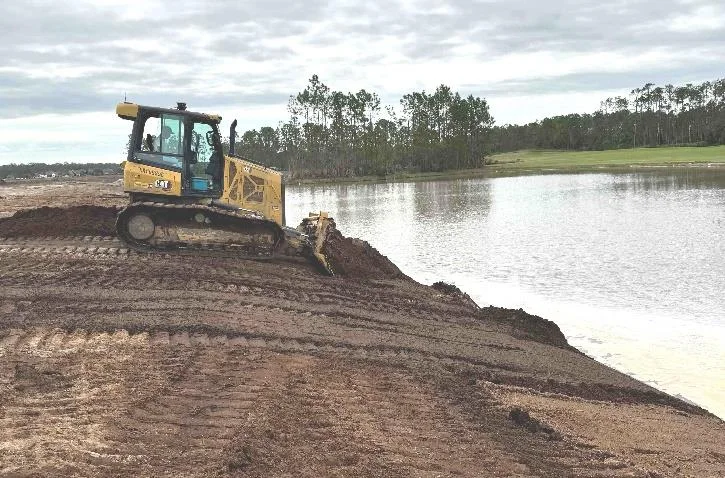
The first project concerned a retention pond at the LPGA International golf course in Daytona Beach, FL. Earthwork damage from hurricane Helene (October 2024) had caused a river to flow into the pond, potentially carrying large quantities of sediment. The pond was now part of an ongoing new housing construction project, and was also being affected by grading and backfilling activities. Site engineers needed to know how the pond volume had been impacted by the hurricane inflow.
The solution
Using Hydromagic software running on a rugged PC and a 14 ft jon boat, the survey crew completed the survey in 3 hrs. With real time view of all data and boat navigation, AOI was able to ensure even coverage with 25 ft line spacing. Adam Holtkamp, CEO of AOI Solutions, Inc was not hitherto familiar with this new hydrographic process for a bathy survey.
“Completing this survey with a sounding line would have taken days; we did not trust a basic rented echo sounder with dozers actively backfilling into the pond during the survey and very high residual turbidity.”
Adam Holtkamp, CEO, AOI Solutions, Inc
Producing the surfaces in Hydromagic
Producing a bottom elevation surface was surprisingly easy in Hydromagic.
“Moving away from a basic GNSS data acquisition to Hydromagic was much easier than I expected. We had an edited RTK-grade bottom surface to the client three hours after the survey was complete. Everyone was a bit shocked it was easier than we were expecting and the data came out very clean.”
Adam Holtkamp, CEO, AOI Solutions, Inc
“It was reassuring to see the echogram view on the cross-section lines show the uniform flat surface of the sediment infill over the uneven original pond bottom below. This extra QA/QC confers so much more confidence in the data.”
Adam Holtkamp, CEO, AOI Solutions, Inc
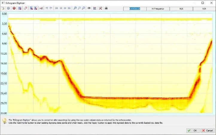
Post processing echogram data allowed reconstruction of the pond bottom in a second TIN model surface and calculation of sediment infill volume.
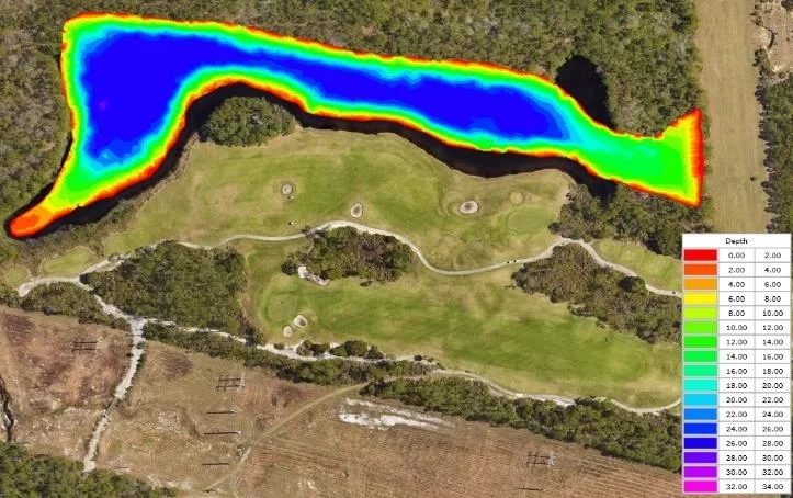
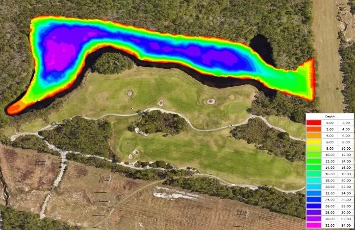
The Hydromagic Google Earth KML export link option allowed site engineers to “fly” to the preliminary survey results almost immediately after the survey.
The results
3 hrsto complete the survey
3 hrsafter the survey, an edited RTK-grade bottom surface was with the client
25 ftline spacing with even coverage
The main perceived benefit of the CEE ECHO™ was the ability to have improved confidence in sonar data. This was supported in this project by the ability of the echo sounder to determine and definitively show not only the sediment elevation but also indicate the original pond excavated bottom level.
“With our new system we don’t have to contend with mysterious data points in midwater, unexplained jumps in the bottom surface or taking days to complete a job manually just so we can trust the results!”
Adam Holtkamp, CEO, AOI Solutions, Inc
Planning a similar survey?
Tell us about your site and we’ll recommend the right equipment.
Talk to us →
More from the field
6 Jan 2026
Dredging contractor brings surveys in-house with the CEE ECHO™ and Hydromagic
ACT Marine, a New England dredging contractor, uses a CEE ECHO™ with Hydromagic for its own QC and pre-final clearance surveys. The system sets up in 20 minutes, its results match the third-party survey, and projects are accepted on the final survey without costly post cleanup.
ACT Marine, a New England dredging contractor, uses a CEE ECHO™ with Hydromagic for its own QC and pre-final clearance surveys. The system sets up in 20 minutes, its results match the third-party survey, and projects are accepted on the final survey without costly post cleanup.
Read case history →
13 Nov 2025
Blue Arc Engineering halves fieldwork on dock permit surveys with the CEE ECHO™ and Hydromagic
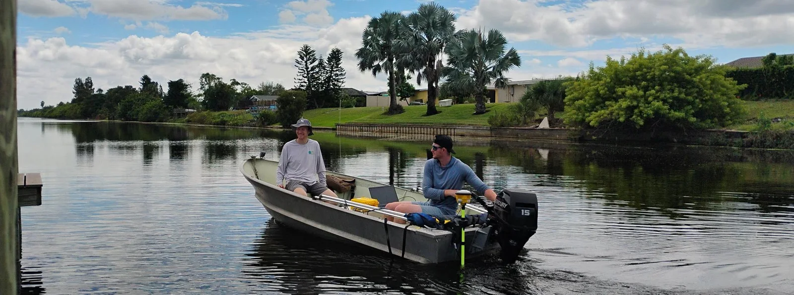
Blue Arc Engineering in Fort Myers, Florida swapped manual range pole and GNSS depth surveys for a CEE ECHO™ with Hydromagic and its existing Trimble R780. Fieldwork that would have taken a full day was cut in half, and the bathymetric product followed within days.
Blue Arc Engineering in Fort Myers, Florida swapped manual range pole and GNSS depth surveys for a CEE ECHO™ with Hydromagic and its existing Trimble R780. Fieldwork that would have taken a full day was cut in half, and the bathymetric product followed within days.
Read case history →
10 Feb 2023
CEE ECHO™ for very shallow surveys in the San Elijo Lagoon Restoration
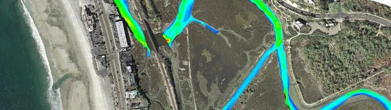
Coastal Frontiers swapped its old echo sounder for a CEE ECHO™ on the San Elijo Lagoon Restoration Project, surveying lagoon depths typically under 4 ft (1.2 m) from a small boat or the CEE-USV™. Auto-gain and sensitivity cut collection and processing time, about 20 lbs of batteries were eliminated, and digital echograms in HYPACK replaced paper charts.
Coastal Frontiers swapped its old echo sounder for a CEE ECHO™ on the San Elijo Lagoon Restoration Project, surveying lagoon depths typically under 4 ft (1.2 m) from a small boat or the CEE-USV™. Auto-gain and sensitivity cut collection and processing time, about 20 lbs of batteries were eliminated, and digital echograms in HYPACK replaced paper charts.
Read case history →