

Case histories › Case history
Case history
Surveying with the CEESCOPE™ in the coldest place on Earth
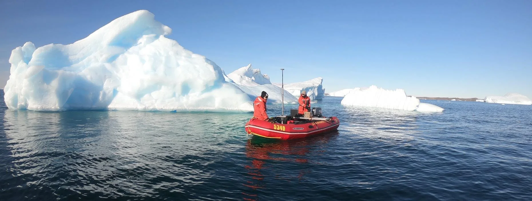
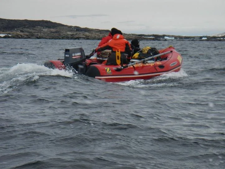
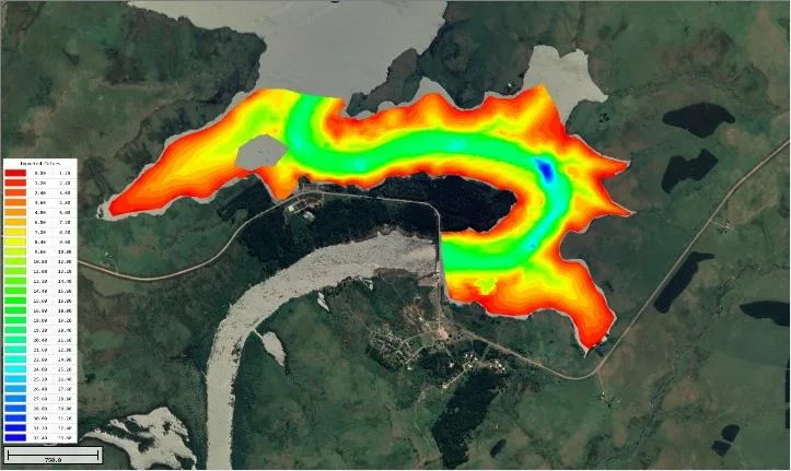
An Antarctic survey team completed bathymetry and side scan surveys around Davis Station with no mishaps or equipment problems, using a CEESCOPE™ and CEE-TSF™ StarFish side scan on a very small boat. The data helps assess a proposed concrete runway.

At a glance
- Client
- An Australian Antarctic survey team (not named in the PDF)
- Location
- Davis Station, Antarctica
- Application
- Bathymetry and side scan surveys to assess a proposed concrete runway
- Equipment
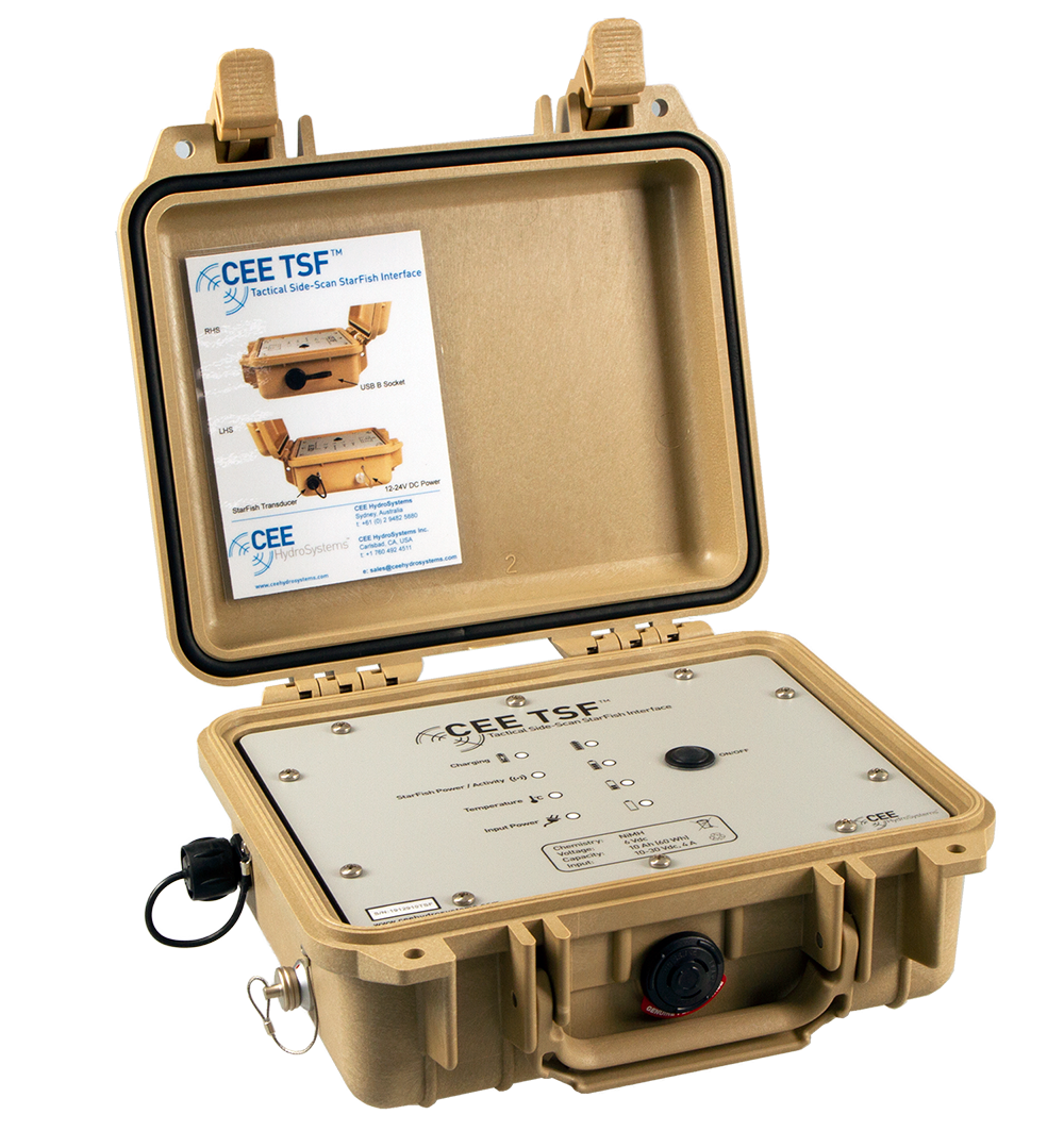
- CEESCOPE™ RTK single beam echo sounder, CEE-TSF™ enhanced StarFish side scan (StarFish 452H), CEE-PACK™ power pack, VOO bracket kit
- GNSS and software
- NovAtel 729 RTK GNSS (inside the CEESCOPE™), HYPACK®
- Program
- Australian government runway initiative announced in 2018
The project
Surveying on the Antarctic continent presents significant challenges for any instrumentation, especially in the marine environment. In 2018, the Australian government announced its intention to construct a new concrete runway at the Davis Station Antarctic base. Apart from the obvious logistical advantages of year-round access, the project is expected to result in wide scientific benefits such as higher resolution weather and climate models, and improved contributions to global sea level studies. The runway would be the first paved runway on the continent.
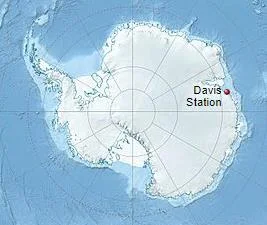
As part of the project, an Antarctic survey team were called in to provide combined single beam and side scan sonar hydrographic surveys. The goal was to better understand the bathymetry close to the Davis Station base in order to assess the viability of constructing the runway. In particular, the surveys focused on the ability of landing craft to safely land and deliver supplies for the future construction of the aerodrome.
The equipment
The surveyors chose to use their Vessel of Opportunity (VOO) kits supplied by CEE HydroSystems, comprising:
- a CEESCOPE™ “all in one” RTK-enabled echo sounder
- the CEE-TSF™ enhanced StarFish side scan
- the CEE-PACK™ super-rugged power pack
- a transducer mounting kit
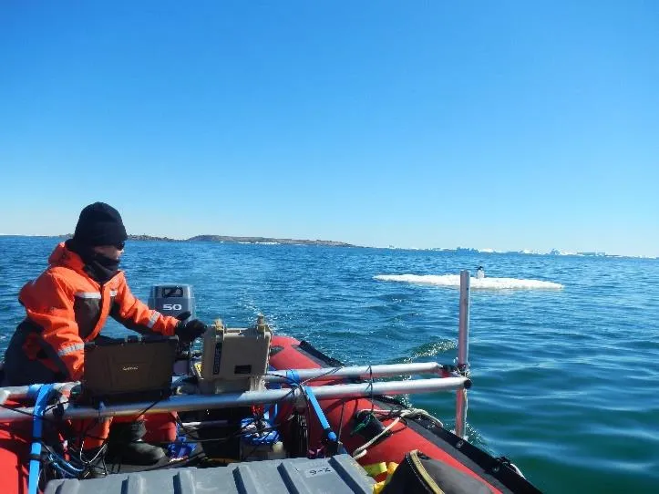
The key to the Australian team’s equipment selection was the ability to mobilize easily on a very small boat, with equipment that was designed with the cold climate specifically in mind. There was no room for equipment failures.
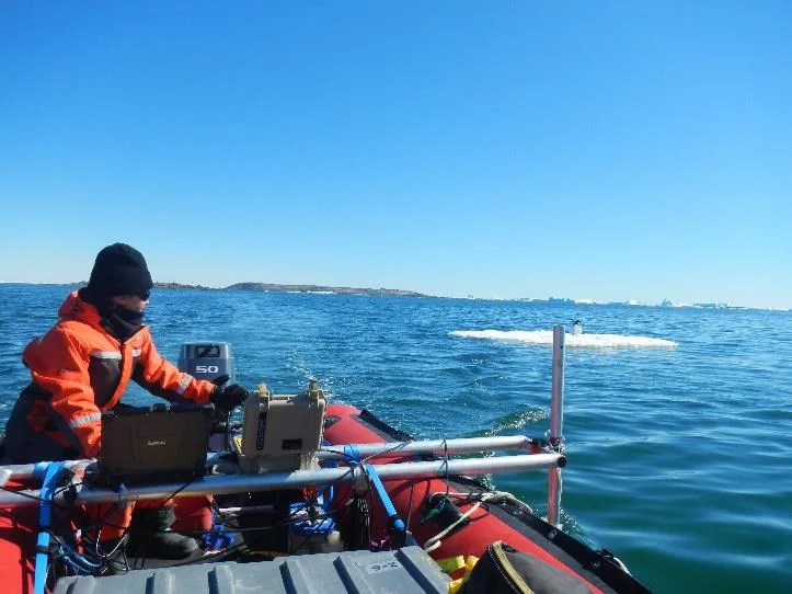
The StarFish 452H side scan towfish was pole-mounted alongside the CEESCOPE echo sounder’s 200 kHz transducer. This arrangement, using CEE’s VOO bracket kit, offered a more suitable deployment method than attempting to tow the towfish behind the small boat. Position data were generated by the NovAtel 729 RTK GNSS receiver inside the CEESCOPE itself.
The results
The surveyors were happy they were able to complete their surveys with no mishaps or equipment problems.
The combined use of side scan with single beam echo sounding was demonstrated to be an effective alternative to more complex multibeam equipment, especially for reconnaissance type surveying. The HYPACK® software package used for the surveys is able to conveniently acquire and georeference side scan images along with the CEESCOPE bathymetry, creating a combined bathymetric map and bottom imaging dataset to allow the project team to better understand the potential future challenges of the area during construction.
“The job was a success and we are always impressed with the CEESCOPE and the rest of the VOO kit. We also enjoy surprising other surveyors with the good results we get from a compact unit that is easy to use and set up!”
One of the project members
Planning a similar survey?
Tell us about your site and we’ll recommend the right equipment.
Talk to us →
More from the field
6 Jan 2026
Trimble RTX for accurate wastewater sludge comparison surveys with the CEE-USV™
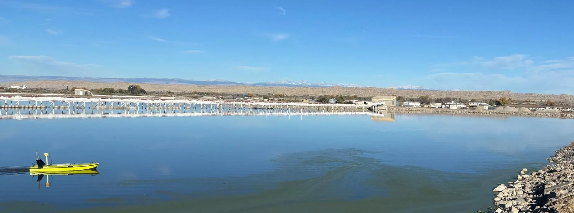
Team Lab monitors sludge in hundreds of wastewater lagoons with the CEE-USV™. Adding a CEESCOPE™ with Trimble CenterPoint® RTX in 2025 gave about 1 in (2.5 cm) vertical accuracy for the lagoon water level on every survey, so repeat surveys compare sludge volumes accurately without anyone going out on the water.
Team Lab monitors sludge in hundreds of wastewater lagoons with the CEE-USV™. Adding a CEESCOPE™ with Trimble CenterPoint® RTX in 2025 gave about 1 in (2.5 cm) vertical accuracy for the lagoon water level on every survey, so repeat surveys compare sludge volumes accurately without anyone going out on the water.
Read case history →
17 Sep 2023
Surveying industrial water with single beam echo sounders and USVs: mine water, frac pits and effluent ponds
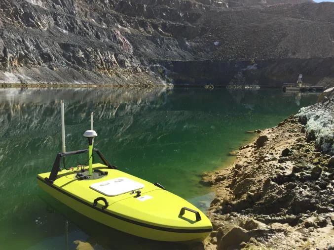
How single beam echo sounders and unmanned survey boats are used for industrial water management: reservoir volume, sludge and sediment, and regulatory reporting. Worked examples cover mine tailings storage facilities, frac pits and effluent lagoon dredging.
How single beam echo sounders and unmanned survey boats are used for industrial water management: reservoir volume, sludge and sediment, and regulatory reporting. Worked examples cover mine tailings storage facilities, frac pits and effluent lagoon dredging.
Read case history →
19 Mar 2020
CEESCOPE™ flyaway kit used for a dam survey in South America
After two days of training, a transport engineer ran his first survey in South America two weeks after receiving the CEESCOPE™. The all-in-one echo sounder and Hydromagic made a successful reconnaissance dam survey simple, with the kit hand carried on the airline.
After two days of training, a transport engineer ran his first survey in South America two weeks after receiving the CEESCOPE™. The all-in-one echo sounder and Hydromagic made a successful reconnaissance dam survey simple, with the kit hand carried on the airline.
Read case history →