

Case histories › Case history
Case history
WaterCube maps the Silver River, Florida through extreme sub-aquatic vegetation with the CEE ECHO™
WaterCube ran a successful reconnaissance survey of the Silver River, Florida, where vegetation covers almost the whole bottom. The CEE ECHO™ 200 kHz channel mapped the top of the canopy and post processed 33 kHz data revealed the true bottom, giving plant height and coverage.
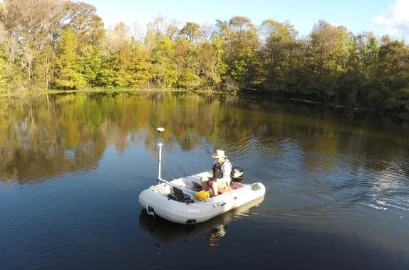
Equipment used
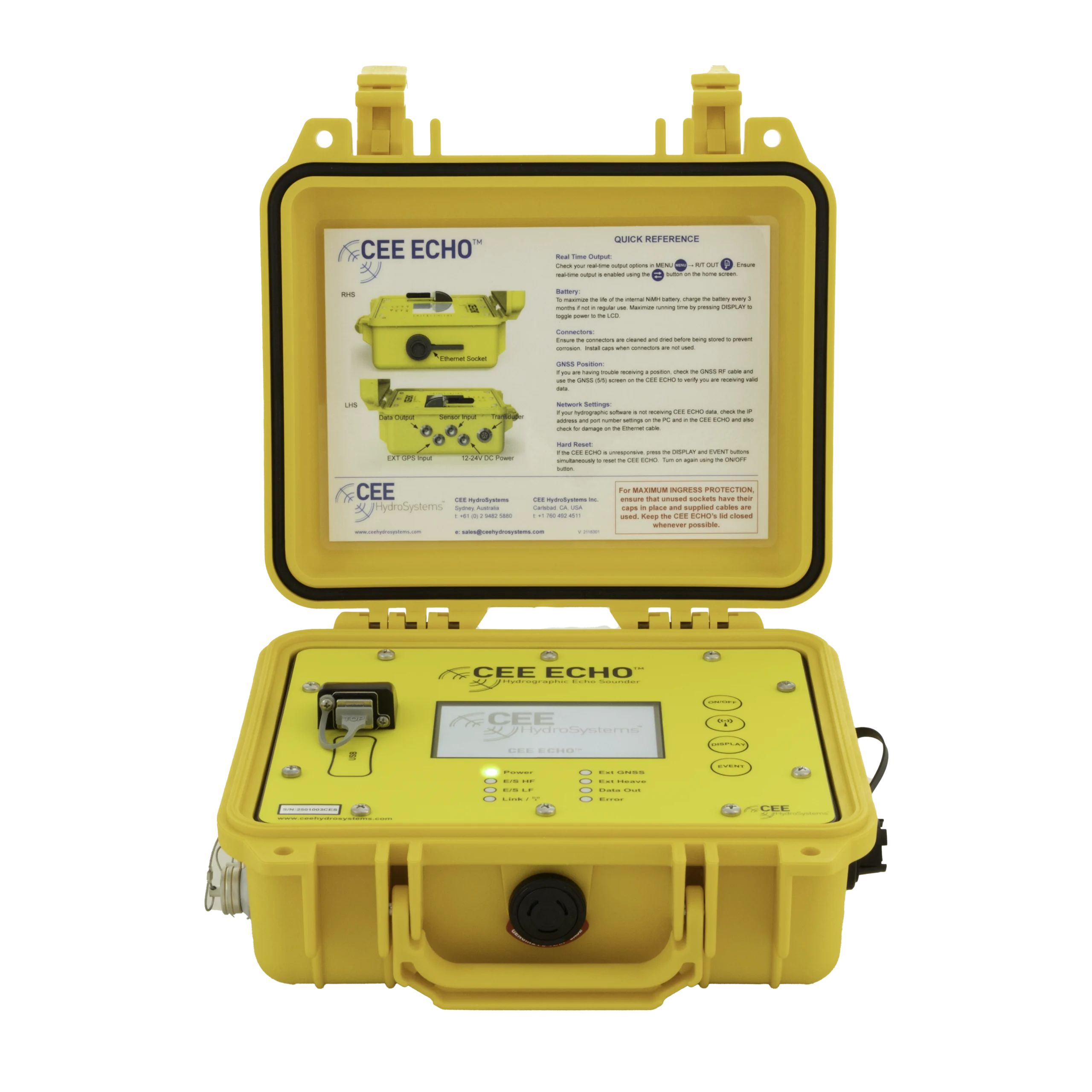
At a glance
- Client
- WaterCube LLC
- Location
- Silver River, near Silver Springs, Florida, USA
- Application
- Reconnaissance bathymetry through extreme sub-aquatic vegetation
- Equipment
- CEE ECHO™ dual frequency (33/200 kHz) echo sounder, pole-mounted transducer, inflatable boat
- GNSS and software
- Hemisphere AtlasLink™ GNSS, HYPACK®
About WaterCube
WaterCube LLC is a river bathymetry and velocity mapping specialist, offering field data collection, consultancy, and advanced software solutions for data visualization and interpretation.
The challenge
Faced with a challenge of determining accurate bathymetry for their river modeling service in the Silver River, near Silver Springs Florida USA, WaterCube turned to their dual frequency CEE ECHO™ portable echo sounder.
The Silver River is characterized by extreme sub aquatic vegetation covering most of the bottom, with growth fed by elevated nutrient levels in the natural spring water source.
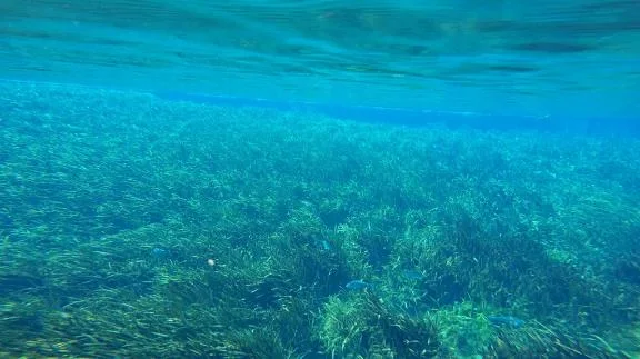
As a result of the thick vegetation, any basic 200 kHz echo sounder would simply map the top of the canopy, with little or no accurate bathymetry relating to the real bottom 0.5–2 m below.
The goal was to determine whether it was possible to gather useable bathymetry in this shallow environment with almost total sub aquatic vegetation coverage.
The solution
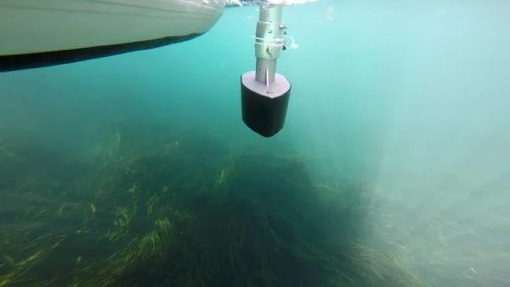
WaterCube used an inflatable boat with an over-the-side pole mounted 33/200 kHz transducer, CEE ECHO™, Hemisphere AtlasLink™ GNSS, and HYPACK® software to perform the survey.

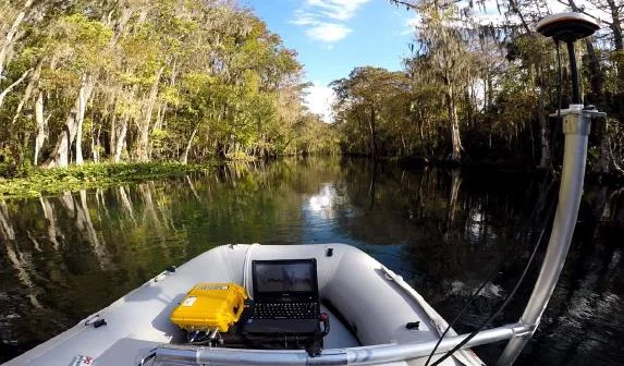
It was immediately obvious that the canopy density was too high to allow the 200 kHz echo sounder to “see” the bottom easily. The substrate was soft, presenting no hard bottom return that could be identified against the canopy above.
The low frequency 33 kHz echo sounder channel was equally attenuated by the vegetation, and could not be used on its own to differentiate a true bottom surface.
Surveying in manual mode
To conduct the survey, the CEE ECHO was operated in “manual mode” with fixed sonar characteristics appropriate for the conditions. The goal was to use the 200 kHz channel to map the top of the canopy and at the same time ensure that there was a secondary but still visible sonar return from the true bottom underneath.
This could be achieved in real time by viewing the HYPACK® echogram window and modifying the settings until the best result was obtained. Below about 3–4 m water depth, the 33 kHz and 200 kHz channels were used in combination to identify the true bottom.
Post processing the true bottom
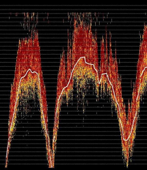
During a survey, the echo sounder digitizes depth values based on its bottom tracking algorithms and these are recorded as soundings. The 200 kHz soundings followed the thick plant canopy accurately and could be used with almost no further editing.
To show the real bottom underneath, the 200 kHz and 33 kHz echograms recorded by the CEE ECHO were superimposed and the 33 kHz soundings were re-digitized into a representation of the true bottom, replacing the soundings digitized during the survey. This was achieved by following the bottom echo trace that was visible on the HYPACK® echogram.
With the two different frequencies now representing the two surfaces (top of canopy and true bottom), differences in plant height may be relatively easily determined.
The result
With the real time 200 kHz echo sounder effectively mapping the top of the vegetation, post processed 33 kHz and 200 kHz data identified the real bottom beneath, allowing determination of plant height and coverage. The result was a successful reconnaissance survey of the Silver River using the CEE ECHO™ with the Hemisphere AtlasLink™ GNSS.
The CEE ECHO’s echogram and ability to use post processing techniques allowed WaterCube to get a better understanding of the requirements to survey this river as part of future mapping projects.
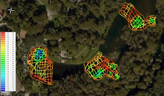
To learn about WaterCube’s mapping and data processing services, visit their web site: www.watercubedata.com.
Planning a similar survey?
Tell us about your site and we’ll recommend the right equipment.
Talk to us →
More from the field
6 Jan 2026
Dredging contractor brings surveys in-house with the CEE ECHO™ and Hydromagic
ACT Marine, a New England dredging contractor, uses a CEE ECHO™ with Hydromagic for its own QC and pre-final clearance surveys. The system sets up in 20 minutes, its results match the third-party survey, and projects are accepted on the final survey without costly post cleanup.
ACT Marine, a New England dredging contractor, uses a CEE ECHO™ with Hydromagic for its own QC and pre-final clearance surveys. The system sets up in 20 minutes, its results match the third-party survey, and projects are accepted on the final survey without costly post cleanup.
Read case history →
13 Nov 2025
Blue Arc Engineering halves fieldwork on dock permit surveys with the CEE ECHO™ and Hydromagic
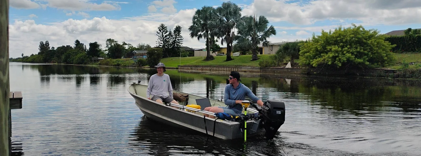
Blue Arc Engineering in Fort Myers, Florida swapped manual range pole and GNSS depth surveys for a CEE ECHO™ with Hydromagic and its existing Trimble R780. Fieldwork that would have taken a full day was cut in half, and the bathymetric product followed within days.
Blue Arc Engineering in Fort Myers, Florida swapped manual range pole and GNSS depth surveys for a CEE ECHO™ with Hydromagic and its existing Trimble R780. Fieldwork that would have taken a full day was cut in half, and the bathymetric product followed within days.
Read case history →
10 Dec 2024
AOI Solutions surveys a hurricane-hit construction pond with the CEE ECHO™ and Hydromagic
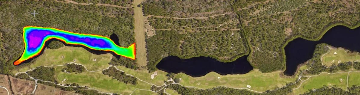
AOI Solutions surveyed a Daytona Beach retention pond, hit by hurricane Helene inflow and active backfilling, in 3 hours with a CEE ECHO™ and Hydromagic. An edited RTK-grade bottom surface reached the client three hours later, and the echograms showed both the sediment level and the original pond bottom.
AOI Solutions surveyed a Daytona Beach retention pond, hit by hurricane Helene inflow and active backfilling, in 3 hours with a CEE ECHO™ and Hydromagic. An edited RTK-grade bottom surface reached the client three hours later, and the echograms showed both the sediment level and the original pond bottom.
Read case history →