

Knowledge base › Survey guide
Survey guide
How do I survey frac pits and effluent lagoons?
Survey each frac pit once with a single beam echo sounder from a small boat or USV, and the software gives you a strapping chart, so a level logger then shows live water volume without going back. For effluent lagoons, an echo sounder maps the sludge surface faster and more consistently than a sludge judge; finding the hard bottom underneath needs dual frequency and enough water depth.
1 survey, then live volume
24 / 33 + 200 kHz for sludge thickness
3 reasons to survey
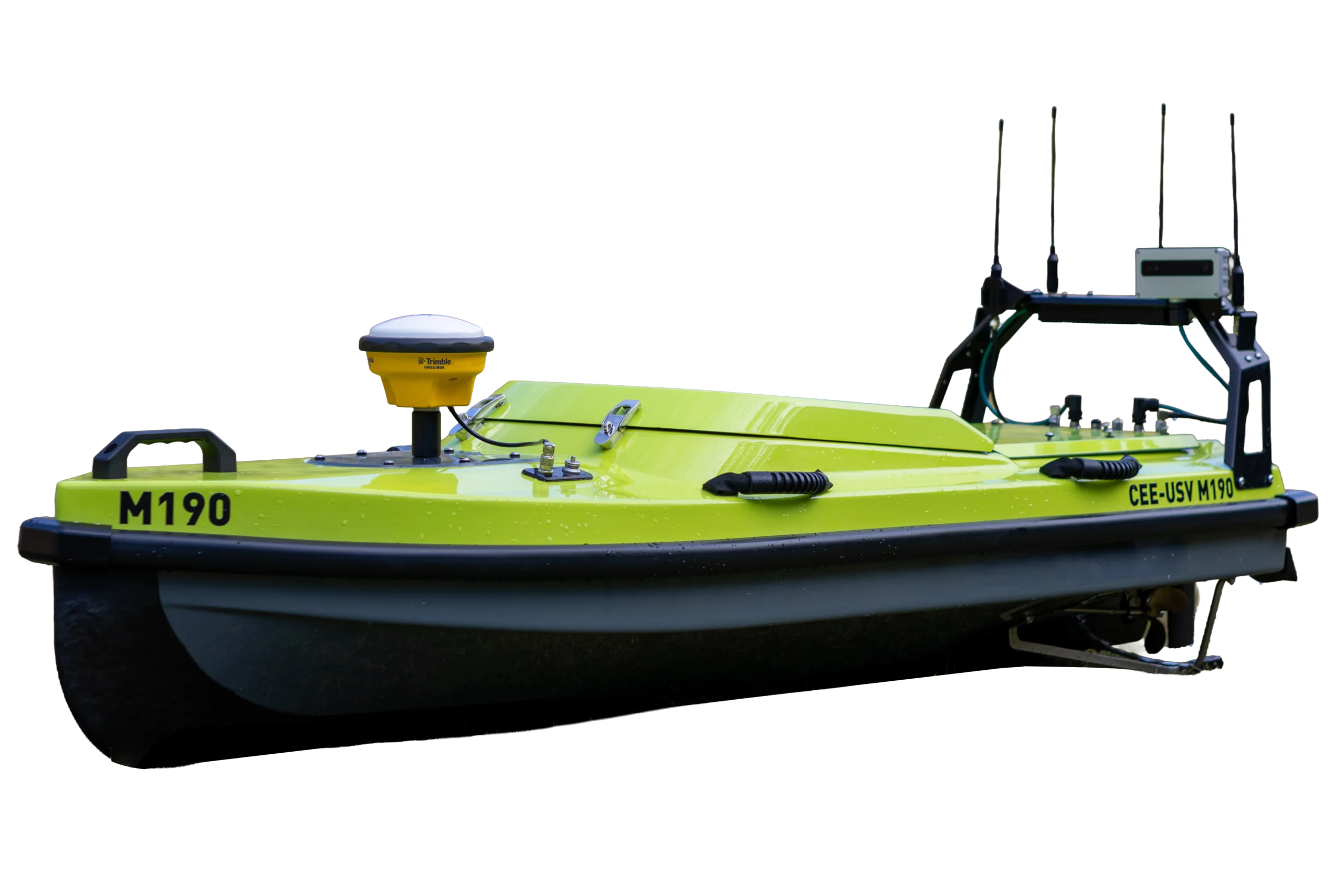
USV for hazardous ponds
In industries where stored water is part of the process (mining, pulp and paper, oilfield services, industrial and municipal effluent treatment), hydrographic methods have only been used sporadically, and few standard procedures exist. Older sonar was hard to use and hydrographic software complex. Better equipment, simpler software and survey drones that work from the safety of the shore have changed that. These examples come from CEE HydroSystems customers.
Why survey industrial water?
- Water volume: stored volume is important but often poorly understood. Methods range from slope calculations, lead lines or poles with a GPS, and fish finders to hydrographic echo sounders. A good survey gives an accurate bathymetry map and a stage (water height) versus volume relationship.
- Sludge and sediment: reservoirs fill with solids, deliberately (settling basins, tailings) or as a by-product. As the mudline rises, water storage capacity falls and residence time drops for the same flow, which can cause effluent quality compliance problems and the need for dredging. Surveys help engineers understand deposition, schedule dredging and check completed dredging for payment.
- Regulatory reporting: dams holding effluent water and solids may need periodic reporting of water volume or extent.
For mine tailings, see surveying a TSF with a USV.
Frac pits
Hydraulic fracturing (“fracking”) for shale gas injects large volumes of fluid, mostly water, into a well bore at high pressure. Flowmeters may record usage for payment to the landowner supplying the water, but the volume in excavated “frac pits” or natural ponds is often unknown.
Towards real-time volume
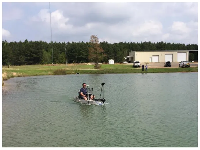
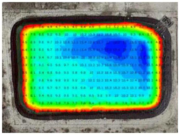
- Map each pit once with a single beam echo sounder and GPS, from a small USV or, for larger ponds, a one-person boat.
- Install a water level recorder at each site, reporting continuously by satellite.
- Use the strapping chart from the survey software (Hydromagic or HYPACK®) to turn level into volume.
Operators get a real-time view of water across multiple sites without visiting or re-surveying. Drone boats are often key, letting crews cover several sites a day.
Does the echo sounder matter?
Early frac pit boats used cheap “smart” transducers with basic processing, since accuracy needs aren’t especially strict. Over time, that saving came at a price. Frac ponds are often lined with hard, reflective surfaces, and the cheap sounders sometimes gave inconsistent results, with double reflections and poor bottom tracking that meant re-surveys or heavy editing. Switching to survey-grade echo sounders such as the CEESCOPE™ removed the onerous editing; with so many surveys, time spent editing poor data adds up.
Lined or concrete ponds: multiple echoes can be unusually strong on hard, flat bottoms. Setting max depth only about 25% deeper than expected helps avoid spikes from the first multiple echo. See blanking and double echoes.
Effluent lagoons
Effluent treatment removes solids and dissolved contaminants before water is discharged. Lagoons (in municipal treatment and industries such as paper making) pass water through bays where solids settle out with particulate contaminants, so they fill up and need periodic dredging. Aeration systems oxygenate the water to help digest organic solids, in a constant battle against sludge build-up.
Why use sonar instead of a sludge judge?
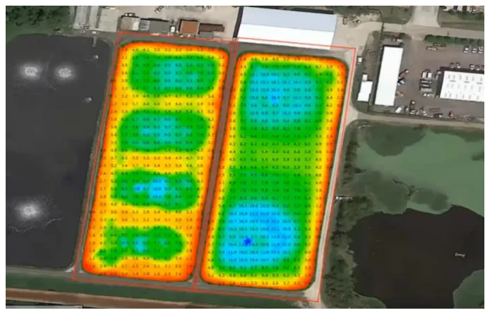
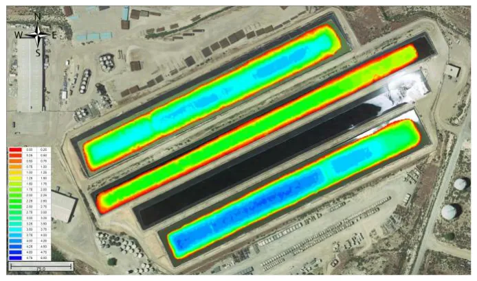
- Detail: a hydrographic sonar shows smaller deposition features, such as a hole scoured out of the lagoon, and lets you evaluate changes to aeration or circulation.
- Speed and safety: surveys are much shorter, with less time on the lagoon.
- Consistency: manual methods (a long stick, or a hollow tube such as a Sludge Judge®, used on a staked-out grid) depend on the operator’s interpretation or “feel”. An echo sounder measures the top of the sludge consistently within and between surveys.
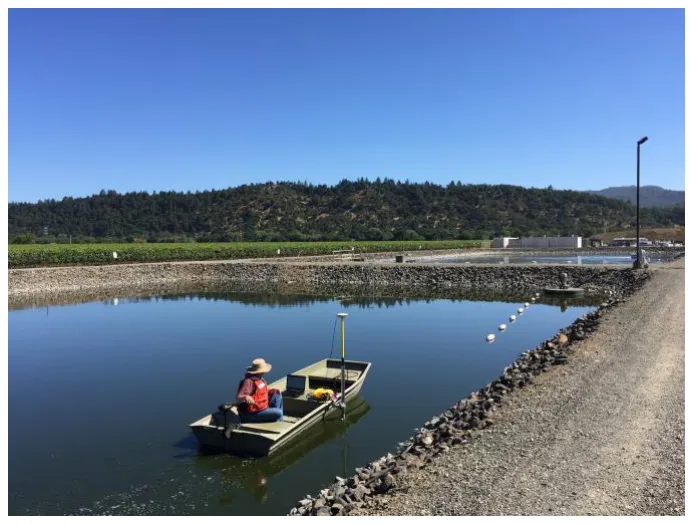
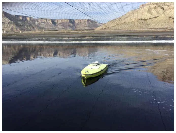
- Access: steep sides, small or shallow ponds, or hazardous contents make manned boats difficult. A USV is a good option.
Can I find the hard bottom?
Often you want the hard bottom as well as the top of the sludge; the difference is the sludge volume. A sludge judge can be forced through the whole layer, but sonar finds it harder:
- The sludge may be thick (lagoons can run for over a decade between dredges), and survey echo sounders usually don’t have the power to get through it.
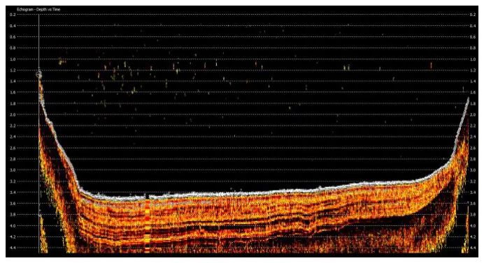
- A shallow water column causes reverberation: double, triple and quadruple reflections between sludge surface and transducer hide sub-bottom detail.
For recently deposited material, a dual frequency 24/200 kHz or 33/200 kHz echo sounder may measure sludge volume directly: high frequency for the top of the sludge, low frequency for the pond bottom. Success depends on the water depth (more is better), how sonar passes through the sludge (mainly its water content) and how much has built up.
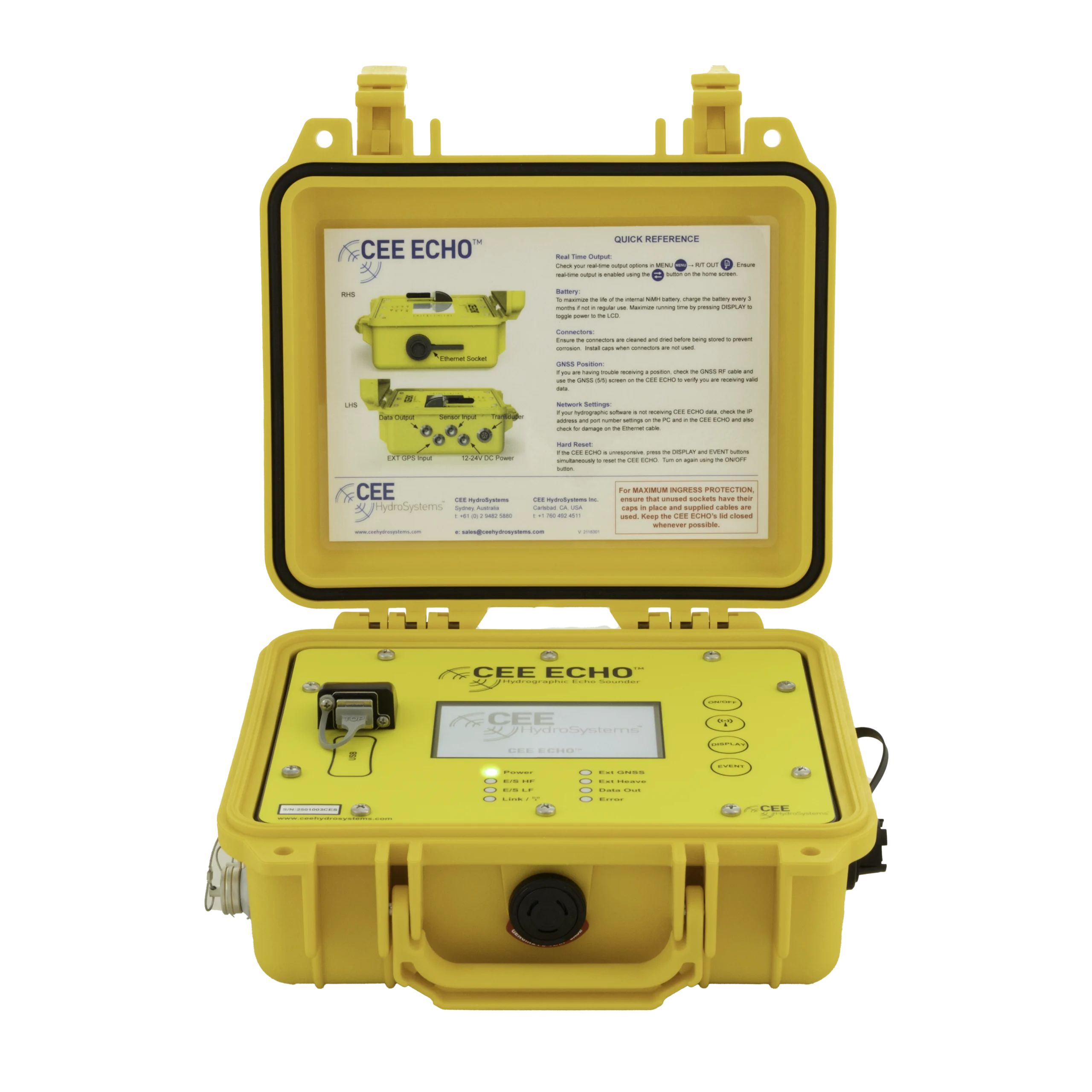
You need hydrographic software (HYPACK® or Hydromagic) and an echo sounder that outputs the full echogram, such as the CEESCOPE™ or CEE ECHO™. There can only be two digital depths per ping, but the echogram shows the whole response from surface to maximum penetration, so the surveyor can identify the hard bottom and make sure the low frequency depths match it. See dual frequency for sedimentation.
Equipment used

Talk to US
Need a hand with your set-up?
Our engineers answer survey questions every day.