

Knowledge base › Survey guide
Survey guide
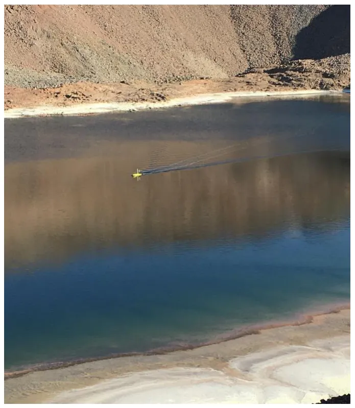
How do I survey a tailings storage facility with a USV?
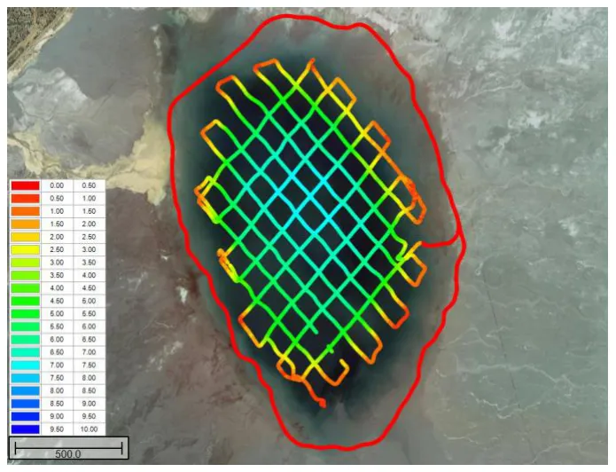
Run a single beam survey of the pond, ideally from a USV so no one has to go on the water, and add a water level, either live from RTK or from one GNSS shot at the water’s edge. From the bathymetry, the software builds a stage-volume curve showing how much water is stored at any level, and repeat surveys show how the pool changes through the seasons.
>90% volume accuracy, single beam
0.25 ft typical USV draft
200% seasonal volume change in the example
~1 ft contour surveyed to, then extrapolated
Why survey a TSF?
A mine tailings storage facility (TSF) is where the rock fines go, but it’s also an emergency water supply for the mine, so knowing how much water it holds matters for planning. Too much water, or water in the wrong place, can raise the risk of dam failure; wet tailings released by dam breaches caused the Bento Rodrigues (Brazil) and Mount Polley (Canada) disasters. As regulations call for more reporting of water volumes, mines increasingly run bathymetry programs with echo sounders.
Mine surveyors aren’t making navigation charts; they need results accurate enough for the job. A few sounding-line points with a GPS are easy, but not enough to understand TSF volumes. A sensible single beam survey gives volume to well over 90% accuracy, quickly and easily with the right equipment. Multibeam’s total coverage doesn’t improve the useful accuracy of a volume estimate, and has no useful application for TSF surveys. With hydrographic software you can repeat lines exactly to show how the pool evolves. See do I need a multibeam?
Why use a USV?
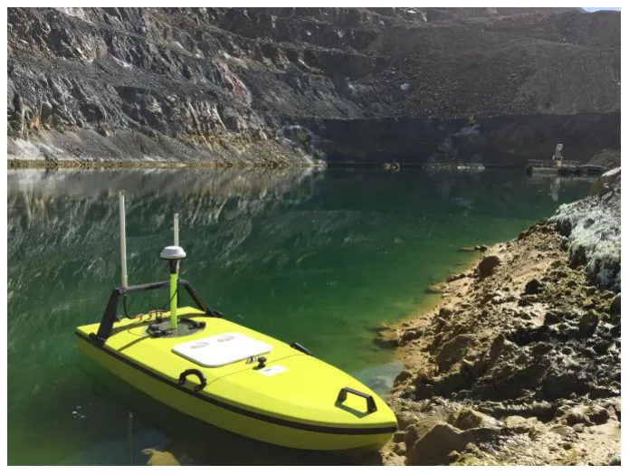
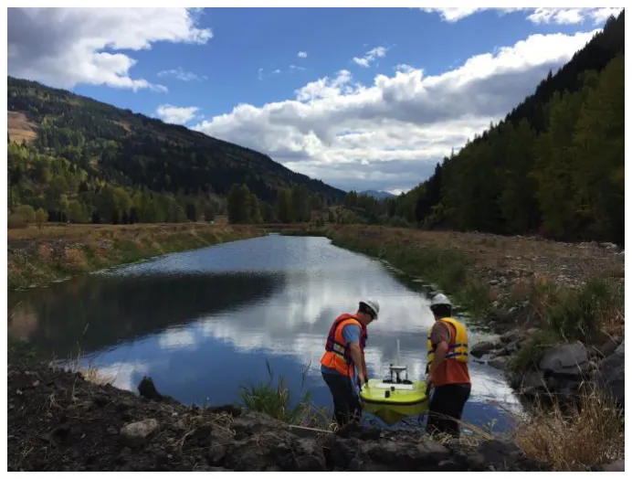
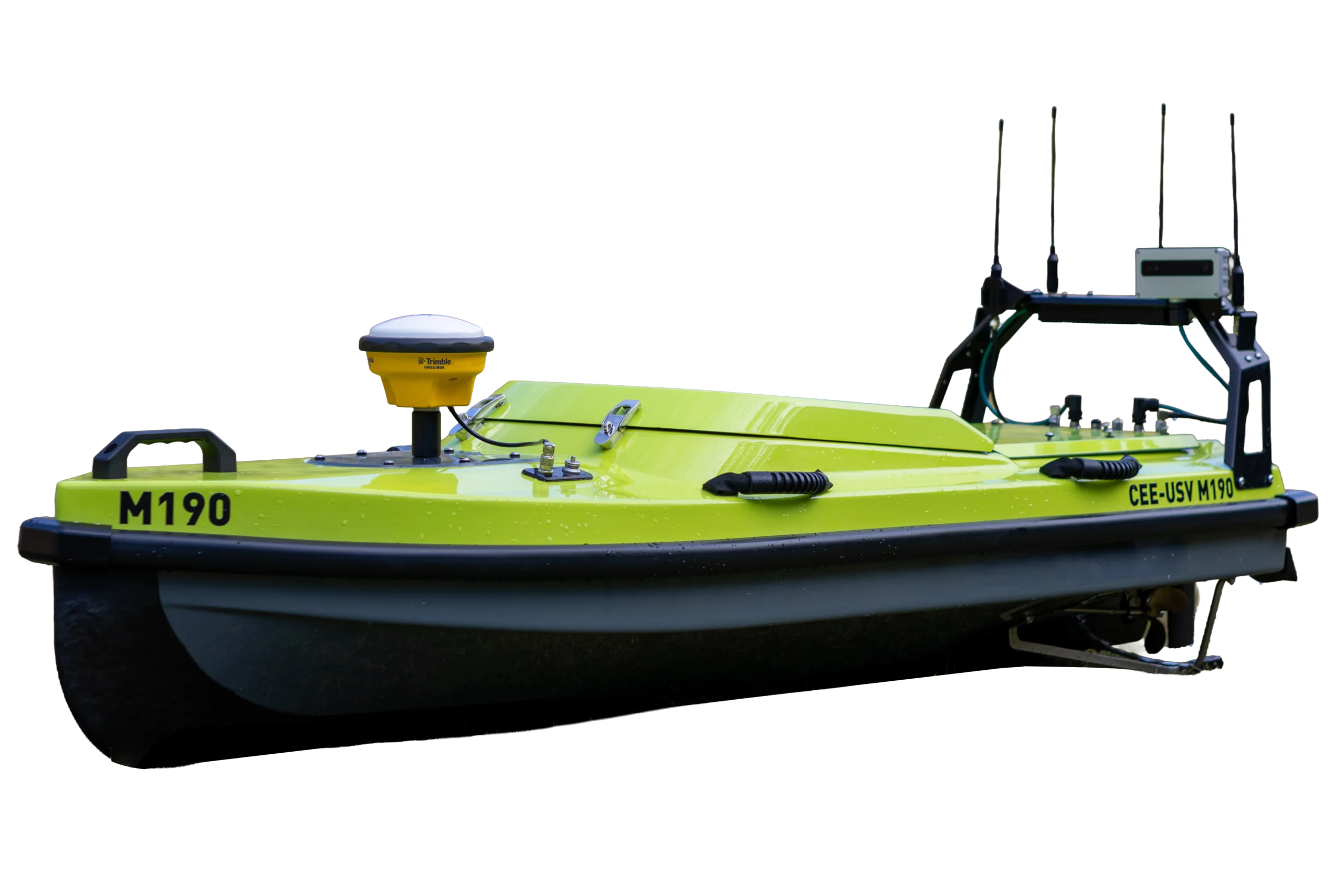
A TSF suits an unmanned survey boat when the water is easy to reach and there’s a convenient shore control point. It saves time over mobilising a manned boat and improves safety: no one on the TSF, and no need for recovery or rescue plans. USVs suit small and medium impoundments; on very large ones, unmanned surveying gets impractical.
Depth or elevation?
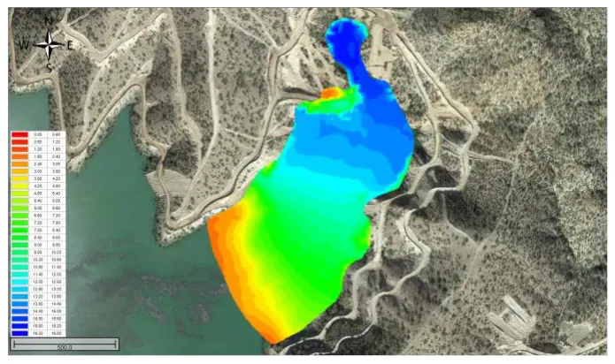
Raw data is always depth: the transducer depth to the mudline plus the USV draft (typically 0.25 ft). For tailings monitoring you usually need absolute elevations and XY in the site coordinate system, which may be a local mine grid (see local grids). Hydromagic only needs the water height, measured one of two ways:
- RTK on the USV records accurate elevations continuously along with depths, using real-time RTK tides and the site geoid model.
- One GNSS shot at the water surface on the survey day, added to every depth as a “tide correction” in processing.
Do I need the mine’s RTK network?
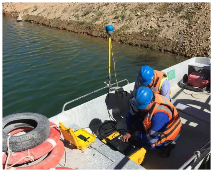
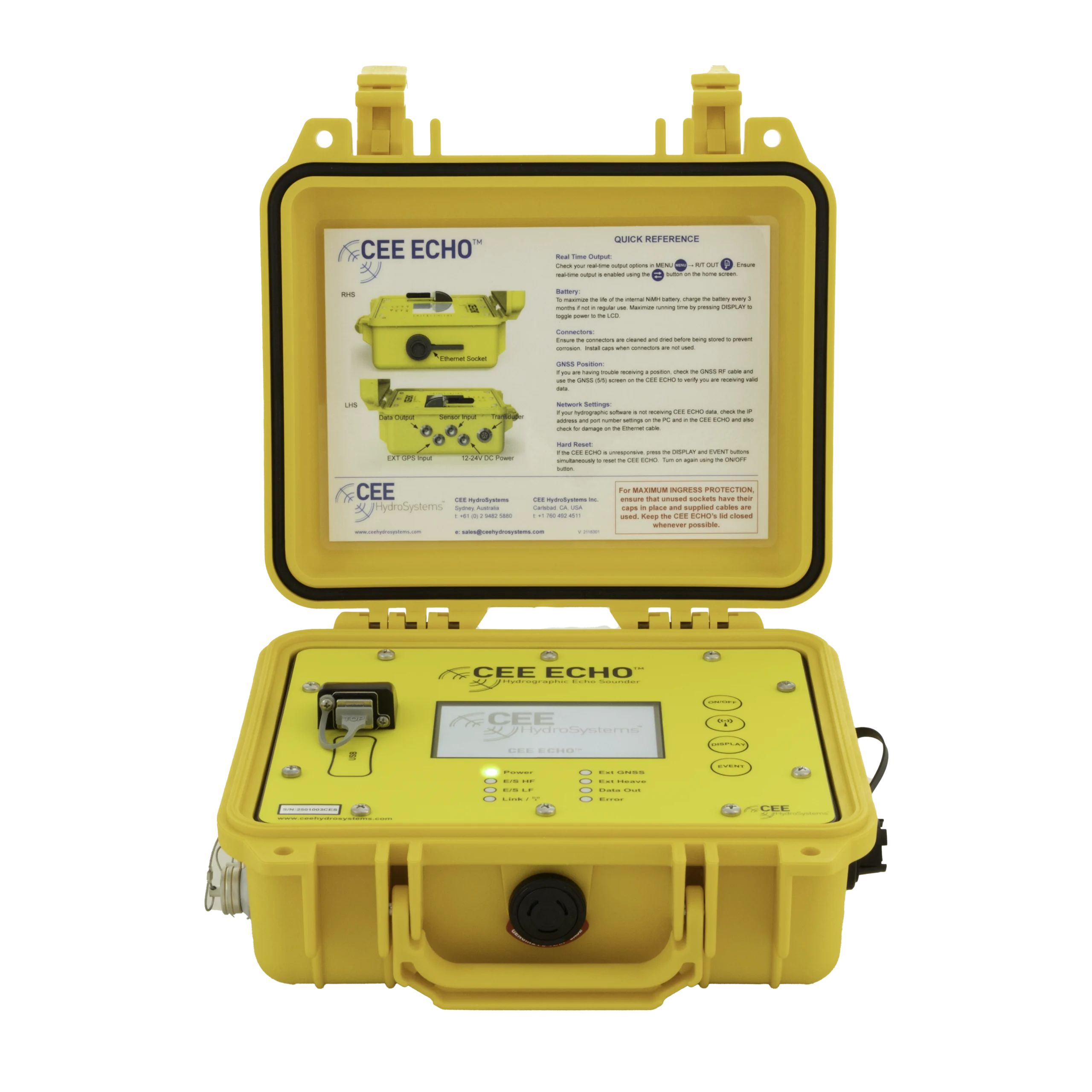
Mine sites always have RTK networks, and site rovers are sometimes brought into the bathymetry program. That means integrating separate GNSS, echo sounder and software, adding complexity. Programs succeed when site surveyors don’t have to become hydrographic set-up experts. An all-in-one echo sounder and GNSS such as the CEESCOPE™ has worked very well: the water level isn’t changing during the survey, and RTK-grade XY isn’t needed for a volume estimate, so dropping the site RTK link improves usability. The water elevation is easy to get without RTK.
What can I produce?
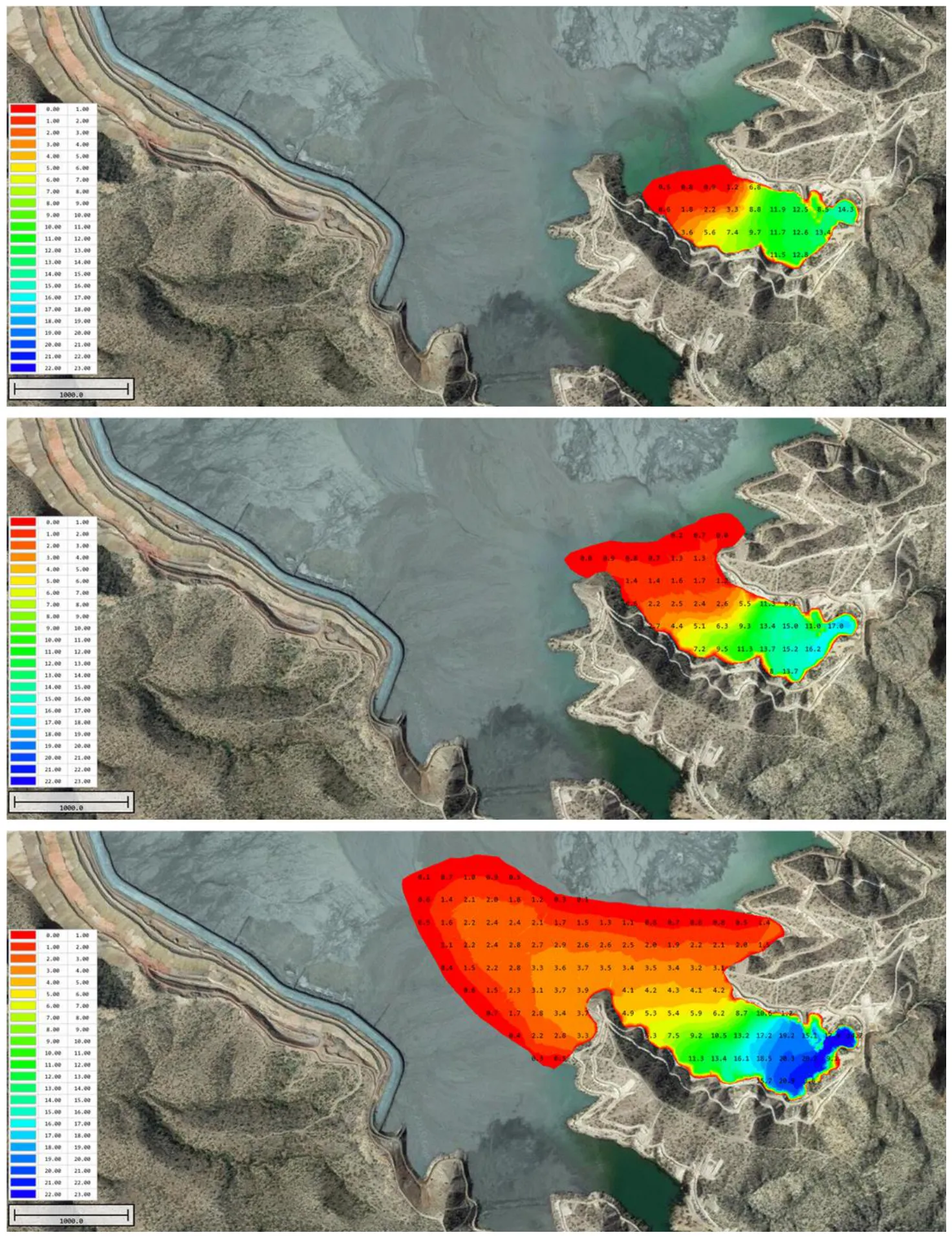
- Colour-filled and contour plots of mudline elevation or depth, which fit exactly with land survey or drone data.
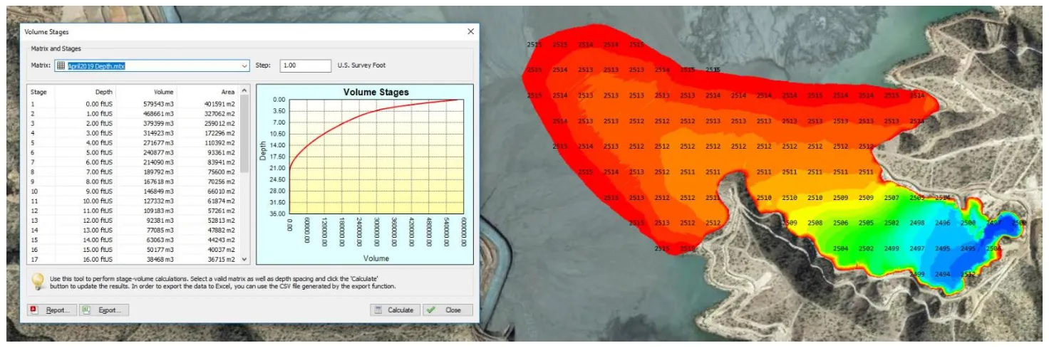
- A stage-volume relationship from Hydromagic’s volume tools, so a survey at high water shows available storage as the level drops.
- A time series of pool volume from repeat surveys. The example shows a 200% increase from low to high stage.
- XYZ point clouds merged with aerial drone orthophotos into a complete site DEM, showing total remaining capacity as the TSF fills.
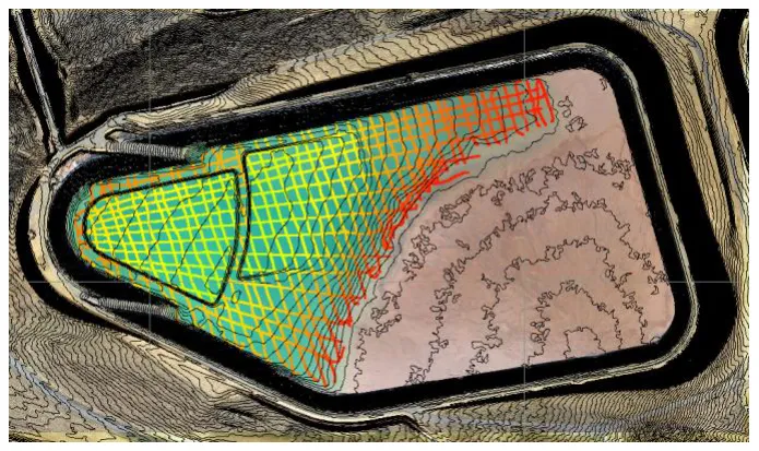
The beach: a USV can’t safely reach the beach, so the whole area can’t be surveyed. Survey to about the 1 ft contour, then extrapolate the gradient to the expected beach position for the best volume estimate. If drone data shows the exact shoreline, use that.
Can I see tailings deposition?
A standard 200 kHz echo sounder works well for the TSF mudline: the tailings / water interface is easy to detect, so dual frequency isn’t needed for mudline surveys. Water content is very high at the mudline and solids increase slowly with depth, so even low energy sonar can penetrate a long way, and differently depending on compaction. Low frequency (24 or 33 kHz) may penetrate as far as 10 m into tailings, and relative penetration at fixed energy has been used to infer relative compaction (Johnson et al., Tailings and Mine Waste 2016). Dual frequency can offer qualitative insight, but there’s no quantitative way yet to relate echo sounder results to the physical properties of tailings.
What about pit lakes and process water?
With a USV, mine engineers can survey every water body on site, including low pH leach solutions and pit lakes where a manned boat may be impossible, not just inconvenient. With short exposure, even aggressive low pH solutions can be surveyed by a robust USV built from corrosion-resistant materials.
- Process solutions may have unusual sound velocity and very high sonar absorption from dissolved constituents.
- In leach solutions, 200 kHz may only reach about 10 m (33 ft), against over 100 m in seawater, so low frequency (24–33 kHz) is needed for deep reservoirs. See the pit lake example in transducer beam angles.
Equipment used

Talk to US
Need a hand with your set-up?
Our engineers answer survey questions every day.