CEETIDE MAX™
Precision Radar Tide Gauge
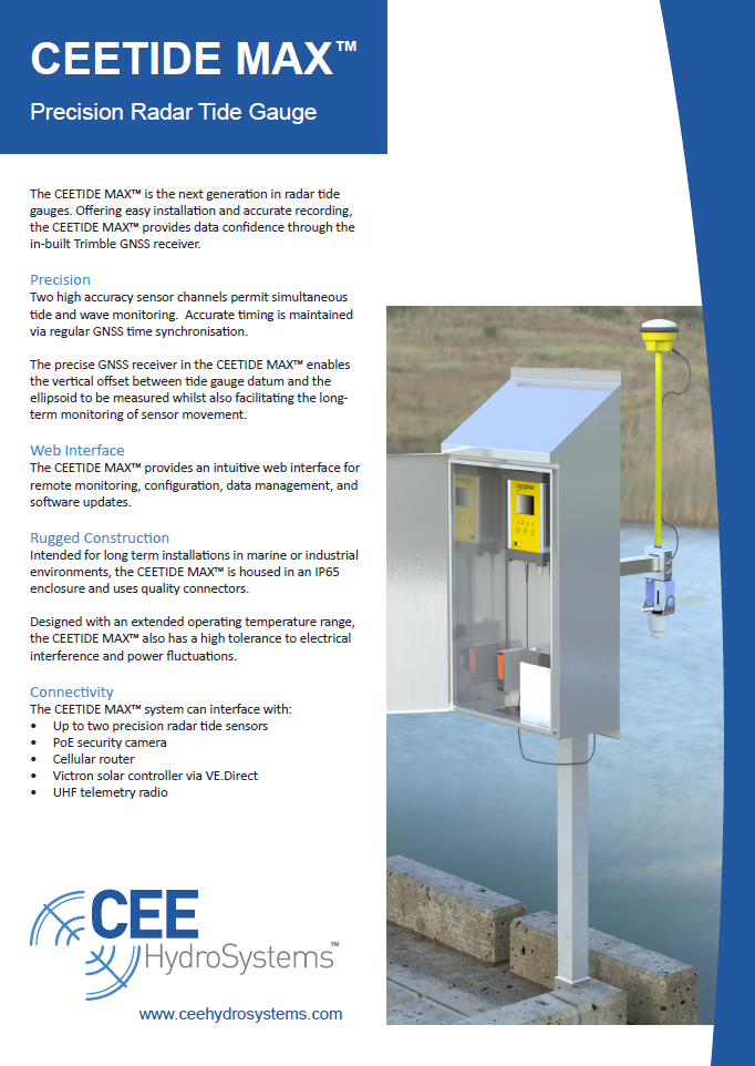
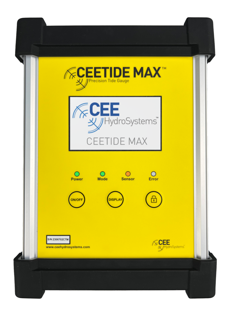
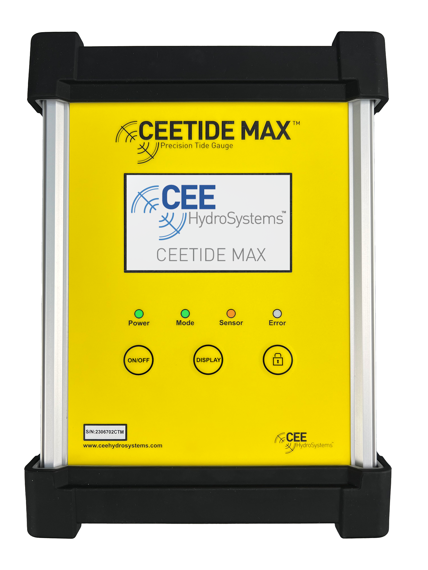
The CEETIDE MAX™ is the next generation in radar tide gauges. Offering easy installation, accurate recording and web connectivity.
CEETIDE MAX™
Precision Radar Tide Gauge
The CEETIDE MAX™ is the next generation in radar tide gauges. Offering easy installation, accurate recording and web connectivity.
Precision
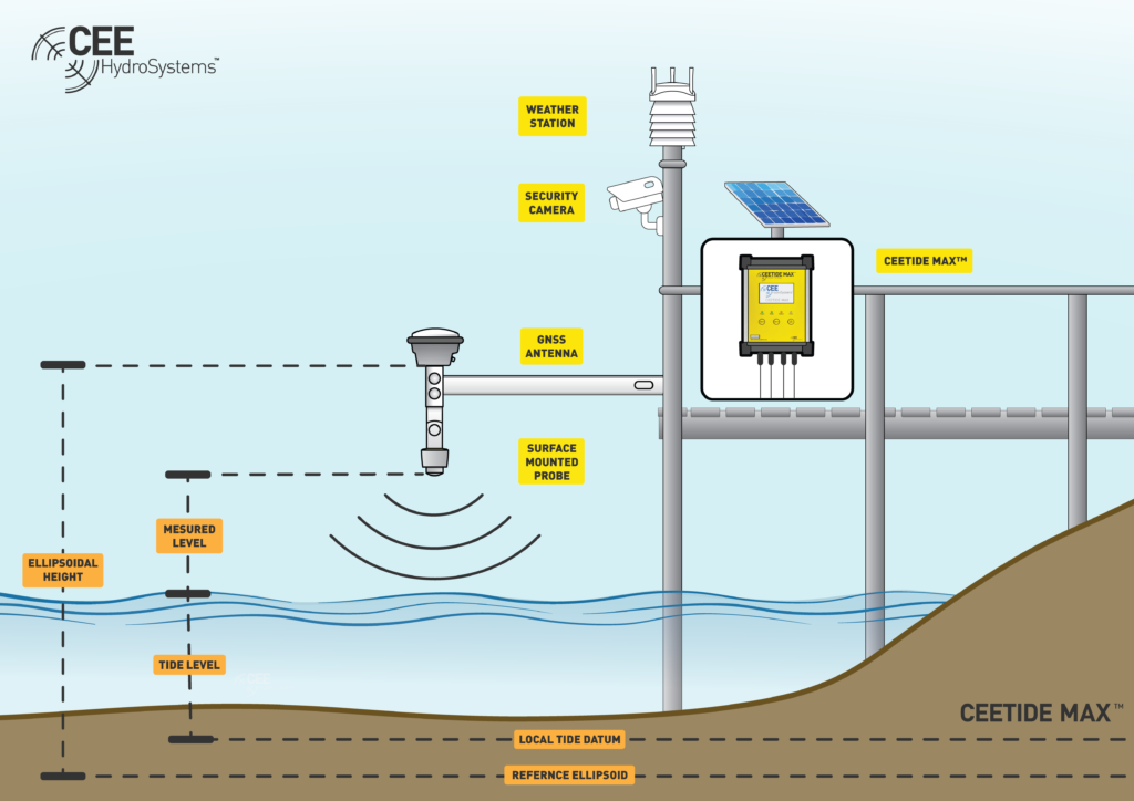
Two high accuracy sensor channels permit simultaneous tide and wave monitoring. Accurate timing is maintained via regular GNSS time synchronization. The option of the precise, internal GNSS receiver in the CEETIDE MAX™ enables the vertical offset between tide gauge datum and the ellipsoid to be measured whilst also facilitating the long- term monitoring of sensor movement.
Web Interface
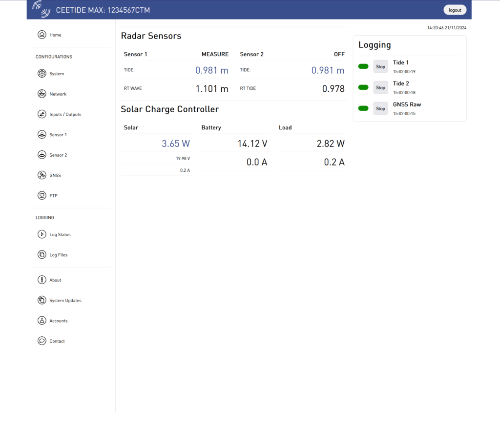
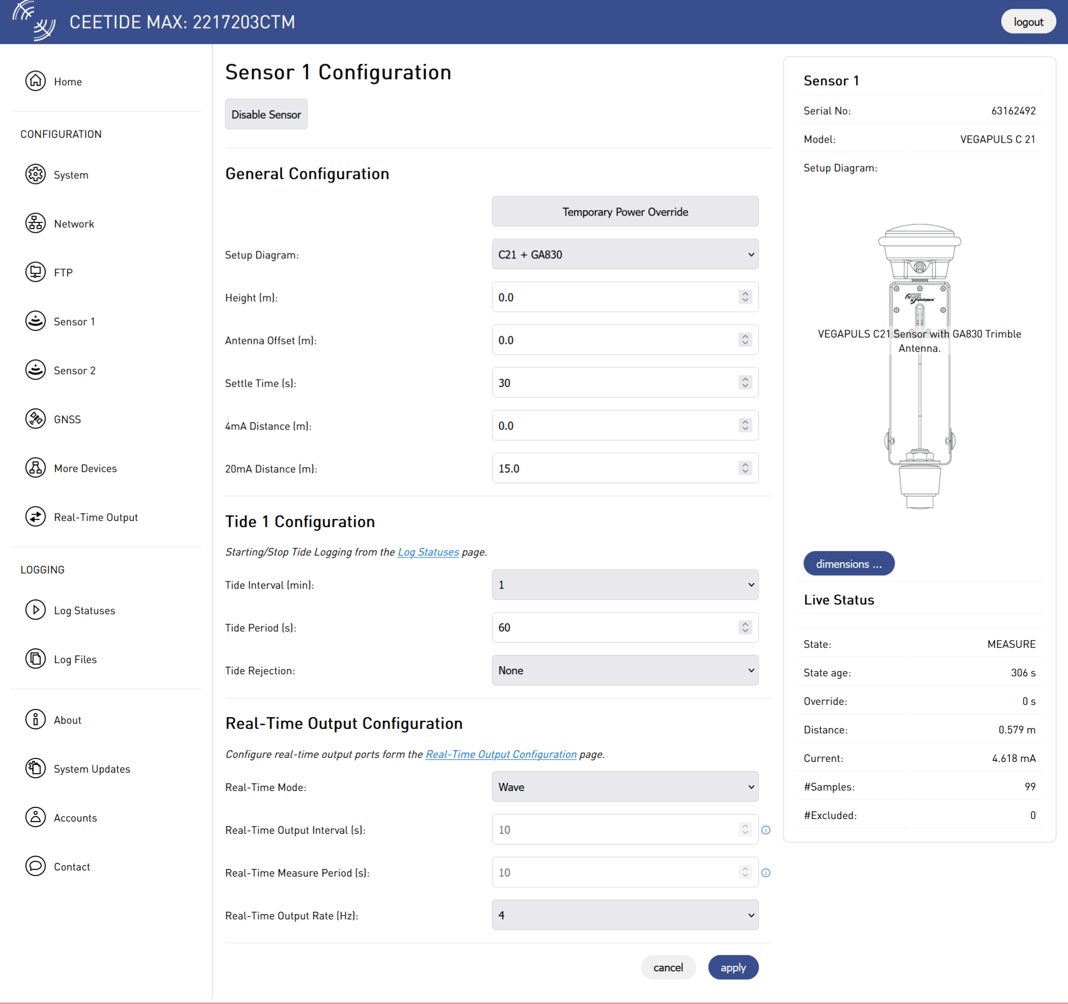
The CEETIDE MAX™ provides an intuitive web interface for remote monitoring, configuration, data management, and software updates.
Rugged Construction
Intended for long term installations in marine or industrial environments, the CEETIDE MAX™ is housed in an IP65 enclosure and uses quality connectors. Designed with an extended operating temperature range, the CEETIDE MAX™ also has a high tolerance to electrical interference and power fluctuations.
Connectivity
Output real-time data via a Satel radio modem or cellular modem. Connect via direct ethernet connection or external VPN network device for web interface connectivity.
The CEETIDE MAX™ system can interface with:
• Up to two precision radar tide sensors
• PoE security camera
• Cellular router
• Victron solar controller via VE. Direct
• Vaisala weather station for meteorological monitoring
• UHF telemetry radio
Precision
Two high accuracy sensor channels permit simultaneous tide and wave monitoring. Accurate timing is maintained via regular GNSS time synchronization. The precise GNSS receiver in the CEETIDE MAX™ enables the vertical offset between tide gauge datum and the ellipsoid to be measured whilst also facilitating the long- term monitoring of sensor movement.
Web Interface
The CEETIDE MAX™ provides an intuitive web interface for remote monitoring, configuration, data management, and software updates.
Rugged Construction
Intended for long term installations in marine or industrial environments, the CEETIDE MAX™ is housed in an IP65 enclosure and uses quality connectors. Designed with an extended operating temperature range, the CEETIDE MAX™ also has a high tolerance to electrical interference and power fluctuations.
Connectivity
The CEETIDE MAX™ system can interface with:
• Up to two precision radar tide sensors
• PoE security camera
• Cellular router
• Victron solar controller via VE. Direct
• UHF telemetry radio
Brochure
 |
CEETIDE MAX™ Precision Radar Tide Gauge Brochure. |
PRODUCT INFORMATION
| Short Range | Long Range | |
|---|---|---|
| Accuracy: | +/- 2mm | +/- 2mm |
| Range: | 0.5 - 15 m (1.64 - 49.21 ft) | 0.5 - 30 m (1.64 - 98.5 ft) |
| Temperature Range: | -40 to 80 C (-40 to 176 F) | -40 to 80 C (-40 to 176 F) |
| Output: | 4 - 20 mA | 4 - 20 mA |
| Power: | 12 - 35 VDC | 12 - 35 VDC |
| Frequency: | 80 GHz | 80 GHz |
| Cable Length: | 10 m (32 ft) or 25 m (82 ft) | 10 m (32 ft) or 25 m (82 ft) |
| Beam Angle: | 8° | 4° |
| Probe Image: | 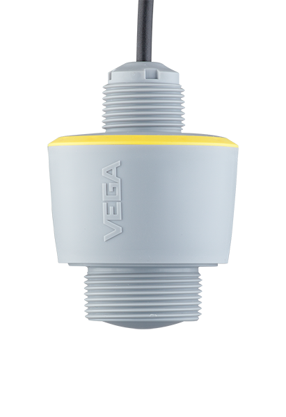 | 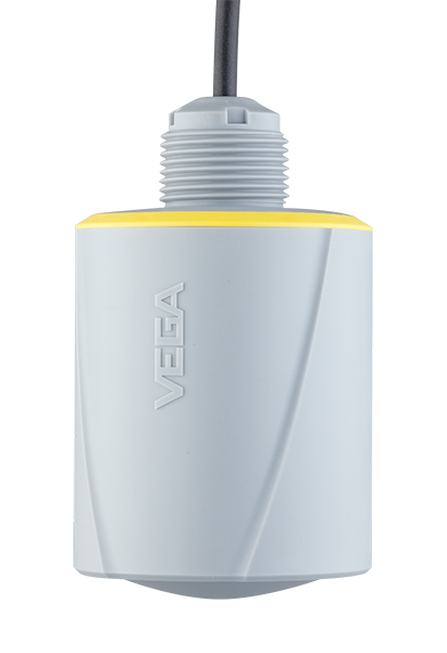 |
| Dimensions | Radar Probe Specifications | ||
| CEETIDE MAX™ | 214 x 90 x 288 mm (W x D x H) | Short Range: | |
| 8.4 x 3.5 x 11.3 inches | Distance | 0.5-15 m (1.64-49.21 ft) | |
| 2.9 kg (6.3 lbs) | Frequency | 80 GHz | |
| Beam Angle | 8° | ||
| Environmental | Cable Length | Up to 25 m (82 ft) | |
| Operating Range | -10°C - 60°C (14°F - 140°F) | ||
| Storage Range | -30°C - 70°C (22°F - 158°F) | Long Range: | |
| Ingress Protection Rating | IP65 | Distance | 0.5 - 30 m (1.64 - 98.5 ft) |
| Frequency | 80 GHz | ||
| Power | Beam Angle | 4° | |
| Input Supply Range | 11.0 V to 33.6 VDC | Cable Length | Up to 25 m (82 ft) |
| Current Consumption (12V) | Sleep: < 20 mA | ||
| Typical: 555 mA | Sensor Inputs | ||
| Maximum (not including PoE): 1200 mA | Channels | 2 | |
| Maximum (including PoE): 4200 mA | Type | 4-20mA with HART master | |
| Maximum PoE Output Power per Channel | 15.4 W | Configuration | For use with 2-wire or 3-wire loop powered devices |
| Nominal Signal Range | 4-20 mA | ||
| Connections | Measurement Range | 0-25mA | |
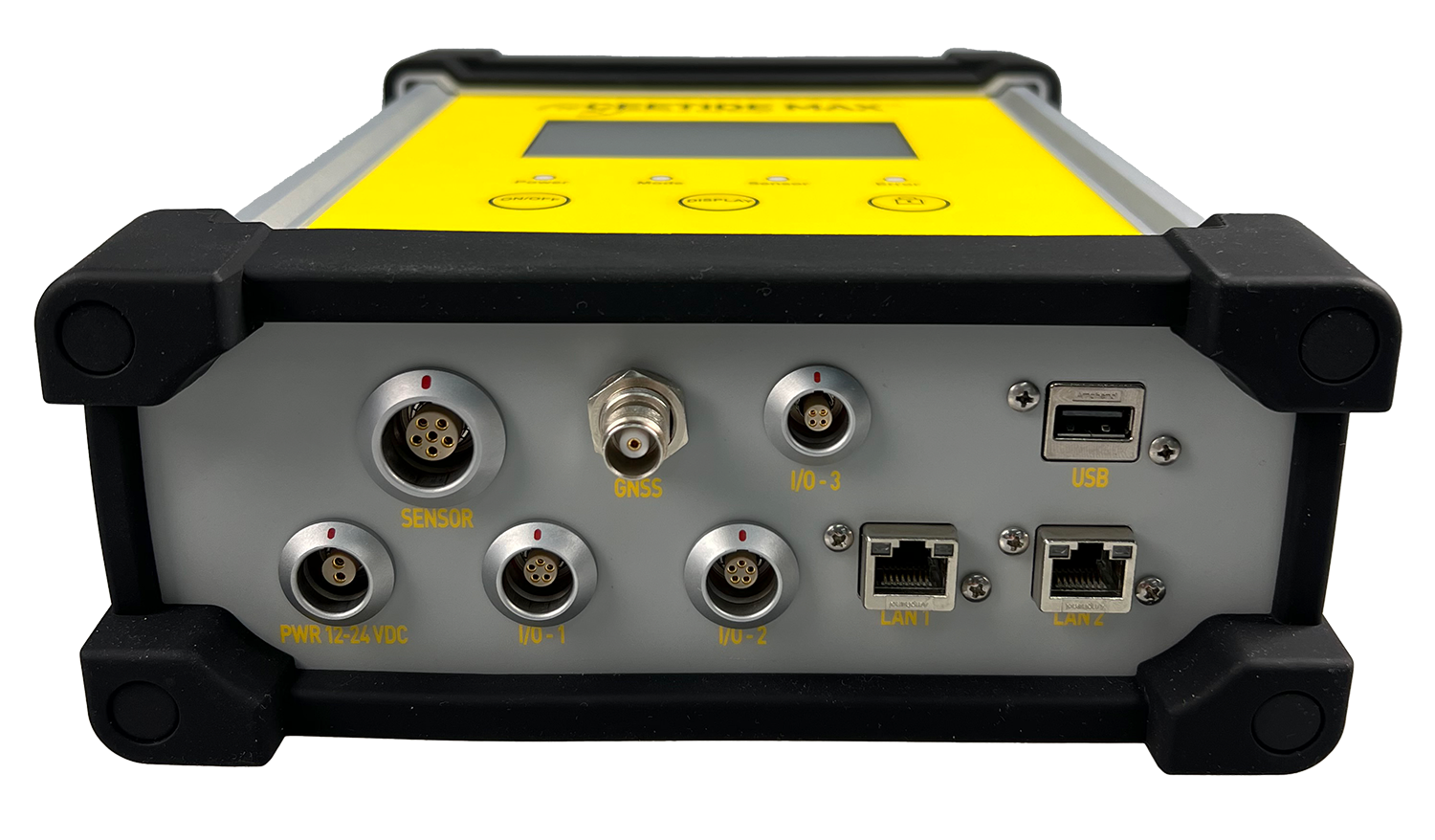
| LEMO (1K 2Pin) | External 12/24VDC power input | Resolution | 1µA (1/25000) |
| LEMO (1K 6 Pin) | 4-20mA/HART sensor I/O | Measurement Error | <± 0.02% full scale |
| LEMO (1K 5 Pin) | RS-232 real time output | Sample Rate (per Channel) | 20 Hz |
| LEMO (1K 5 Pin) | RS-232 spare | Input Resistance | 230 Ω @ 20mA min. |
| LEMO (1K 2 Pin) | Victron VE.Direct interface to MPPT 75/15 | Current Loop Supply | (2-wire): 16V @ 22mA min. (3-wire): 21V @ 22mA min. |
| TNC | GNSS antenna with 5V active supply | Isolation | 500V channel-to-channel |
| RJ45 | Ethernet / Active POE | Tide Filtering | None, 1σ or 2σ rejection |
| RJ45 | Ethernet / Active POE | ||
| USB | Data transfer and firmware upgrades | Recording Capabilities | |
| Internal Memory | 32GB flash | ||
| Communications | Tide Recording | 5+ years of tide readings | |
| Ethernet | 2 x 10/100Base-TX (802.3u) with PoE PSE (802.3af) with integrated Ethernet switch | GNSS Raw Recording | Trimble RT17 / RT27 |
| RS-232 | 2 x 3-wire with 12V 100mA relay drive for activating external equipment (e.g. UHF radio transmitter) | GNSS Sample Rate | 1Hz |
| TTL UART | Isolated Victron VE.Direct (requires 5V external power) | ||
| Front Panel | |||
| Touchscreen | 4.3” backlight LCD | ||
| Buttons | ON/OFF, DISPLAY and LOCK | ||
| LEDs | Power, Mode, Sensor and Error | ||
| Data Options | |||
| Logged | Stored tides over an extended period of time | ||
| Standard Real Time | Live tide data Configurable up to 1Hz | ||
| Wave Real Time | Live wave data Configurable up to 20Hz | ||
| Internal GNSS Options | |||
| Trimble BD990 | 336 tracking channels GPS L1/2/3, GLONASS L1/2/5 Trimble RT27 binary format for post-processing | ||
The CEETIDE MAX™ operates with a radar level sensor that eliminates issues associated with corrosion and fouling of submerged pressure sensors. The non contact probe makes installation easier and maximises flexibility of probe positioning. As the position of the radar sensor can be precisely and easily recorded, it makes the establishing of its position relative to the survey datum easy. Unlike submerged pressure measuring devices, the accuracy of the tide measurements are not affected by changes in water density and atmospheric conditions. The option of the precise, internal GNSS receiver in the CEETIDE MAX™ enables the vertical offset between tide gauge datum and the ellipsoid to be measured whilst also facilitating the long- term monitoring of sensor movement.

