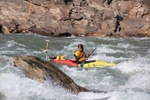
SHALLOW WATER SURVEY NEWS
News articles, press releases, customer stories and product updates
CEE HydroSystems shallow water survey news is a useful resource for hydrographic survey-related information and specifically single beam echo sounder surveys in shallow water. If you have any news related to CEE HydroSystems equipment being used on surveys around the world then please contact us. We would greatly appreciate the chance to pass on news of survey activities in varied and interesting environments. If you have managed to solve a survey problem with an innovative approach, or constructed a custom survey platform, vessel, or installation then we are particularly keen to find out about it. In addition you will be able to see news updates relating to our hydrographic survey equipment and ancillary devices such as echo sounders, tide gauges, sound velocity profilers, and hydrographic software. If we come across useful software tips for HYPACK® or Eye4Software Hydromagic then we will include them to allow for future referencing as appropriate.
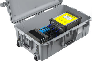
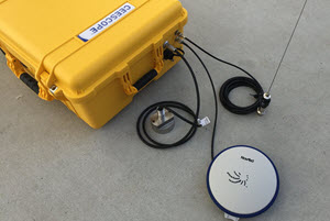
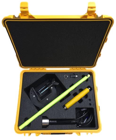
NEW PORTABLE TIDE GAUGE STATION OPTION USING CEETIDE MAX™
For a remote site project requiring extended battery backup, solar power and real time internet connectivity we took our standard tide station and incorporated the required accessories such as the Tosibox VPN, solar charge controller and a high-capacity battery and fabricated a portable robust Pelican Case integrated kit for a complete solution. This configuration is now available as a standard CEETIDE™ option
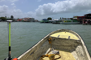
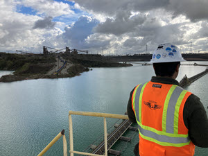
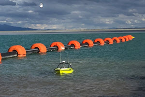
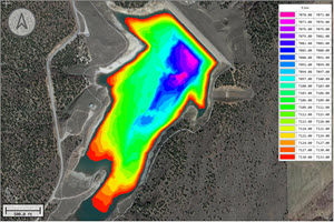
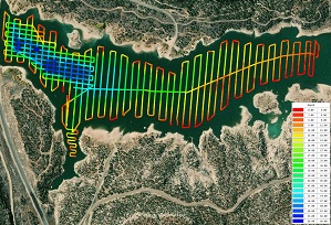
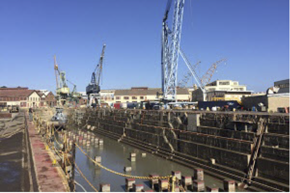
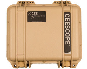
CEESCOPE SINGLE BEAM SURVEYS FOR ONGOING BELIZE CITY PORT DREDGING
The small port in Belize City, Belize manages tenders coming onshore from cruise ships moored a few miles out to sea, in addition to numerous local water taxis. The maintenance of a navigable channel and berths is a challenge owing to extreme sedimentation from the river, necessitating continuous dredging. To help with the dredging program management, the dredge operators recently received their new CEESCOPE™ and we were on hand to kick off their in-house hydrographic survey program. Learn more about the project HERE
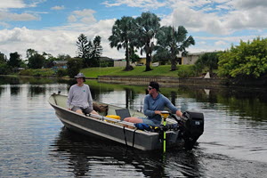
BLUE ARC ENGINEERING REPLACE TRADITIONAL LAND SURVEY METHODS
Civil, coastal and environmental engineers at Blue Arc Engineering in Florida, USA relied on time-consuming land survey type manual point measurements for their small bathymetry projects. That ended with the startup of a significantly more efficient hydrographic echo sounder program based on the CEE ECHO™ and Hydromagic software, in combination with their existing Trimble R780 GNSS receiver. Learn more about the project in the new CASE HISTORY HERE
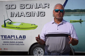
TEAM LABORATORY CHEMICAL CO ADD TRIMBLE RTX FOR PRECISE ELEVATION DATA
Experienced municipal wastewater surveyors at TEAM LAB have been using their CEE-USV™ and CEESCOPE™ echo sounder for several years. The process involved laborious manual measurements to determine changes in lagoon water level between surveys. This step has now been eliminated by the incorporation of the Trimble CenterPoint RTX precision corrections available with the new CEESCOPE™ 9250. TEAM LAB can now rely on the accurate absolute water level elevation provided by RTX to allow multi-year comparisons of sludge buildup in effluent lagoons. Learn more in the new CASE HISTORY HERE
CEE-USV USED TO DEVELOP PRECISE OILFIELD FRAC PIT VOLUMES
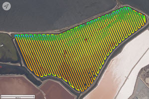
Oilfield water management specialist companies operate water sourcing and management programs throughout the USA. In the West Texas Permian Basin, water management and automation engineers upgraded their existing USV program to the latest CEE-USV with robotic operation. Simultaneously conducting bathymetry surveys and precise RTK land surveys around each pit, operators are able to calculate an accurate stage-volume curve for each pond, providing data on the exact volume of water on hand as the pits are filled or emptied. Learn more HERE.
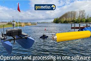
GEOMETIUS USE CEE-LINE™ ON NEW SMALL USV
To provide their customers in the BeNeLux region with a portable small remotely-operated survey boat, Trimble marine construction dealer and CEE HydroSystems representative Geometius bv developed their own "HydroScout" in-house solution. Using the Blue Robotics BlueBoat and the CEE-LINE™ echo sounder, customers may install their own GNSS receiver. Command and control is provided by local hydrographic software specialists Eye4Software.With the CEE-LINE™ 200kHz transducer, very shallow depth measurements are possible. Watch the HydroScout in action HERE.
CEE-USV™ AND HYDROMAGIC USED FOR TWO-YEAR WASTEWATER LAGOON SLUDGE ACCUMULATION SURVEY
To determine the amount of industrial sludge accumulated over two years in a food processing plant wastewater lagoon, an East Coast USA construction firm used their in-house CEE-USV™ to conduct highly detailed bathymetric surveys. Each survey was precisely referenced to the water elevation allowing a direct comparison of sludge levels. Eye4Software Hydromagic was used to plan the robotic mission, acquire data, and post process the results. Hydromagic's volume calculation tools were used to determine the total sludge accumulation volume. Learn more about the surveys HERE
NEW USA RESELLER - GRAVA HYDROGRAPHIC SOLUTIONS
New industry consultant and equipment supplier Grava Hydrographic Solutions (Ventura, CA - USA) has teamed up with CEE HydroSystems for off the shelf and customizable single beam solutions. With many years expertize in hydrographic systems technology including single beam, multibeam and various unmanned platforms principal Josh Grava can offer a consultative approach to clients' survey challenges. If that might include single beam survey or tide monitoring equipment we will be happy to help. https://gravahydro.com/
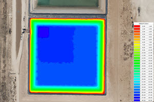
AGGREGATE MINE OPERATOR TACKLES IN-HOUSE BATHYMETRY WITH THE CEE-USV™
An aggregate mine operator in Los Angeles switched from subcontracting periodic pit surveys to doing the work in-house. The idea behing investing in the CEE-USV™ was to allow greater flexibility in conducting surveys without needing to coordinate with external contractors, in addition to lowering the cost of monitoring their dredging activities. On the first two-day survey of a large pit, the remarkable consistency in the on-board CEESCOPE LITE™ data was noticed - of 723,600 sounding points collected only 4 were not showing the correct surface. Learn more about the pit survey HERE.
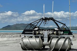
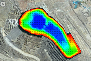
MINE TAILINGS CONTRACTORS COPERSTONE TECHNOLOGIES WIN AWARD FOR BATHYMETRY ADVANCES
Exclusively using CEESCOPE™ echo sounder systems, Copperstone Technologies has been internationally recognized for innovation in the mining industry, securing First Place in the Tailings Dam Bathymetry Safety Category in the SafetyTech Mining Challenge. This challenge, organized by Fundación Chile’s Expande program in collaboration with Servicio Nacional de Geología y Minería | Sernageomin and sponsored by the Chilean Ministry of Mining, set out to tackle one of the industry’s greatest challenges—the inherently hazardous environment of tailings facilities. Out of 170 applications spanning 11 countries, Copperstone Technologies emerged as a leader, showcasing commitment to advancing safety and innovation in the sector.
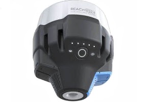
NEW SETUP GUIDE FOR INTERFACING EMLID REACH GNSS WITH CEESCOPE™ AND CEE ECHO™ ECHO SOUNDERS
Low-cost Emlid GNSS receivers are easy to use with the CEE ECHO™ or CEESCOPE™, utilizing their Bluetooth NMEA data output direct to the echo sounder. Often used by academic researchers or non-specialists undertaking hydrographic surveying, these operators may be less familiar with data formats and protocols. As a result, we wrote up a setup guide to help connecting the devices. To download the Emlid Reach setup document visit the CEE HydroSystems Knowledge Base and get the guide HERE.
FLORIDA SURVEYORS HAVE REVELATORY EXPERIENCE WITH THE CEE ECHO™ FOR CONSTRUCTION SURVEYS
Central Florida, USA land surveyors Area Of Interest (AOI) Inc, had conducted occasional hydrographic surveys using rented basic pole-mounted echo sounders over recent years. Data quality was questioned and often AOI resorted to manual pole or line soundings so their surveyors could trust datasets provided to their clients. AOI invested in the CEE ECHO™ package with Hydromagic software and had a revelation in terms of their data quality and usability. Read the new CASE HISTORY HERE.
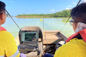
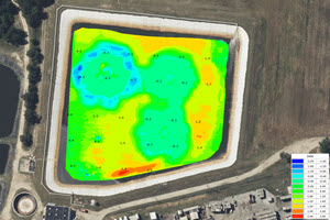
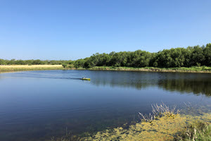
SURVEYING AN ENORMOUS TAILINGS DAM IMPOUNDMENT WITH THE CEE-USV™
CEE recently visited a gold mine in South America to conduct USV survey training. At this site, the huge tailings impoundment is a natural feature of submerged trees and complex channels and inlets. It typically will take at least two days to complete a thorough bathymetric survey to determine the stored water volume. On an impoundment of this size, operating a USV from the shore is impossible as there is no access to most of the pond. Instead surveyors operate from a manned boat and drive the boat into the shallow areas the manned boat can't easily access - particularly in the shallow areas closest to the beach. To see the boat in action on the tailings pond WATCH THE VIDEO HERE.
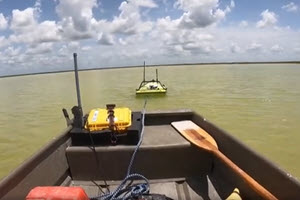
CAN YOU TOW A MANNED BOAT WITH THE CEE-USV™
This is not a question we ever have been asked or indeed had much interest about, but it turns out the answer is YES, and quite easily. Here at this mine in the USA, deposited sediment is so close to the surface the manned boat motor just gets stuck, or things become a big mess. SOLUTION - simply raise the motor and let the CEE-USV tow you along, no problem. Not in the operators manual though.......WATCH THE VIDEO EVIDENCE HERE.
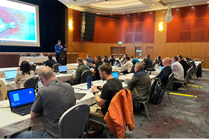
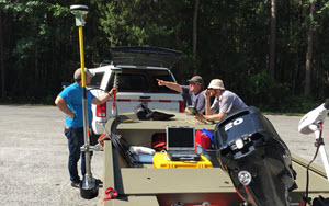
CEE HYDROSYSTEMS HOST 16TH ANNUAL AUSTRALASIAN HYPACK USER TRAINING CONFERENCE
After a hiatus started as a result of recent COVID years, the annual HYPACK single and multibeam training event returned for the 16th Australian user conference, hosted by CEE HydroSystems. Due in part to rabid customer demand, the three-day event was held at the Hornsby RSL Club, Sydney with HYPACK's John Lindberg in attendance. It looks like this annual event will get back onto the calendar permanently for 2025 and beyond.
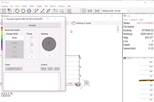
HYPACK 2024 DRIVER FOR CEE-USV™ SPECTRE AUTOPILOT NOW RELEASED
The ability to manage CEE-USV™ autopilot operation through HYPACK hydrographic software is here courtesy of the new SPECTRE.DLL driver. CEE HydroSystems, HYPACK and Dynautics recently collaborated to bring the existing Dynautics control interface into HYPACK SURVEY. In addition to allowing directional and speed control through the driver, autopilot routes may be easily uploaded from a HYPACK line plan (.lnw file). With HYPACK's automatic logging feature, discrete survey lines may be easily recorded as the CEE-USV™ reaches the start and end waypoints of each line. Watch a video demonstrating the HYPACK driver in action HERE.
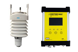
CEETIDE MAX supports Vaisala Weather Transmitter
The Vaisala WXT530 range can now interface with the CEETIDE MAX™ and output real time data via RS-232 or TCP. To provide a streamlined set up, the CEETIDE MAX™ can power the Vaisala WXT530 series (non-heated option) through the supplied data/power cable. The Vaisala WXT530 range of weather transmitters can measure six of the most important weather parameters: air pressure, temperature, humidity, rainfall, windspeed and direction. CONTACT US for more information.

HYDROMAGIC 2024 Launched with New Features for CEE-USV™ Operators
The latest Hydromagic release contains a new Xbox plugin designed for CEE-USV™ users using the CEE PILOT™ autopilot system (Dynautics SPECTRE). Previous versions allowed manual control of the USV through Hydromagic using on screen controls however now with the Xbox controller plugin option, a convenient redundant manual control system is available. The joysticks and controller buttons are used to command instantaneous autopilot heading and speed changes, making it possible to steer the boat manually through Hydromagic. Leave your RC transmitter in the office? No problem - plug in the Xbox controller! Additionally, Hydromagic now has real time USV battery and temperature monitoring with provision of on-screen alarms. CONTACT US to get the setup instructions.
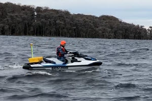
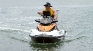
CEE-JET™ Training with University of Florida - Wireless Surveying using Hydromagic
The problem of how to conduct hydrographic survey training when using personal watercraft (PWC) / jetski vehicles is neatly solved by the CEE JET 1600 single beam survey kit for the SeaDoo PWC. With its built-in WiFi able to telemeter survey data, trainees were able to view and learn about the data collection process and interact with the on-board CEESCOPE-R™ survey system from the (relative) comfort of the chase boat. Running Hydromagic software, the SBG Systems Ellipse-A was used to correct for motion artifacts and RTK from the state VRS / NTRIP was supplied to the CEESCOPE-R™ using the WiFi link. LEARN MORE about the CEE JET 1600 setup as used on the Florida PWC HERE.
TEAM LAB Chemical Break their own CEE-USV™ Survey Record with 168 Surveys in 2023!
For the previous 2022 survey season in Northern Minnesota and surrounding regions, CEE-USV™ operators TEAM LAB Chemical racked up 130 wastewater lagoon surveys. When you consider that the weather does not allow surveying for more than six months a year that is a lot of productivity, and quite impressive. However not compared to 2023 when 168 surveys were performed over the summer. The benefits of reliable equipment allowing 24/7 continuous operation on the road! After this successful season, dual frequency was added ready for the 2024 season to enhance evaluation of surface sediment particulary related to organic material digestion and removal.
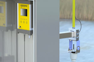
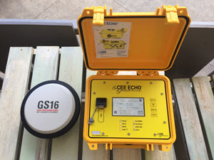
CEE HydroSystems Launch All New CEETIDE MAX Tide Gauge
CEE's new range of tide gauges are here. Replacing the CEETIDE MkIV is the new CEETIDE MAX. Designed for permanent monitoring stations, the new MAX incorporates advanced ancillary system control and logging features. With a built-in Trimble BD990 high performance GNSS, the MAX also monitors the position of the tide sensor - not just the tide - for maximum data assurance. The familiar CEE HydroSystems yellow Pelican case option will remain in the CEETIDE MAX-P which is a ruggedized portable version of the new tide gauge. Review the new device specifications on the web page HERE or CONTACT US with specific questions.
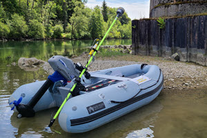
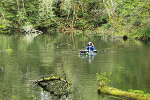
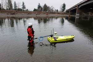
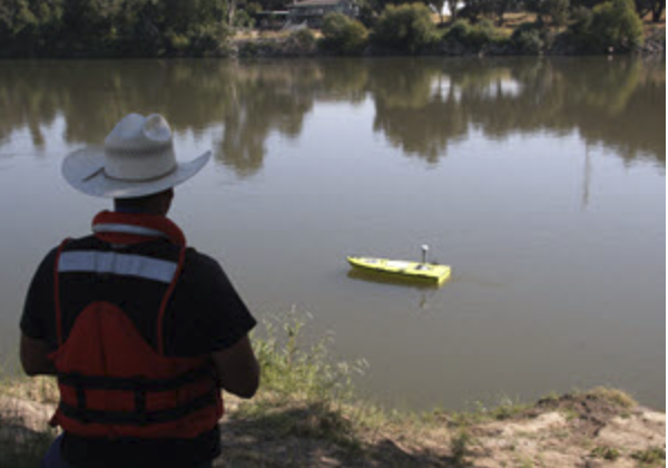
CEE-USV™ in Super Shallow Intertidal Zone for Wetland Project
For a wetlands project in California, just north of the USA - Mexico border local survey firm Project Design Consultants needed to produce a topo map of an area of wetlands. While their drone survey was able to handle the exposed areas, the presence of narrow winding tidal salt-water channels created a problem. Impossible to safely wade for manual measurements, the wetlands presented an opportunity to blend the terrestrial data with USV-generated bathymetry. Using their own Trimble R12 on the CEE-USV™ for position, the shallow draft vessel was just about able to navigate up the main channel and fill in the missing parts of the survey. Data were recorded inside the CEESCOPE™ and later uploaded and processed using Hydromagic software.
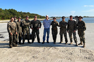
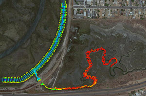
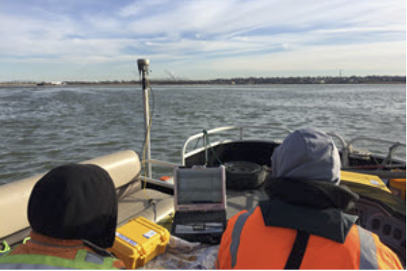
Updated CEESCOPE™ Shallow Water Survey Equipment for United States Marine Corps.
In summer 2023, CEE conducted training at Camp Lejeune for USMC survey teams. With ageing CEESCOPE™ units over a decade old replaced with the latest Vessel Of Opportunity military-spec CEESCOPE™ kits, additional capabilities included integrated side scan, motion sensors and multi-vessel mounting options. The CEESCOPE™ packages are ideal for rapid deployment surveying often conducted by military forces. With the extraordinary complexity and operational constraints of multibeam leading to this technique being largely unsuitable, single beam technology is still the best fit. Then, it comes down to improving the user experience to reduce complexity as much as possible to promote reliability in service.
Trinchero Family Estates use Recycled USV for Wastewater Surveys.
In the wine industry of Northern California, a recent safety incident related to wastewater lagoons caused enhanced focus on safe operating around water. At the Trinchero Family Estates winery near Napa, the environment department had been using a CEESCOPE survey system since 2017 on a small jon boat. Looking to eliminate the need for an operator on the lagoon, TFE wanted to get a USV for their CEESCOPE™. Instead of a new CEE-USV™ for very occasional surveys, CEE was able to commingle old Z-Boats and strip out all of the payload. The resulting USV offered a great cost-effective approach for annual surveys while retaining the CEESCOPE™ simplicity. To learn more about CEE's custom Recycled-USV made for TFE read more HERE.
Critical HYPACK Driver Changes for CEESCOPE™ and CEE ECHO™ for 2022 Release.
For the 2022 release, HYPACK changed the handling of the "User Modified NMEA Messages" incorporating the CEE "POS" time stamp in the standard GPS-NMEA driver. The change caused some previous CEE setup procedures often used on versions up to 2022 to become invalid. New setup guides are available in the CEE Knowledge Base HERE and it is strongly recommended that you confirm your HYPACK driver setup is correct by following the test procedure HERE.
CEE-LINE™ Offers Reliable and Repeatable Shallow Water Surveys.
In Germany, surveyors at Consulting Engineers Saam LLC were looking for a simple and reliable echo sounder for their Trimble total station S7 and GNSS setup. Often working around bridges, they had tried a few different "pole mounted" sounders without finding a reliable solution. The CEE-LINE™ kit was a great discovery according to the new users: "Only a low number of artifacts (mostly when quite shallow), very fine! I'm very happy finally having found a reliable equipment for water surveying, thanks to
you!". The all-electric inflatable boat worked well with the CEE-LINE™ transducer mounting assembly. Learn more on the CASE HISTORY from Germany
Barr Engineering and Select Water Solutions Replace Old Timer USVs.
Back in 2012-13, CEE's Adrian McDonald - before working for CEE - provided Barr Engineering (MN, USA) and Select Water Solutions (TX, USA) with USVs both incorporating CEE echo sounders. These vehicles were maintained in service for a decade, but in July 2023 they finally because unserviceable and were replaced with the top-spec CEE-USV. With a fully integrated RTK GNSS and advanced autopilot managed entirely in Hydromagic, the new system offers a next generation step forward for the surveyors, ending the long hours of manual controlled surveys!
Coastal Frontiers Corporation use CEE ECHO™ for Lagoon Restoration Project.
The CEE ECHO™ is designed to operate in very shallow water and will still provide consistent data when the survey boat is barely above the bottom. In a major California lagoon restoration project, Coastal Frontiers' new CEE ECHO™ was put to the test. Purchased specifically for the project, the CEE ECHO™ was used on manned and unmanned boat surveys most of which were under 4ft (1.2m) deep. Learn more by reading the CASE HISTORY HERE.
Minnesota, USA Firm TEAM LAB Conduct 130 CEE-USV™ Wastewater Surveys each Year.
Wastewater lagoons throughout Minnesota and surrounding states are more likely to see a CEE-USV™ in action now that TEAM LAB Chemical's unmanned bathymetry program is in full swing. With an annual monitoring program designed to report the quantity of sludge accumulated in lagoons, TEAM LAB implemented a manned and unmanned survey program for comprehensive data on effluent lagoon performance. The firm also supply biological treatment "bug" programs to digest the organic matter in the sludge, and the USV is used to track the effectiveness of these treatments. Learn more by reading the CASE HISTORY HERE. To see the program in action watch the video HERE.
CEE HydroSystems USA Complete Contract Tailings Impoundment Survey.
Usually we leave the surveying to our customers however in late 2022 CEE USA were called on to complete a one-off survey of a large tailings impoundment in the Southwest USA. The survey proved to be a great example of how to complete a tailings survey "on the fly". Little information about the impoundment extents was available prior to the survey and so the survey plan was drawn up on the job. Read more about how the survey was completed HERE.
New Wide Band Echo Sounder Control Boards for 2023 CEESCOPE™ and CEE ECHO™
From 2023, new CEE echo sounders will be shipping without the need to first define either a 24kHz or 33kHz selected low frequency channel. Our new wide band low frequency echo sounder control electronics means both 33kHz and 24kHz transducers may now be used interchangeably. Transducer selection can be slightly confusing for newcomers to hydrographic surveying; transducer considerations are explained in addition to more details about this useful new design feature HERE.
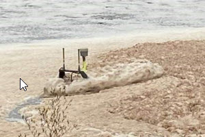
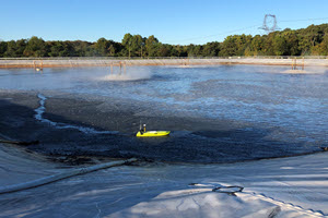
The Filthiest CEE-USV™ Survey Ever?
The picture of the CEE-USV™ in action with Oregon, USA based AKS Engineering & Forestry LLC tells the story. In order to prevent employee exposure to unknown and unmentionable material floating on the water surface in a system of wastewater lagoons they were contracted to survey, the firms CEE-USV™ was drafted in to take the punishment. To see the full extent of the survey challenge read more HERE.
Upgrading Capabilities - Canadian Marine Surveyors Lani Maritime get to Work with CEE ECHO™
After joining the market providing hydrographic survey services with an entry level echo sounder, Lani Maritime's initial experiences showed that just because a manufacturer may claim "survey grade" this does not guarantee survey grade results. After determining that there was room for improvement in their hydrographic offering to clients, Lani Principal Chris Kirby took the plunge and replaced his still fairly new echo sounder with the CEE ECHO™. Mindful of the improvements needed in the quality of the survey product presented to clients, the CEE ECHO™ was selected to improve both data consistency and quality control. To learn more about the transition and what Chris had to say about his equipment read more HERE.
Hydromagic Version 10 Released with NEW CEE Training Videos Now Available.
With new editing tools to facilitate faster editing of single beam data, and more features for CEE-USV™ unmanned boat operation, Hydromagic acquisition software VERSION 10 is available for download on the Eye4Software web site HERE. Owing to the cumulative addition of features and improvement of data processing since the original set of CEE training videos recorded for Hydromagic, the time has come to re-record the videos. So, a new set of dedicated Hydromagic training videos for Version 10 are available for CEE customers. CONTACT US to get the videos.
Unseasonal Surveying in Midwestern USA with the CEE-USV™.
Surveying with the CEE-USV™ at a temperature of 25F (-4C) might not sound too extreme, however when mixed with winds of 25mph gusting to 35-45mph a challenging survey environment is created. In East Grand Forks, Minnesota USA, surveying started early in the season on a medium size effluent lagoon. With ice almost immediately forming on all the equipment owing to the spray and waves, the survey still proceeded without issue. However, maintaining the USV on the survey line was a lot trickier than usual with the extreme wind gusts. Although it was fortunate the on-board camera was not required as the lens was quickly coated with ice! To see the details of this survey, read the NEW CASE HISTORY and watch the video HERE.
CEE ECHO™ Used on Copperstone Technologies' Remarkable HELIX Robot.
Canadian robotics firm Copperstone Technologies developed an unusual "all terrain" mining survey vehicle using a type of Archimedes Screw propulsion. The HELIX robot is able to traverse dry land, wet tailings, and water thanks to its four independent screws. HELIX can provide survey data in areas that might be inaccessible to manned or unmanned boats. As a result of CEE's extensive experience in mine surveying and exceptional shallow water surveying performance, Copperstone chose the dual frequency CEE ECHO™ to provide bathymetry survey capability on board HELIX. The 33/200kHz transducer can even be raised and lowered for tricky terrain. Curious Fact: Modern day propellers on ships can all trace their origins to the type of screw technology used on the HELIX robot. To learn more, read the CASE HISTORY HERE.
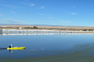
More Amazing Robotic CEE-USV™ Surveys Completed.
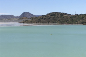
Working together with KDD Meridian based in Irvine, California, CEE HydroSystems USA supported a bathymetric survey of a salt lagoon in south San Diego Bay. The lagoon was very shallow in places and made an ideal candidate for an unmanned USV survey. The goal of the survey was to accurately determine the bottom elevations for a reclamation study. The on-board Trimble RTK CEESCOPE LITE™ echo sounder was used with Hydromagic software and its built-in NTRIP interface to obtain high precision GNSS through the Leica VRS network. The CEE-PILOT™ auto navigation system made short work of the windy conditions next to the exposed bay. LEARN MORE.
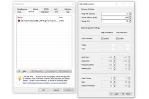
CEE LINE™ Plugin for Hydromagic.
The latest version of Eye4Software Hydromagic includes a new comprehensive CEE LINE™ device plugin that allows users to access all of the echo sounder settings without needing to use any other software utility. Prior to the plugin development, users would need to connect to the CEE LINE™ using the CEE LINE CONNECT software in order to make changes to operating parameters. Using the echo sounder is now made even easier with the new plugin. LEARN MORE.
CEE-USV™ Robotic Surveys for Utah Reservoir Capacity Evaluations.
Often, drinking water storage reservoirs do not allow boating activities which can make conventional hydrographic surveying a challenge - unless you have an unmanned electric vehicle. In order to understand the potential benefit of dredging to help mitigate a dramatic loss in water storage owing to the West coast USA drought conditions, Richfield UT-based engineering firm Jones & DeMille were called in. After conducting an aerial drone survey to map the above-water topography, the CEE-USV™ was used to take care of the bathymetric data. To find out how the drone and USV were used in partnership LEARN MORE.
CEE-USV™ Fly Ash Surveys in Arizona, USA.
In another example where an aerial drone was used to assist the hydrographic survey element of a wider site survey, engineering firm Bowman Consulting used the CEE-USV™ to successfully survey three fly ash ponds at a coal power station in Arizona, USA. With some tricky extremely shallow pools accessible only through narrow channels, real time drone video was useful for navigation too. READ THE NEW CASE HISTORY HERE.
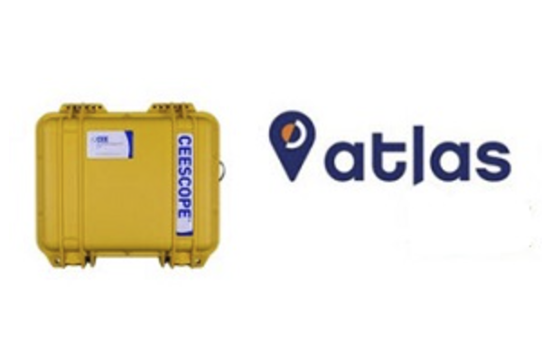
CEESCOPE™ Phantom Next Generation GNSS Option Launched with Latest Hemisphere OEM Receiver.
The entry-level CEESCOPE™ all-in-one echo sounder has received an upgrade. The Eclipse GNSS board has been replaced by the new Hemisphere Phantom. With even more channels and faster acquisition times, the Phantom represents the latest generation GNSS technology. The majority of users selecting the CEESCOPE™ Phantom will be using the Atlas L-Band differential correction signal for at least 50cm XY accuracy worldwide. This L-Band solution has proven to be an exceptionally versatile option since it was introduced in the previous generation CEESCOPE™ Eclipse.
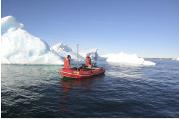
CEESCOPE™ Used for Davis Station Antarctic Base Runway Project Surveys.
Surveying in the coldest place on earth presents significant challenges for instrumentation. As part of an Australian government initiative to investigate the possibility of a new concrete runway at the remote base site, a survey team were brought in to conduct a detailed site investigation using the CEESCOPE™ single beam echo sounder and the CEE-TSF™ side scan package. Read the case history to LEARN MORE
CEE-USV™ with 33kHz CEESCOPE LITE™ Tackles Deep Acid Pit Lake Survey.
Containing over 100ft of pH 2.5 acidic process leachate solution, the a large Western USA mine pit lake was successfully surveyed in October 2020 using the CEE-USV™. The low frequency 33 kHz transducer, on loan from CEE USA, was required to penetrate the concentrated solution. With the bathymetry complete, the future volume in the pit as it is drawn down can be calculated easily using the stage – volume curve generated by Hydromagic software. LEARN MORE.
CEESCOPE™ Selected for Reliability and Simplicity – US Navy.
After extended testing of the CEESCOPE™ “all in one” echo sounder and GPS, a US Navy unit outfitted their teams with the latest Military-spec CEESCOPE™ Eclipse system. Each CEESCOPE™ was supplied with HYPACK and Hydromagic software, rugged laptops and a heavy duty boat mount. The goal of the project was to simplify the collection of single beam data and eliminate separately interfaced GPS and sonar components, erratic Bluetooth connections, and temperamental equipment. With the CEESCOPE™, Navy users can opt to simply record all the data at the push of a button inside the echo sounder for a fast recon, or set up a full software acquisition project for more detailed surveys. The Hemisphere Atlas BASIC H-50 L-Band signal option offers inshore and coastal 0.5m accuracy with multi-constellation GNSS worldwide.
CEESCOPE™ Survey Program Commenced at Mississippi River Grain Terminal.
As a result of rapid sedimentation at the grain terminal dock, frequent surveys are required to ensure dredging can be scheduled to maintain a safe water depth. The terminal operator was conducting surveys “in house” using a basic sonar and pen-and-paper recording, which was laborious and provided rudimentary data output. A CEESCOPE™ was acquired to offer a quantum leap in survey capabilities. The key benefit is the integrated data recording; the boat driver can simply turn on the CEESCOPE™, press the record button and then drive a survey pattern. Data are then later downloaded to the office PC where the site engineer can edit and generate bathymetry plots using Hydromagic software. LEARN MORE
Hydromagic Latest Version 9 with Multiple New Features.
Through 2020, new features have been added to Hydromagic acquisition software. As has been the case for several years, many of these additions are a direct result of requests by CEE or our customers. As a result, the new features and improvements are particularly beneficial when using CEESCOPE™ or CEE ECHO™ systems, and especially useful when using the CEE-USV™ with its fully integrated Hydromagic waypoint route planner. LEARN MORE about all the new functionality in detail.
Mining Operator Invests in CEE-USV™ to Replace Existing RC Sonar Boats.
After successful transitions to the CEE-USV™ remotely operated hydrographic survey boat at some of the firm’s other US sites, CEE were again in action conducting a startup and commissioning training course for mine water surveying, this time in the Arizona Desert. Limitations of the previous, “first generation” USV in use at the site for several years meant it was not able to survey the large tailings impoundments without needing to be towed by a manned boat. After the introduction of the CEE-USV™, with its longer control range and endurance, all the site’s impoundments may be surveyed without needing a manned boat in the picture, improving the job safety. Read a CASE HISTORY detailing USA tailings surveying HERE.
Montana DOT Upgrade Unmanned Capabilities for River Cross Sections.
After a competitive public tender, Montana Department of Transportation based in Helena MT acquired a CEE-USV™ survey boat for in-house bathymetry studies. After a project to obtain unmanned survey data with a smaller, low cost drone in the previous field season, DOT surveyors decided that only a professional-grade solution would provide the anticipated return on investment in the challenging field conditions in the state. LEARN MORE
Lagoon Survey with the CEE-PILOT™ Robotic Autopilot.
A coastal lagoon was surveyed using the CEE-USV™ operated in robotic navigation mode. Allowing the operator to obtain remarkable survey lines with typical cross track error (XTE) of under 15cm (6″), the CEE-PILOT™ relies on an integrated blend of hardware and software to make operation of the system simple. Read the NEW CASE HISTORY describing the operation of the robotic navigation controller and data quality benefits associated with the autopilot. LEARN MORE.
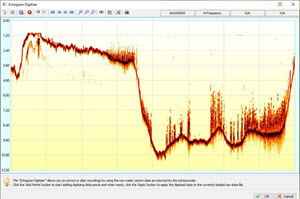
Surveying in the Forest Pit.
With survey sites resembling scenes from the Jurassic era, Statewide Land Surveying (OR, USA) were recently in action conducting surveys of small ponds with extreme canopy overhang in the Pacific Northwest. It was impossible to safely launch or use a USV, and with extreme vegetation and debris in the water the CEESCOPE™ echo sounder with its detailed water column echogram could be used to gather accurate bathymetry data. With no usable GNSS, a total station was used to track position of a custom floating CEESCOPE™ echo sounder towed by a surveyor in a float tube. Statewide’s CEE-LINK™ radio, usually used as a USV shore station, was pressed into service transmitting the echo sounder data to the shore PC running Hydromagic.
Environmental Business Specialists go Unmanned.
Southeastern USA wastewater consultants EBS Inc have been using a manned boat with a CEESCOPE™ dual frequency echo sounder for site surveys since 2017. Owing to an increasing call by clients for an unmanned option, EBS added the CEE-USV™ to their boat options. Using HYPACK® software for all data acquisition, EBS contributed to a new CASE HISTORY detailing the benefits of the unmanned approach for their surveys, often conducted at paper mills. Read the new CASE HISTORY HERE.

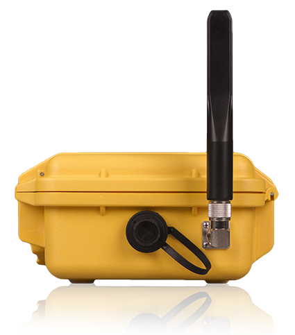
New CEE LINK™ Radio Launched.
While retaining the same external form factor, the CEE-LINK™ shore station used with the CEE-USV™ and CEESCOPE-USV™ has been extensively redesigned. A new panel and switchgear gives useful status indicators of battery life and radio operation. Internal battery runtime is improved from 9 hrs to 14 hrs between charging, and a rugged LEMO connector is added, allowing the CEE-LINK™ to use the same power supply as CEESCOPE™ echo sounders. With the latest long range WiFi radio inside, high bandwidth data telemetry is possible over several kilometers.
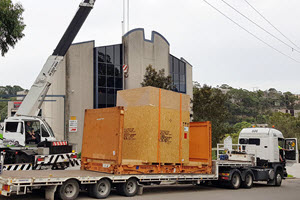
Enormous Environmental Testing Chamber Installed.
To replicate field temperature variations and extremes, CEE HydroSystems’ Sydney factory recently installed a climate controlled electronics testing chamber. The huge chamber was delivered on a large flatbed and after a successful installation all CEE electronics such as echo sounders, GNSS, radio telemetry and tide gauges are now exposed to a pre-determined temperature cycling designed to cause failure in any substandard components. The chamber investment is part of CEE’s continued commitment to product improvement and testing to maximize reliability when equipment is in the hands of customers.
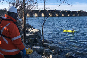
Dam Bathymetric Surveys where Manned Boats Can’t Reach.
Hydrologists at HydroQuebec in Canada are tasked with surveying areas around dams. Often in regions of high water flow and high velocities, it is generally forbidden to use a manned boat. The surveys are completed from the safety of the shore with the CEE-USV™ using the Trimble RTK CEESCOPE-LITE™ on board. See more of the system in action on a dam survey HERE.
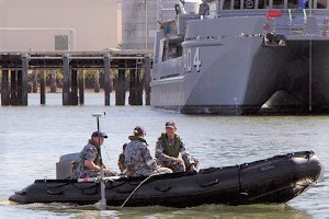
Rapid Mobilization CEESCOPE™ and Side Scan Survey Kits for Royal Australian Navy.
Military surveyors in the Royal Australian Navy recently received their new CEE tactical singlebeam and sidescan kits. With new packaging designed for the application, and specially ruggedized StarFish side scan and RTK CEESCOPE™ topsides, units are deployed on board survey ships HMAS Leeuwin and Melville, as well as survey launches Paluma, Mermaid, Shepparton and Benalla. Learn more about the RAN applications for the new equipment on the CEE Case History HERE. The tactical kit specifications and equipment component breakdown can be found in the brochure HERE.
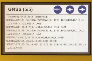
Latest CEESCOPE™ and CEE ECHO™ Firmware adds Unique GNSS Terminal Viewer.
After a significant programming effort, now all echo sounders sold after 2014 may be upgraded with a new GNSS terminal window within the echo sounder LCD menus. The new feature is designed to further reduce the potential for downtime when connecting an external GNSS receiver to the CEE ECHO™, or occasionally the CEESCOPE™ echo sounder and allows the user to see exactly what is being received from the GNSS receiver. Watch the terminal viewer in action HERE.
CEE-USV™ Combined Bathymetry and Water Quality Surveys.
With a simple but effective installation featuring real time data transfer to the shore operator, a West coast US surveying firm used their CEE-USV™ with an In-Situ multiparameter sonde. Read the In-Situ case history HERE.
CEE-USV™ Hydrographic Surveying in the Desert.
The summer temperatures in the southwest USA desert are routinely in the region of 110F (43C). There are not too many lakes in Arizona, but a mine operator recently used their CEE-USV™ to conduct a water storage investigation on a dam that supplies water to the site. See more of the surveys HERE.
CEE HydroSystems Launch CEE-PILOT™ Robotic USV Navigation Controller.
In partnership with marine autonomy experts Dynautics Ltd and hydrographic survey acquisition software developer Eye4Software, CEE HydroSystems can now offer uniquely simple robotic control for the CEE-USV™. Like all CEE products, the principal design criteria was ease of use. With the survey line planning and USV course uploading handled by Hydromagic and no remote PC on-board the USV, or cumbersome additional autonomy software, the CEE-PILOT™ architecture reduces to an absolute minimum the added complexity of a robotic solution, while still realizing the benefits of autonomous operation. LEARN MORE about the CEE-PILOT™ by visiting the web page or read the news release HERE.
Latest Generation Hemisphere Eclipse GNSS Offers Major CEESCOPE™ Upgrade.
Representing a substantial performance upgrade to differential-grade CEESCOPE™ echo sounders, all new 2019 CEESCOPE™ units are standardized on the advanced multi-constellation, multi-frequency Eclipse OEM receiver. The new CEESCOPE™ is fully scalable from an SBAS solution to Hemisphere’s Atlas BASIC “lifetime” 0.5m accurate worldwide service, up to Atlas H10 8cm precision subscription corrections. The Trimble and NovAtel RTK CEESCOPE™ models are unaffected. LEARN MORE.
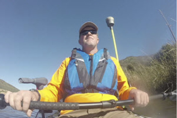
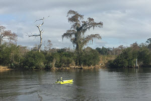
CEE-LINE™ Case History from GIS Surveyors, Inc USA.
Surveying Lake Eleanor near Thousand Oaks, California called for a simple and easy method. The small lake was perfect for a kayak, and GIS Surveyors’ Gavin McKellar outfitted the boat with a trolling motor so he could survey without excessive roll movement. The CEE-LINE™ echo sounder was connected to a Trimble TSC3 data collector and continuous topo points were collected from the R10 GNSS receiver as Gavin undertook a survey grid pattern covering the lake. Read the full case history HERE or watch GIS in action on the VIDEOS page.
CAJUN-USV in Action on Lake Pontchartrain, Louisiana USA.
Destined for effluent pond surveying in the paper mill industry throughout the south eastern USA, the NovAtel DGPS equipped CEE-USV™ adds rapid mobilization capability to traditional manned-boat survey services. Running HYPACK software on the shore laptop, real time telemetry from the on-board CEESCOPE-LITE™ survey system presents an identical acquisition method whether using the USV or the manned boat. Before embarking on their first industrial water job using the USV, the field crew tested the system on a bayou off Lake Pontchartrain.
Icy Training with BayLand Consultants & Designers Inc. in Baltimore.
Surveyors at the Maryland, USA firm recently augmented their hydrographic surveying capabilities with a new CEE ECHO™ and HYPACK acquisition software. With years of surveying experience using various methodologies, BayLand decided to expand their survey capabilities in 2019 with a classical hydrographic survey approach. During the CEE HydroSystems training event in Baltimore, January cold weather meant the BayLand pontoon boat was called into action as an icebreaker. However, a successful outcome was reached as a high quality HYPACK hydrographic survey was completed just a week later. Read the NEW CASE HISTORY HERE.
More River Monitoring USVs for California Department of Water Resources.
Hydrologists from the CA DWR Central region are the latest group to benefit from remotely-operated acoustic Doppler velocity profiling courtesy of ARC-Boat USVs supplied by CEE HydroSystems USA. With typically low to moderate flow velocities in the region, the vehicle’s fine-tuned rudder and differential steering capability allows precise navigation even in the lowest flows. Set up to deploy Sontek M9 profilers with the River Surveyor software, hydrologists quickly were able to get to work monitoring early 2019 rains.
CEE-USV Surveying on the Trans Alaska Pipeline System (TAPS).
Surveyors and engineers responsible for the crude oil pipeline stretching 800 miles from the tanker port of Valdez to the oilfield at Prudhoe Bay experienced a quantum leap in field work efficiency and data quality with the implementation of a USV survey program using the RTK CEESCOPE-enabled CEE-USV. With pipeline crossing surveys required annually along the length of the pipeline, the USV approach is a perfect match. WATCH THE VIDEO.

Integrated CEE Surveying Solution for Safe River Navigation.
A river transportation company pushed their safety culture further forward with a high quality hydrographic survey program to manage river barge movements in the huge inland river system of the United States. The seamless interface between the CEESCOPE echo sounder, RosePoint ECS navigation and Hydromagic acquisition software allows easy production of “on the fly” charts. LEARN MORE.
Australian Land Survey Firm Start Hydrographic Services with 66km River Survey.
New South Wales Survey and Planning firm Newton Denny Chapelle (NDC) recently called on CEE HydroSystems to get them up to speed with modern hydrographic methods and equipment. Starting with a river survey using their existing Leica GNSS equipment paired with the latest CEE echo sounders, NDC were able to see the benefits of an updated approach. READ MORE.
Historic Naval Dockyard Starts Hydrographic Surveys with RTK CEESCOPE™.
Mare Island Dry Dock (MIDD) near Vallejo California, USA is on the site of a historic naval dockyard on the Napa River. With rapid sediment accumulation at the berths and caissons, routine dredging is needed. Instead of calling out a survey contractor, MIDD decided to start up their own “in house” survey capability. With the RTK CEESCOPE™ accessing local California Real Time Network NTRIP corrections through HYPACK® software, the MIDD survey boat was in action after only three days on-site CEE training. Learn more and read the new CASE HISTORY HERE.

Synergy Positioning Systems Become CEE HydroSystems Resale Partner.
GNSS and drone equipment specialist Synergy Positioning Systems in New Zealand are the latest CEE partner, offering our full range of high quality hydrographic solutions. To visit Synergy Positioning, click HERE.
Five Hours of On-Line Hydromagic Training Now Available.
New tutorial videos are available for all aspects of hydrographic surveying using Eye4Software Hydromagic only directly from CEE HydroSystems. Learn more HERE.
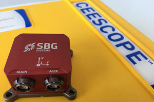
SBG Systems Ellipse2-E INS and WiFi Connectivity Added to CEESCOPE™ for Jet Ski Surveys.
Designed for Personal Watercraft (“Jet Ski” – PWC) hydrographic surveying using HYPACK®, CEE HydroSystems’ latest CEESCOPE™ echo sounder adds a direct interface to the SBG Systems Ellipse2-E GNSS aided Inertial Navigation System (INS) and high-power WiFi telemetry to create an even more flexible single beam “all in one” survey package. The latest CEESCOPE-R™ variant represents a particularly appropriate and unique solution for surf zone hydrographic surveying. Learn more HERE.
USV Hydrographic Surveying – From the Land Surveyors Perspective.
Often surveying with unmanned survey boats such as the CEE-USV™ is described by hydrographic surveyors or marketing specialists for the equipment manufacturers. The June 2018 edition of the US survey magazine xyHt featured a great article contributed by surveyors at Statewide Land Surveying in Oregon, USA describing their hydrographic exploits using the CEE-USV™, compared to historically (difficult) methods. Download the PDF HERE or visit the xyHt web site HERE.
CEE HydroSystems Supply Jet Ski Single Beam RTK Survey Package.
CEE HydroSystems recently supplied a unique single beam hydrographic survey package for shallow water surveys to be performed using a Jet Ski by a French survey firm on behalf of an oil major. Instead of a complete “turnkey” survey personal watercraft, CEE supplied a portable “add on” survey pack that the client could easily mount onto an existing craft. Using the unique compact CEESCOPE™ RTK as the foundation for the system offered a small form factor solution with a waterproof design ready for the rigors of surveying in the surf zone and beyond. Learn more HERE.
CEESCOPE Echo Sounder Now Available With NovAtel OEM7 555-Channel GNSS.
The NovAtel OEM6 GNSS receiver card used in the CEESCOPE has been replaced with NovAtel’s latest low power, high performance OEM729 receiver. The new GNSS option brings a vast increase in available channels for future-proofing, improved interference rejection, and better performance in challenging environments. The TerraStar L-Band support remains and the OEM729-equipped CEESCOPE is available with a built-in UHF radio modem and direct Ethernet connectivity to the GNSS receiver for NTRIP cell-phone RTK corrections
New CEESCOPE Drivers for HYPACK 2018 are Available.
HYPACK has recently upgraded the GPS and CEESCOPE drivers used by the CEE ECHO and CEESCOPE echo sounders. The method that HYPACK uses to handle CEE’s special time stamps has been modified, resulting in even tighter precision for CEE single beam surveys. Users operating a CEESCOPE or CEE ECHO on a USV or with telemetered data may find some benefits in conditions where the radio link is weak. HERE.
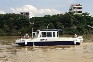
CEE HydroSystems in Myanmar for Hydrographic Survey Training.
In support of a major World Bank hydrographic survey equipment initiative in Myanmar, CEE HydroSystems was on hand to provide two weeks of intensive hardware and software training for local Directorate of Water Resources and Improvement (DWIR) hydrographers. Using the latest Trimble CEESCOPE™ with RTK “all in one” single beam survey echo sounder systems and HYPACK® software delivered by CEE HydroSystems, the survey department quickly were able to start their single beam survey program. READ MORE.
Surveying with the CEESCOPE on the E-Flow Project Bhutan.
If you have ever wondered about surveying a flushing toilet then this challenge probably comes close. There was no easy way to obtain bathymetry data for the river surveys and Bhutanese surveyors were tested in fitness as well as hydrographic data collection. The RTK CEESCOPE was used for river bed elevation measurements with all data logged on the echo sounder as the operators had other things to worry about than operating a laptop. NEW CASE HISTORY.
CEE-USV Mine Site Surveying in British Columbia, Canada.
For bathymetry surveys of settling ponds, pit lakes, tailings dams and other water reservoirs where access is restricted or unsafe, the CEE-USV presents a perfect solution. Coal mine surveyors in Western Canada kicked off their new USV program with three unmanned surveys during the CEE on-site training course with plenty more to follow including coal tailings deposition reservoirs. WATCH THE VIDEO.
CalTrans Developing New Scour Assessment Methods using Inertial Navigation and GPS.
Conducting effective bathymetry surveys for bridge scour monitoring is hampered by a lack of GPS coverage under the bridge. Bad data, no data at all, or laborious manual measurements producing sparse data are the usual options. CalTrans are using their CEE single beam echo sounder with an Advanced Navigation INS sensor to improve their bridge scour hydrographic surveys and minimize missing data. LEARN MORE.
Statewide Land Surveying Use CEE-USV for Oregon Marina Surveys.
As part of their new unmanned vehicle surveying program, Statewide’s new CEE-USV hydrographic survey boat was in action performing a pre-dredge survey at Detroit Lake in Oregon, USA. Able to weave between the hundreds of moored boats in the marina, the CEE-USV was the perfect way to maximize coverage in the confined spaces of the survey. See more of the marina survey HERE.
2017 CEE HydroSystems USA Hydrographic Field Training.
The summer survey season is the busiest time for CEE’s customer field training. From experienced land surveyors to users with no previous survey experience at all, new CEE customers in North America benefit from field training to get their hydrographic survey programs effective and efficient without delay. Including HYPACK and Hydromagic training, introduction to hydrographic survey methods, GPS setup and integration, and boat operation, new users are not left scratching their heads after opening their new echo sounder delivery! See some examples of CEE survey setups HERE.
CEE HydroSystems USA Delivers ARC-Boats to California State Hydrologists.
To improve safety, efficiency and measurement flexibility in their stream and river gauging program, California State Department of Resources has begun implementing a drone survey capability using the HR Wallingford ARC-Boat remotely-operated acoustic Doppler current profiler vehicle. ARC-Boats are already in action at the Sacramento and Red Bluff offices and present an exceptionally well designed, high performance survey tool for flood stage and routine measurements. See the ARC-Boats in action HERE.
Los Angeles Times – CalTrans use CEE Echo Sounders for Bridge Scour Surveying.
The LA Times filmed a segment about ongoing surveying of California’s bridge infrastructure by California’s Department of Transportation. The hydrographic survey program aims to better understand risks to highway bridge integrity from scour during high flow conditions, and incorporates evaluation of novel techniques to aid scour surveying. Senior Bridge Engineer Kevin Flora explains to the LA Times details about their program, which relies on CEE HydroSystems single beam echo sounding and Trimble GNSS equipment. Watch CalTrans in action HERE.
CEESCOPE-USV Training for University of British Columbia (UBC), Vancouver.
CEE HydroSystems recently supplied a turnkey USV system built around the RTK CEESCOPE-USV telemetry-enabled echo sounder to Dr Brett Eaton of the Geography Department of UBC. With a Leica GS15 GNSS RTK base station supplied by Spatial Technologies (Calgary, AB) the new USV will be used for shallow water river surveys, in combination with airborne drone ortho photogrammetry for topography. The research goal is to better understand how rivers and streams respond to environmental changes. CEE were on hand for training in picturesque Deep Cove, North Vancouver.
CEE HydroSystems Launch CEE LINE™ Echo Sounder Kit.
Packaged into a complete mounting kit for basic hydrographic surveys, the latest CEE LINE™ is aimed at land surveyors wishing to undertake small hydro projects. With the CEE LINE, you don’t have to make do with a rudimentary echo sounder for a basic survey. The CEE LINE is almost bomb proof, has a simple communication interface and does not ever need charging courtesy of its USB connection. No trimmed down performance specs or recreational transducers here – professional grade components only! The “sonar on a stick” concept has been around for a few years but the CEE LINE offers a quality-first approach to this survey setup. LEARN MORE.
CEESCOPE™ and CEE ECHO™ with New Bluetooth GNSS Input Delivered to USACE.
New firmware launched in April 2017 activates direct GNSS data input from any Bluetooth-enabled Smart Antenna (eg. Trimble R8, R10, SPS, Leica GS, Hemisphere S320, S321, TopCon Hiper, Topcon GR5) that can output a standard NMEA message over a Bluetooth link. Instead of connecting a serial data output cable between the GNSS serial or USB port to the echo sounder, users may choose to pair the devices using the CEESCOPE touchscreen and operate in wireless mode for RTK, L-Band, or DGPS surveys. The most modern, flexible survey echo sounder just got more flexible! The first three CEE ECHO units with the new firmware were shipped to the Louisville USACE district to replace ageing single beam equipment, through CEE HydroSystems representative Measutronics.
Hydroline LLC Set New Standard in Frac Water Volume Surveys.
With a custom-designed one-person survey boat using the CEESCOPE™ echo sounder system and HYPACK® software, Lousiana-based oilfield support company Hydroline LLC are able to offer the best frac water volume surveys in the region. Using professional hydrographic-quality hardware, software, and survey processes, Hydroline customers get accurate and trustworthy frac water volume estimates. Read the CASE HISTORY to LEARN MORE.
CEE HydroSystems USA Launch CEE-USV™ Remotely-Operated Hydrographic Survey Boat.
Matching the unique CEESCOPE-USV™ remote echo sounder technology with the leading portable USV from HR Wallingford has led to the new standard in remote drone bathymetry. With exceptional “survey grade” durability and an unparalleled modular flexibility and ease of operation unlike any USV on the market, the CEE-USV™ sets the new standard for shallow water hydrographic systems. LEARN MORE.
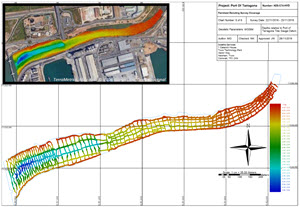
Swathe Services (Truro, UK) conduct bathymetric survey for the Port of Tarragona.
Swathe surveyors used their new Belisama Inception remotely-operated survey boat “drone” with CEE HydroSystems RTK CEESCOPE-USV single beam echo sounder and telemetry package on board. With shallow water and restricted access, the job was ideal for a small USV. MORE.
American Engineers Inc. Offer Hydrographic Surveying with State-of-the Art CEE USV.
Incorporating the unique CEESCOPE-USV echo sounder, CEE USA recently delivered a custom remotely-operated unmanned surface vessel (USV) to engineering and surveying firm AEI. With an unrivalled simplicity in operation owing to the modular and advanced design, AEI are at the forefront of inshore USV technology. READ MORE.
NewFields present sonar paper at Tailings and Mine Waste Conference 2016.
Using detailed “HD” dual frequency echo sounder data from their CEE ECHO™ deployed on a USV, NewFields surveyors are able to track tailings storage facility (TSF) bathymetry as a new TSF evolves, and use the sub bottom echogram data to better understand tailings deposition processes and material distribution inside the TSF.
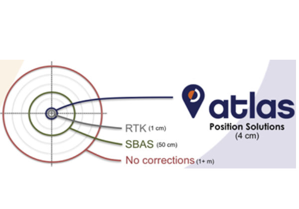
New CEESCOPE with Hemisphere Atlas L-Band Subscription GNSS Corrections.
With the new Hemisphere GNSS P326 Eclipse™ OEM receiver installed inside the waterproof CEESCOPE™ enclosure, the latest CEE package offers a scalable approach combining dual frequency GNSS with the world-wide Atlas L-Band® correction service. Users gain access to decimeter-accurate positioning and the benefit of multi constellation performance with a single subscription. MORE
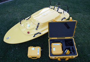
Swathe Services Select CEESCOPE-USV for new Inception Remote Survey Boat.
Swathe Services (Truro, UK) recently started trials of their first remotely-operated survey boat, jointly developed with local partner MSDS Marine. The Inception class portable USV is a professional hydrographic survey vehicle for single beam and multibeam surveying. A robust aluminum-hulled catamaran with dual weed-resistant thrusters, the main design goal was to provide maximum utility with minimum complexity, eliminating the often hidden cost of ownership of a USV. With easily-replaceable critical components and off the shelf battery power. Simply launch, power up and start surveying! MORE
Two new CEE HydroSystems distributors in Southeastern USA.
Aqua-Tech Services and Measutronics have become the first CEE distributors supporting hydrographic customers in the Southeastern USA. Based in Lakeland, Florida, Measutronics are an established Trimble Marine dealer and Service Center and are active selling GNSS positioning, advanced LiDAR and multibeam echo sounder packages to the marine construction and hydrographic survey industries. Aqua-Tech Services of Broussard, Louisiana supply rental equipment to the offshore oil and gas and hydrographic industries, and represent several manufacturers including Hemisphere GNSS. MORE
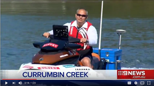
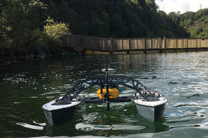
Gold Coast Mayor Tom Tate Describes CEE HydroSystems S.A.M. Jet on Channel 9 News.
The latest weapon in the survey arsenal to combat beach erosion in the city of Gold Coast Australia was featured on Channel 9 News, with Mayor Tom Tate taking the state of the art personal watercraft survey system supplied by CEE HydroSystems for a spin. While including some obvious technical inaccuracies regarding the data density achieved by the system, the story does a great job explaining the benefits of the new survey vehicle. MORE
CEE HydroSystems launch CEESCOPE-USV™ hydrographic system for USVs.
Based on the CEESCOPE™ echo sounder, the CEESCOPE-USV™ incorporates long range data telemetry and a dedicated shore radio (base) station for use on remotely-operated boats. With a built-in long range data telemetry system inside the echo sounder, the CEESCOPE-USV™ is a unique survey solution for unmanned, autonomous or remotely-operated boats – as well as manned boats. Eliminating the need for instrument integration on the vessel, CEE HydroSystems can make sure your USV is a survey tool not a science project. MORE
Royal Australian Navy Receive Six RTK CEESCOPE™ Systems for Rapid Response Surveys.
CEE HydroSystems delivered the last of six high performance RTK CEESCOPE™ “all in one” echo sounder survey systems to the Royal Australian Navy hydrographic group based in Cairns. Acquired to replace ageing CEEDUCER™ echo sounders, the CEESCOPE systems will be used with HYPACK® MAX for littoral reconnaissance surveys and hydrographic training at HPAS Penguin in Sydney Harbor. Selected for ruggedness, simplicity in operation, and the availability of local hardware and software support support from the CEE HydroSystems factory in Sydney, the new equipment will be dispatched to remote locations. READ MORE
CEE HydroSystems Adds New UK and Ireland Distributor Swathe Services
CEE HydroSystems has added Truro, UK-based hydrographic equipment specialist Swathe Services as an official representative for the United Kingdom and Ireland. With experience in supplying multibeam, singlebeam, side scan, and interferometric sonar, motion, and positioning systems for bathymetric surveys as well as Unmanned Surface Vessel solutions, Swathe Services are well placed to support CEE’s latest echo sounder equipment. READ MORE

CEE HydroSystems Adds New European Distributor Geometius b.v.
CEE HydroSystems has entered into a new 2016 distributor agreement with marine and land survey specialist Geometius b.v. As a Trimble dealer, Geometius is now able to offer CEE HydroSystems’ survey-grade echo sounders along with their positioning solutions. READ MORE

Feature Article in GPS World Magazine – CEESCOPE™ and HYPACK For Navigation Surveys
GPS World magazine published a great story based on the CEESCOPE™ surveys conducted by YWAM in Papua New Guinea. READ THE ARTICLE
PrimeGPS Become CEE HydroSystems Representative in France and Africa
CEE HydroSystems recently signed a representation agreement with positioning and hydrographic equipment distributor PrimeGPS. Based in Sainte Luce Sur Loire, PrimeGPS supply survey equipment to the offshore, construction, mining, and dredging industries in Europe and French-speaking African countries.
CEE HydroSystems USA Inc. Opens in San Diego, California
CEE HydroSystems has continued its recent expansion by opening an office in San Diego, California. Located in North San Diego County, CEE HydroSystems USA Inc. will help to maximize growth in the USA, Canada, and South America. The San Diego office will be run by newly-appointed Vice President (Sales) Adrian McDonald. READ MORE
City of Gold Coast Receive First CEE JET™ PWC Hydrographic Survey System
In order to reduce its reliance on labour-intensive manual measurements with a level rod and total station through the surf zone, the city council of Australia’s premier beach destination has taken delivery of a CEE JET™ single beam hydrographic survey system. Using a RTK CEESCOPE™ and Sea-Doo personal watercraft, the CEE JET™ is a turnkey nearshore hydrographic package for sand nourishment studies. READ MORE
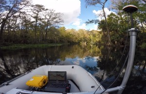
WaterCube use CEE HydroSystems Echo Sounder with Hemisphere AtlasLink™ GNSS For Florida River Survey
River bathymetry and velocity mapping specialists WaterCube LLC recently completed a three-day field survey of the Silver River in Florida. The goal was to develop a detailed view of the river characteristics needed for mathematical modeling. With big challenges from tree canopy and the river bottom completely covered in thick vegetation, the CEESCOPE™ was used to define the true bottom underneath the dense plant growth. READ MORE
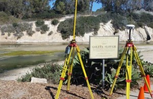
CEE HydroSystems Brings Hydrographic Surveying to County of Santa Barbara, CA
Surveyors from the County of Santa Barbara, California USA decided to expand their range of in-house services by performing hydrographic surveys of local creeks using their CEE HydroSystems CEE ECHO™ survey echo sounder and HYPACK® hydrographic software. The Santa Barbara team are part of an ongoing flood control project, that requires periodic surveys of the Goleta Slough creek system and surrounding wetland. READ MORE