Bathymetric surveying under bridges represents a major challenge as a result of the partial or total obstruction of the view of GPS / GNSS satellites used for positioning. As the survey boat gets close to the bridge, position quality is first degraded and then shortly afterwards completely lost. To overcome this problem, non-GPS solutions are used such as optical positioning using a total station on the shore and prism reflector on the boat. Measurements are conducted slowly and the position of the bridge piers may require several shore positions for the total station and certain portions of the survey area still may not be measurable at all. To improve their bridge scour program, CalTrans are evaluating alternative developing technologies to aid data collection under bridges in the state.
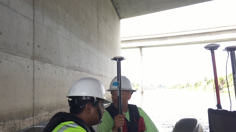
CalTrans has used CEE HydroSystems echo sounding equipment for their bathymetry studies since 2015, usually in combination with Trimble PPK GPS positioning. In 2017, trials of inertial navigation systems (INS) aim to identify a solution that can give seamless position and depth information even as the survey boat goes under a bridge. When the INS equipment is in use, under normal conditions with an open sky view the GPS satellite position is used for the hydrographic survey data but as the satellites are obscured under a bridge, the inertial “dead reckoning” position output takes over until the GPS signal is reacquired. As the data output is a single GPS-type latitude / longitude position message irrespective of which way the position is calculated, data collection procedures used for conventional GPS are largely unaffected. The Spatial Dual INS from Advanced Navigation, Sydney Australia used by CalTrans has a two-antenna GNSS system aiding a MEMS inertial motion sensor to provide continuous position data output derived either from the satellite or motion systems to achieve this goal. Special post-processing may be used to improve inertial position data quality.
Trials of the equipment continue, to develop survey procedures that minimize the unavoidable and potentially large position accuracy drift as time increases from the last good GPS position shot.