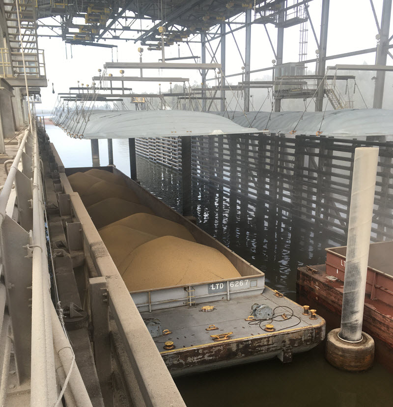
Grain from US farming is transported down the Mississippi River in enormous quantities for export to customers all around the world. The grain barges that have been transported downriver are unloaded at grain elevators and rapidly transferred to cargo vessels alongside the docks. Ships are continuously arriving to collect their grain cargo and safe operation of the terminal relies on having enough water at the dock to accommodate the vessels. The Mississippi River is a huge river with a high sediment content and high currents; the river bottom is continuously changing. Sediment buildup means routine dredging is needed to maintain adequate water at the docks………
The grain terminal operator was using a hand-held sonar to determine water depth on a rough grid pattern, with the boat driver using visual landmarks to position the boat while the surveyor measured the water depth. The measured depths were entered on a print-out sheet to show terminal managers. The method was laborious, with each measurement requiring the boat to be stationary in the right position; the data density was sparse with no detailed view of the bottom terrain…….
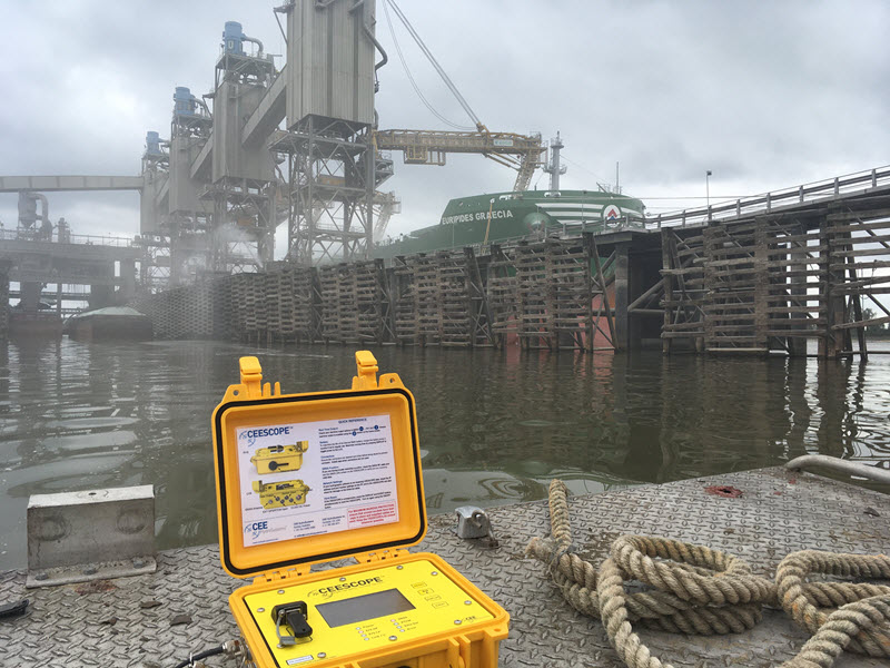
After review of available equipment, the CEESCOPE™ all in one echo sounder and GPS was selected to replace the manual survey method. One key goal was to minimize the requirement for skills and training of the boat operator contractors by using the built-in datalogging capability of the CEESCOPE™. The boat crew can simply clamp the transducer and GPS pole to the launch, connect the CEESCOPE™ and then hit “Record” to collect the detailed single beam bathymetry while driving on an approximate grid pattern. The GPS position and echo sounder readout on the LCD display are enough to ensure all is well with the survey. With no requirement to stop and take measurements, survey time is greatly reduced and data detail and overall consistency and accuracy improves hugely. With more detailed bathymetry, dredging can be more closely monitored by the dock operator independently of the dredge company and planning for dredge operations is improved.
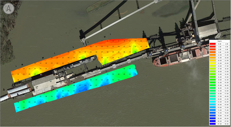
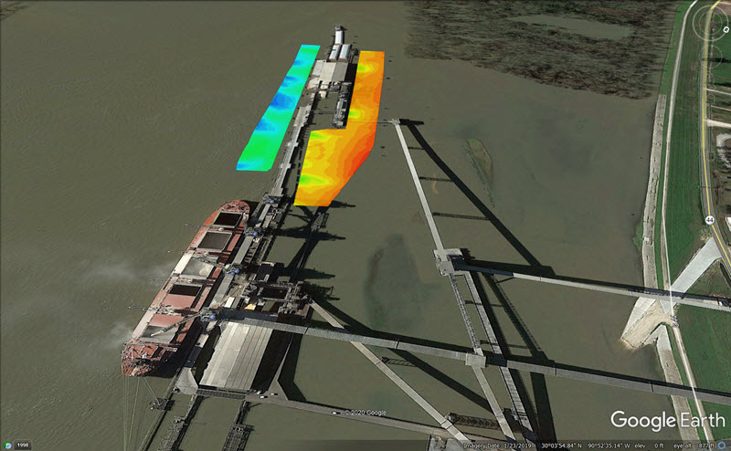
Back in the office, the CEESCOPE™ data recorded on the connected USB stick are uploaded directly to Eye4Software Hydromagic where the terminal engineer can clean up the data and almost immediately generate depth plot matrices and contours. After a convenient export of the bathymetry data to Google Earth, results can be emailed to plant management as a single KML link……..
This application demonstrates the substantial advantages provided by the CEESCOPE™ compared to traditional echo sounders and GPS receiver setups. For this operator, having a boat crew trained in connecting equipment, troubleshooting data, and setting up hydrographic survey software would not be feasible. The CEESCOPE™ was really the only option.