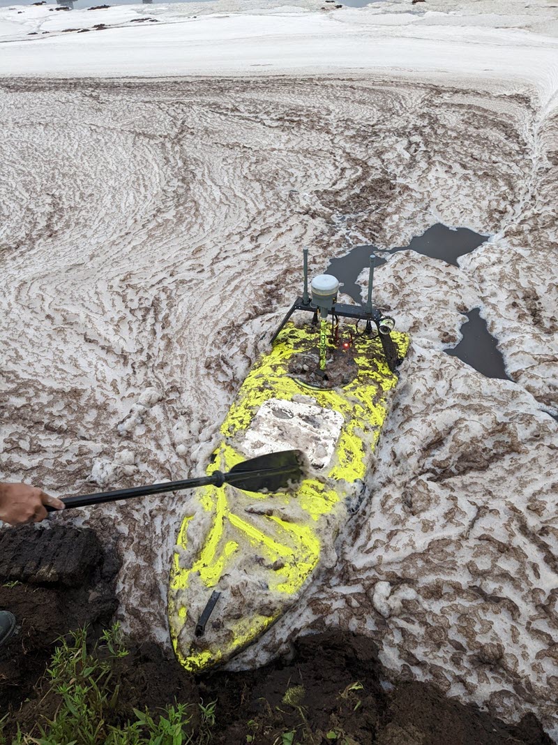
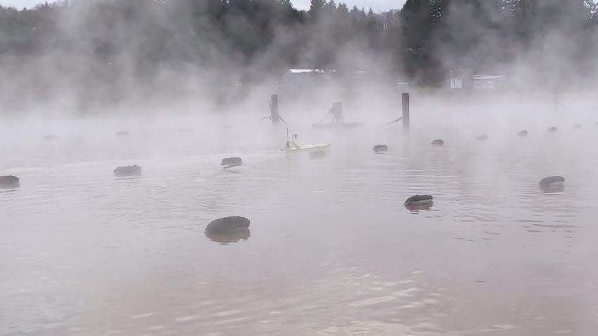
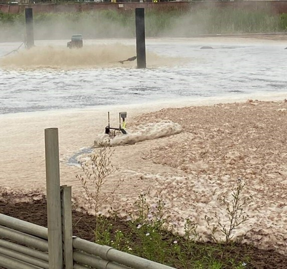
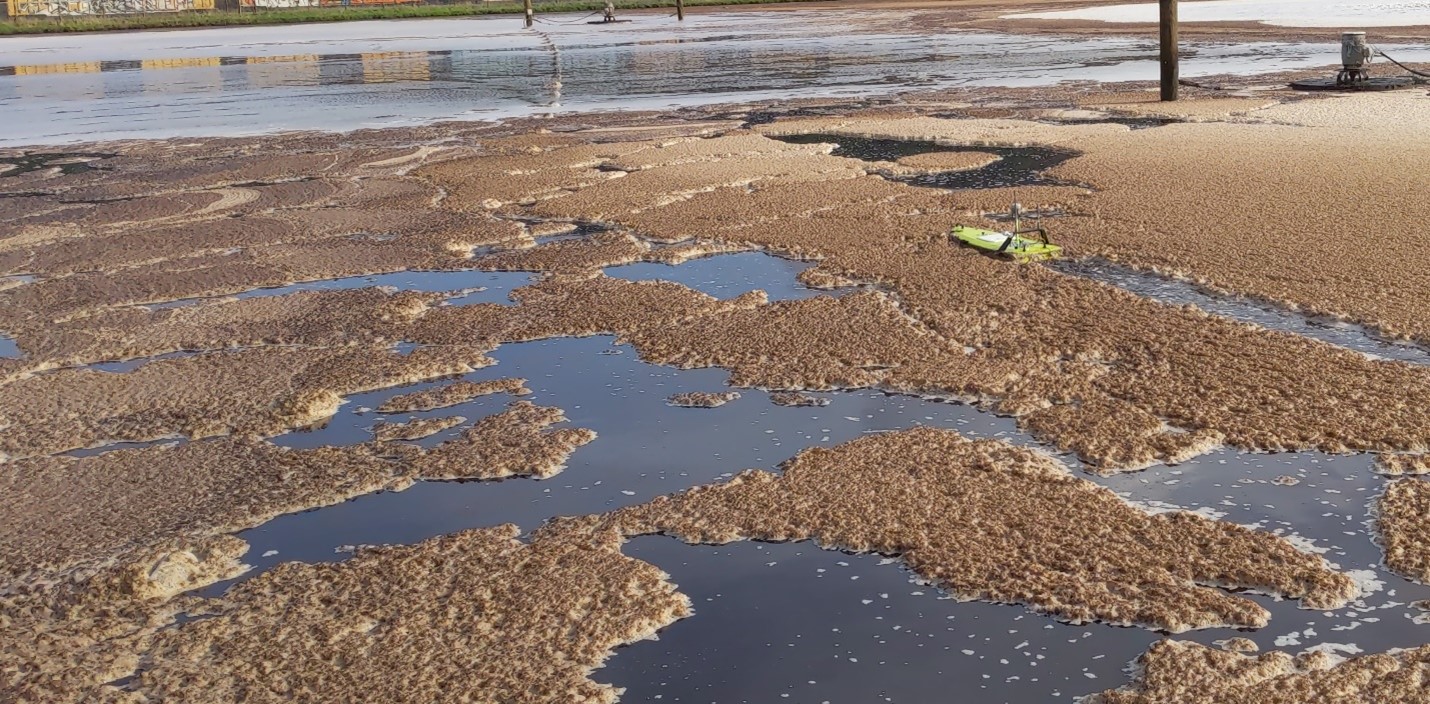
Surveyors at Oregon, USA firm AKS Engineering & Forestry LLC might have set a new record for CEE equipment users while working on recent wastewater lagoon surveys – the dirtiest USV in action! AKS recently completed a hydrographic survey for an industrial client; while the wastewater environment is a common application for the CEE-USV™, this particular site had some fairly extensive surface foam and detritus. The project objectives were to determine present-day bottom elevations within seven (7) wastewater treatment ponds at the site. The USV approach was selected to protect employees from exposure to uncertain and potentially dangerous conditions within the ponds. The benefit of using a small remotely-operated boat for maneuvering around the many obstacles in the lagoons was significant.
Choosing the USV proved to be a sensible decision! The surveyors encountered a variety of undesirable environments in each pond, including the objectionable aroma of wastewater being aerated and treated, significant amounts of surface foam generated by the aerators, steam from warm wastewater obscuring visibility, and residual sludge that required manual scrubbing to remove from the vessel hull. The photographs below illustrate some examples of the less-than-ideal survey environment.
Unusually for CEE-USV™ operators who typically have setups utilizing the internal GNSS of the CEESCOPE LITE™ echo sounder, AKS’s CEE-USV™ consists of a CEESCOPE LITE™ with 200 kHz transducer paired with a Trimble R10 RTK-GNSS rover for 3D positioning. A Trimble R10 RTK-GNSS base station was set up on upland survey control and broadcast GNSS position corrections to the receiver on the USV. Sonar and GNSS data were collated in the CEESCOPE LITE™ and time stamped internally before being transmitted to a shoreside acquisition computer via the CEE LINK telemetry. Data were monitored and acquired in real-time using HYPACK Survey software.
It was not possible to survey autonomously with the USV. The presence of water aerators, numerous floating buoy lines, and other surface obstacles required an operator to control the USV at all times. The targeted line spacing was 25 feet. In total, the linear survey distance within all ponds was approximately 14 miles, comprising 200 lines, that required two days to complete.
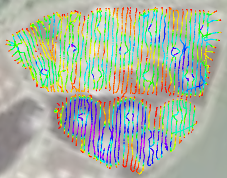
The screenshot below illustrates example survey results from a few of the ponds. Water depths ranged from approximately 0 feet (red) to 15 feet (purple). As would be expected, deeper water depths are observed in proximity to aerators, where sediment is mobilized, while shallower areas are located further away from the active aeration process.
To learn more about AKS’ survey services visit their web site: https://www.aks-eng.com/