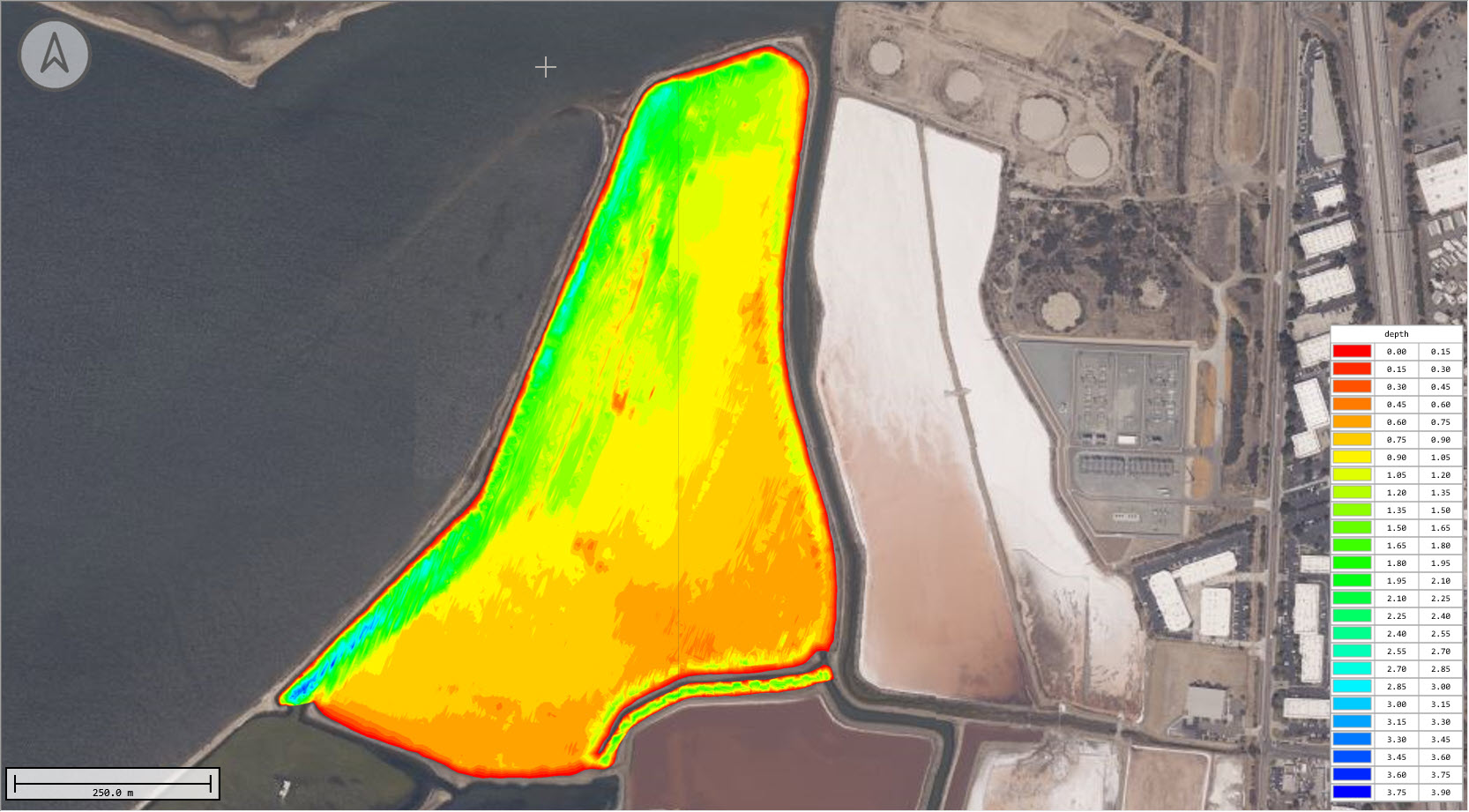
California land surveying firm KDD Meridian were contracted to perform a bathymetric survey of a salt lagoon in south San Diego bay. The lagoon was about 1km (0.6 miles) long and it would have been incredibly time-consuming to survey using conventional land survey GNSS rod measurements from a manned boat, so it was decided that using sonar equipment was the only realistic method to conduct the survey. Instead of bringing in a manned boat with a couple of surveyors, KDD decided to work in partnership with CEE and use the robotic CEE-USV™ to complete the survey with less manpower, lower cost, and with a superior end product.
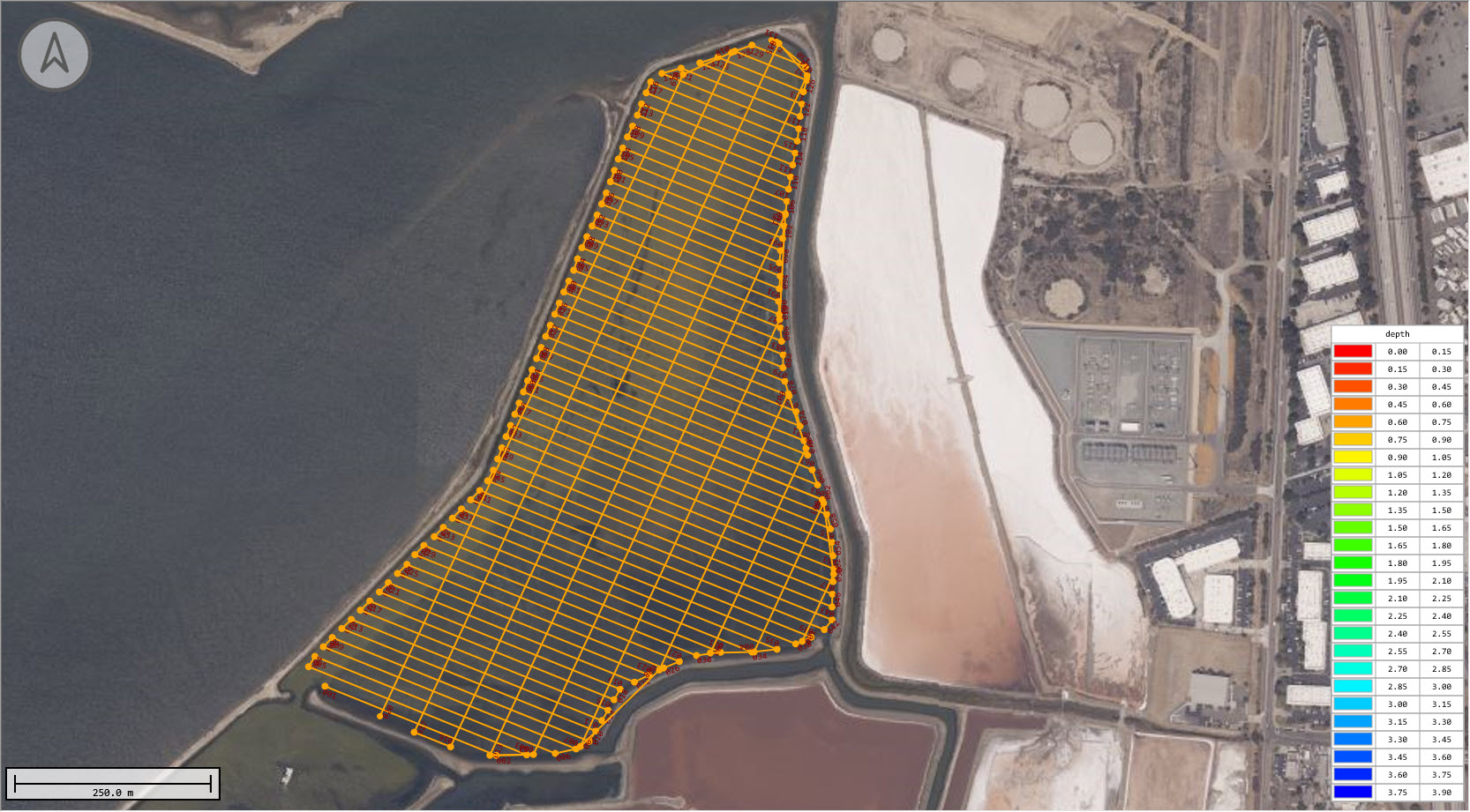
Before the survey proper commenced, the USV was driven around the perimeter of the lagoon to establish the safe boundary of the survey area. The CEESCOPE LITE™ on board was set to log data internally and the operator briskly walked around the lagoon with the boat following the edge at about 1-2ft water depth. Upon completion of the boundary track, the recorded data were transferred from the CEESCOPE LITE™ to the Hydromagic acquisition software using a USB flash drive. With the boundary established, the vessel waypoint track could be generated in the Hydromagic software. With a safe track loaded, the USV could be subsequently remotely operated without fear of encountering unexpected obstacles or shallow areas that might cause the boat to become beached.
Track lines were chosen at 50ft spacing, with perpendicular sections to afford cross checking of elevations. The total route was 29km (18miles):
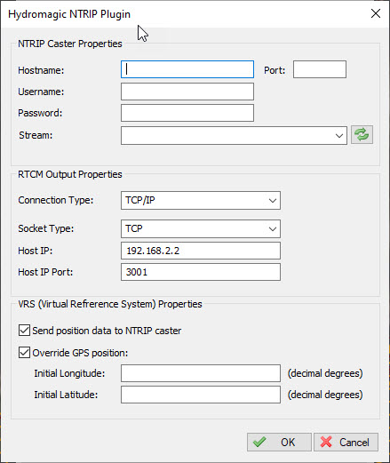
Survey data were collected using RTK corrections supplied by the Leica VRS network through a cell phone connected to the acquisition laptop. The Hydromagic NTRIP client manages the receipt of the RTK corrections, which are sent to the CEESCOPE LITE™ on the USV over the survey datalink. This built-in device plugin means the provision of RTK corrections to the USV does not need any standalone radio or additional hardware setup.
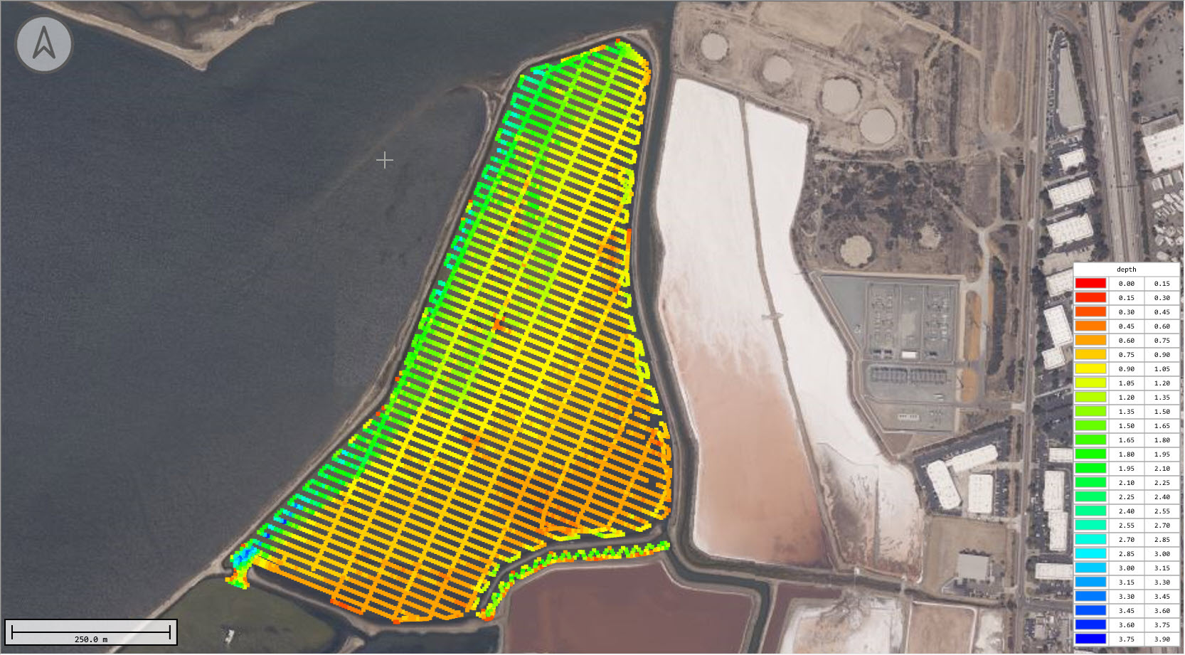
The final results demonstrated the benefits of using a USV for this survey environment. Only a single operator was required for the survey, and the job was completed in just a day and a half. The coverage allowed by the USV, right up to the edge of the lagoon, provided a thorough survey and data quality was maximized owing to the great consistency of the boat track. Additionally, areas of particular interest at the lagoon entrance and inside a narrow channel otherwise inaccessible to a manned boat were surveyed in more detail.
The survey location close to the bay and ocean beyond means that the lagoon is often windy and this survey was no exception. The Dynautics SPECTRE autopilot used as part of the CEE-PILOT™ robotic operation package was able to keep the USV right on track irrespective of the orientation.
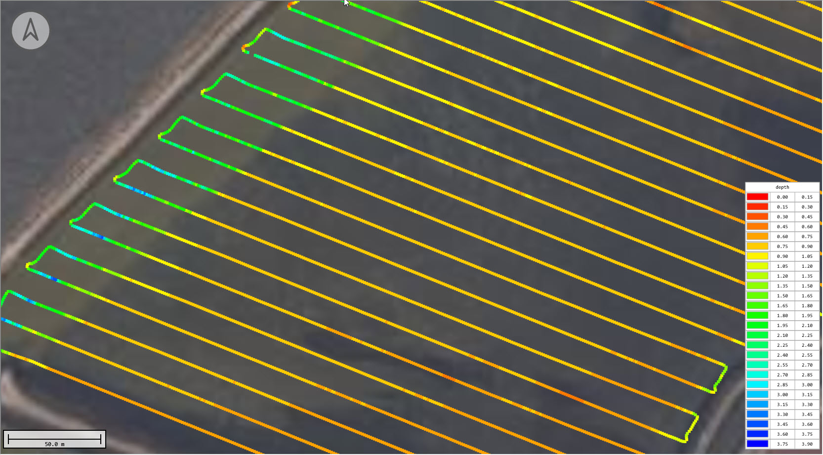
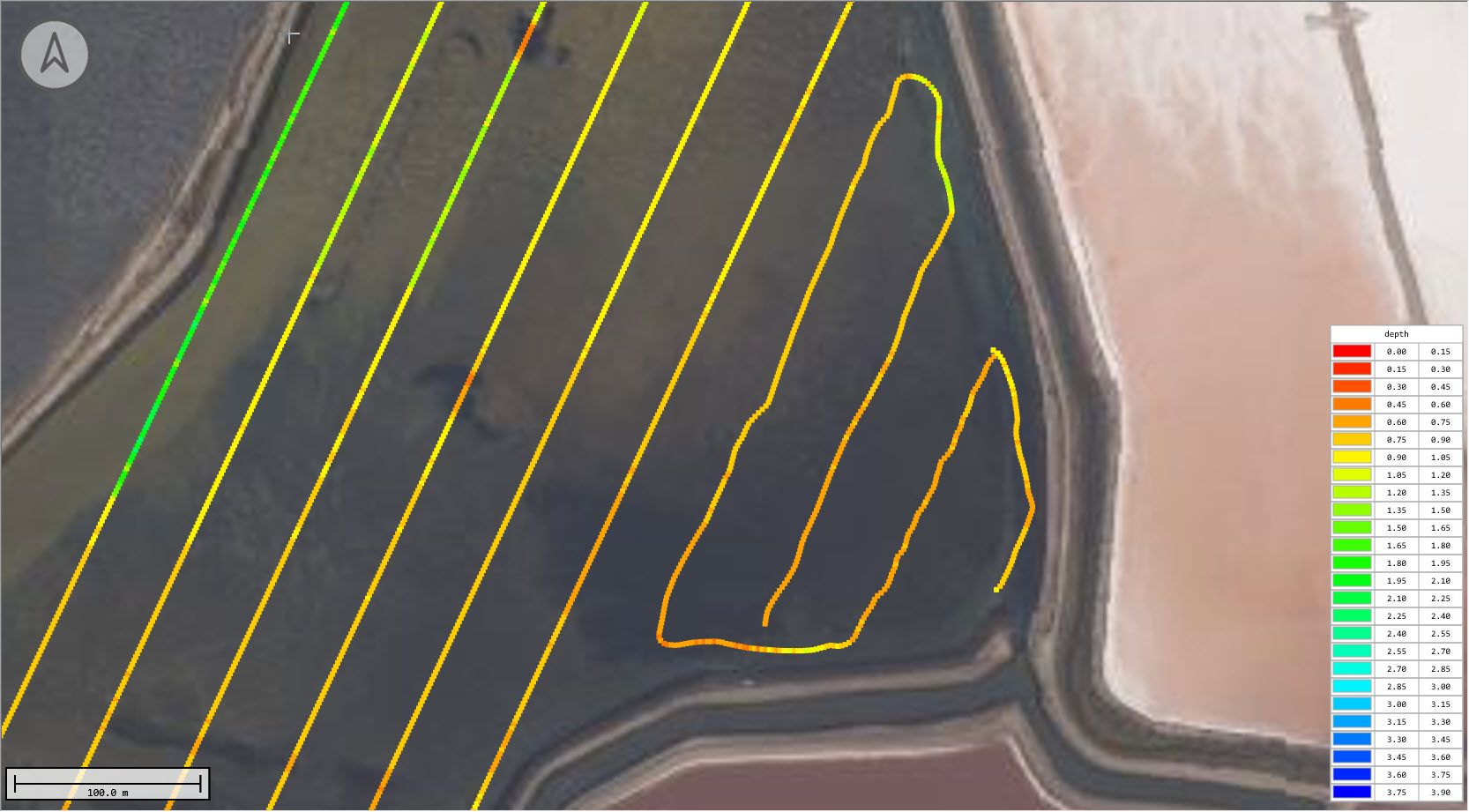
For these conditions, a manually operated USV survey without the autopilot over 19km would have presented quite a challenge of concentration for the operator! Indeed, as a comparison, a short section of the track was completed with manual operation in the wind and the difference in results is quite obvious: