

Search
Product
Topic
All articles

Knowledge base · Nov 2017
How do I survey through vegetation, and map seagrass extent?
Knowledge base · Nov 2017
How do I survey frac pits and effluent lagoons?
Knowledge base · Nov 2017
CEE VIEWS – Why we do not make Echo Sounders with Paper Chart Recorders
Despite there occasionally still being a requirement for paper records supporting single beam hydrographic surveys, we choose not to offer any echo sounders that have this feature. Besides focusing more on portable units where paper is of no value, here are our thoughts on why we believe the paper chart to be entirely unnecessary.
Knowledge base · Jan 2017
How can a dual frequency echo sounder show recent sedimentation?
Knowledge base · Oct 2016
CUSTOMER PROJECT – Using a Dual Frequency CEE ECHO and a USV to Evaluate Mine Tailings Deposition
In addition to providing valuable water volume data for site water balance models and tailings storage facility (TSF) operations, using advanced echo sounder techniques may also provide insight into tailings deposition pattern and compaction processes. This paper as presented by Newfields LLC at the Tailings and Mine Waste 2016 conference in Keystone, CO, USA describes an unmanned survey vehicle approach to tailings dam bathymetry.
Knowledge base · Aug 2016
CEE VIEWS – Why Single Beam Echo Sounders Continue to have a Place Alongside Multibeam

Knowledge base · Jan 2016
Using RAW GNSS Data Recorded on the CEESCOPE™ for Post Processed Precise Positioning in HYPACK®
Knowledge base · Dec 2015
What is an echogram, and how does it show the true bottom?

Knowledge base · Dec 2015
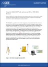
Using the CEESCOPE™ and CEE ECHO™ in RTK Mode on a Local Grid
For land surveyors, the process used in hydrography to collect the coordinate position and elevation data underwater might be unfamiliar. However, using an RTK-enabled system it is easy to collect data that will fit seamlessly into separately collected land survey datasets using the same RTK GNSS receivers / base station.
Knowledge base · Dec 2015
Using an External GNSS Receiver with the CEE ECHO™ – Introduction
The CEE ECHO™ is designed to take in NMEA0183 format position from a GNSS / GPS receiver and merge the position data with echo sounder data simultaneously being recorded. The combined data stream is output to an acquisition software package.